
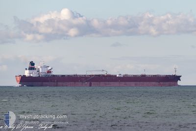
PS AMALFI
Oil Products Tanker
Current Trip
USDCI>===GOLA
| Time Travelled | 5 days |
|---|---|
| Remaining Time | --- |
| Distance Travelled | 1352.30 nm |
| Remaining Distance | --- |
| AVG Speed | 12.2 Knopen |
| MAX Speed | 14.4 Knopen |
| AVG Wind | 11.9 knots |
| MAX Wind | 17.6 knots |
| MIN Temp | 22.9°C / 73.22°F |
| MAX Temp | 25.3°C / 77.54°F |
| Diepgang | 8.6 M |
| Positie ontvangen | 2025-01-01 10:47 |
Current Position
| Lengtegraad | -79.49704° |
|---|---|
| Breedtegraat | 25.87713° |
| Status | Under way using engine |
| Snelheid | 10.9 Knopen |
| Koers | 189.3° |
| Gebied | North Atlantic Ocean |
| Station | T-AIS |
| Positie ontvangen | 2025-01-01 10:47 |
Info
Information
The current position of PS AMALFI is in North Atlantic Ocean with coordinates 25.87713° / -79.49704° as reported on 2025-01-01 10:47 by AIS to our vessel tracker app. The vessel's current speed is 10.9 Knopen
The vessel PS AMALFI (IMO: 9439395, MMSI: 229869000) is a Oil Products Tanker that was built in 2010 ( 15 Jaar oud ). It's sailing under the flag of [MT] Malta.
In this page you can find informations about the vessels current position, last detected port calls, and current voyage information. If the vessels is not in coverage by AIS you will find the latest position.
The current position of PS AMALFI is detected by our AIS receivers and we are not responsible for the reliability of the data. The last position was recorded while the vessel was in Coverage by the Ais receivers of our vessel tracking app.
The current draught of PS AMALFI as reported by AIS is 8.6 meters
Weather
| Temperature | 23°C / 73.4°F |
|---|---|
| Wind Speed | 12 knots |
| Direction | 176° S |
| Pressure | 1022.7 hPa |
| Humidity | 85.5 % |
| Cloud Coverage | 3 % |
Featured Company
Last Port Calls
| Port | Arrival | Departure | Time In Port |
|---|---|---|---|
| 2025-02-03 13:33 | 2025-02-07 18:14 | 4 d | |
| 2024-12-22 18:09 | 2024-12-24 07:14 | 1 d |
Most Visited Ports (Last year)
| Port | Arrivals | |
|---|---|---|
| 9 | ||
| 7 | ||
| 3 | ||
| 1 | ||
| 1 |
Last Trips
| Origin | Departure | Destination | Arrival | Distance | |
|---|---|---|---|---|---|
| 2024-12-24 07:14 | 2025-02-03 13:33 | 2041.10 nm | |||
| 2024-11-17 10:22 | 2024-12-22 18:09 | 4098.06 nm |
Events
| Tijd | Evenement | Details | Positie / Bestemming | Info |
|---|---|---|---|---|
| 2025-02-08 09:58 | Start beweging | 7.85 nm, North of COATZACOALCOS |
18.27899 / -94.41428
USDCI>===GOLA
|
Snelheid: 5 kn Koers: 26° |
| 2025-02-08 02:00 | Stop beweging | 7.57 nm, North of COATZACOALCOS |
18.27407 / -94.41859
USDCI>===GOLA
|
Snelheid: 0.3 kn Koers: 63° |
| 2025-02-08 00:14 | Vertrekhaven |
|
18.17542 / -94.41684
USDCI>===GOLA
|
Snelheid: 9.3 kn Koers: 343° |
| 2025-02-08 00:05 | Start beweging |
18.15358 / -94.40994
[MX] COATZACOALCOS
|
Snelheid: 9.3 kn Koers: 343° |
|
| 2025-02-03 19:33 | Stop beweging |
18.13147 / -94.39742
[MX] COATZACOALCOS
|
Snelheid: 0.1 kn Koers: 359° |
|
| 2025-02-03 19:33 | Aankomsthaven |
|
18.13147 / -94.39742
[MX] COATZACOALCOS
|
Snelheid: 0.9 kn Koers: 359° |
| 2025-02-03 18:17 | Start beweging | 3.47 nm, North of COATZACOALCOS |
18.20583 / -94.40884
USDCI>===GOLA
|
Snelheid: 6.6 kn Koers: 208° |