
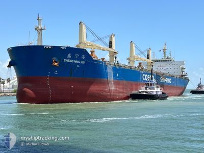
SHENG NING HAI
Cargo
Current Trip
DJEN-DJEN
| Time Travelled | 22 days |
|---|---|
| Remaining Time | --- |
| Distance Travelled | 722.84 nm |
| Remaining Distance | --- |
| AVG Speed | 9.4 Noeuds |
| MAX Speed | 14 Noeuds |
| AVG Wind | 6.6 knots |
| MAX Wind | 24 knots |
| MIN Temp | 5.9°C / 42.62°F |
| MAX Temp | 21.8°C / 71.24°F |
| Tirant d eau | 6.8 m |
| Position reçue | 22 d depuis |
Current Position
| Longitude | 2.16129° |
|---|---|
| Latitude | 39.02458° |
| Etat | Under way using engine |
| Vitesse | 12.3 Noeuds |
| Parcours | 120.3° |
| Zone | Balearic Sea |
| Station | T-AIS |
| Position reçue | 22 d depuis |
Info
Information
The current position of SHENG NING HAI is in Balearic Sea with coordinates 39.02458° / 2.16129° as reported on 2025-02-20 20:38 by AIS to our vessel tracker app. The vessel's current speed is 12.3 Noeuds
The vessel SHENG NING HAI (IMO: 9663180, MMSI: 414174000) is a Cargo It's sailing under the flag of [CN] China.
In this page you can find informations about the vessels current position, last detected port calls, and current voyage information. If the vessels is not in coverage by AIS you will find the latest position.
The current position of SHENG NING HAI is detected by our AIS receivers and we are not responsible for the reliability of the data. The last position was recorded while the vessel was in Coverage by the Ais receivers of our vessel tracking app.
The current draught of SHENG NING HAI as reported by AIS is 6.8 meters
Weather
| Temperature | 16.1°C / 60.98°F |
|---|---|
| Wind Speed | 4 knots |
| Direction | 172° S |
| Pressure | 1005.4 hPa |
| Humidity | 77.6 % |
| Cloud Coverage | 78 % |
Featured Company
Last Port Calls
| Port | Arrival | Departure | Time In Port |
|---|---|---|---|
| 2025-02-15 19:49 | 2025-02-20 12:13 | 4 d | |
| 2025-02-05 03:09 | 2025-02-09 15:45 | 4 d | |
| 2025-01-27 16:51 | 2025-02-02 10:27 | 5 d | |
| 2025-01-11 10:42 | 2025-01-14 09:30 | 2 d |
Most Visited Ports (Last year)
| Port | Arrivals | |
|---|---|---|
| 2 | ||
| 1 | ||
| 1 | ||
| 1 | ||
| 1 | ||
| 1 |
Last Trips
Events
| Heure | Evenement | Détails | Position/ Destination | Info |
|---|---|---|---|---|
| 2025-03-14 21:37 | Arret | 13.5 nm, North of JIJEL |
37.04636 / 5.72656
DJEN-DJEN
|
Vitesse: 0.3 kn Parcours: 356° |
| 2025-03-14 14:14 | Démarrage | 20.73 nm, North East of DJEN DJEN |
37.14460 / 6.06694
DJEN-DJEN
|
Vitesse: 4.2 kn Parcours: 229° |
| 2025-03-14 13:24 | Arret | 20.52 nm, North East of DJEN DJEN |
37.14304 / 6.06051
DJEN-DJEN
|
Vitesse: 0.3 kn Parcours: 10° |
| 2025-03-13 17:16 | Démarrage | 10.77 nm, North East of DJEN DJEN |
36.95414 / 6.05173
DJEN-DJEN
|
Vitesse: 3.6 kn Parcours: 294° |
| 2025-03-13 13:42 | Arret | 9.56 nm, North East of DJEN DJEN |
36.96920 / 5.98565
DJEN-DJEN
|
Vitesse: 0.3 kn Parcours: 227° |
| 2025-03-11 21:11 | Démarrage | 16.23 nm, North of DJEN DJEN |
37.09687 / 5.93759
DJEN-DJEN
|
Vitesse: 7.7 kn Parcours: 92° |
| 2025-03-11 17:14 | Arret | 15.35 nm, North of DJEN DJEN |
37.08255 / 5.93235
DJEN-DJEN
|
Vitesse: 0.3 kn Parcours: 23° |
| 2025-03-11 14:17 | Démarrage | 10.77 nm, North of DJEN DJEN |
37.00753 / 5.91012
DJEN-DJEN
|
Vitesse: 7.3 kn Parcours: 35° |
| 2025-03-11 07:28 | Arret | 13.27 nm, North of DJEN DJEN |
37.04837 / 5.85933
DJEN-DJEN
|
Vitesse: 0.3 kn Parcours: 165° |
| 2025-03-11 05:32 | Démarrage | 21.12 nm, North of DJEN DJEN |
37.18063 / 5.87357
DJEN-DJEN
|
Vitesse: 7.7 kn Parcours: 194° |