
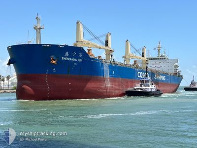
SHENG NING HAI
Cargo
Current Trip
| Trip Time | 2 days |
|---|---|
| Trip Distance | 801.90 nm |
| AVG Speed | 12.6 Knopen |
| MAX Speed | 14.4 Knopen |
| Diepgang | 6.9 M |
| AVG Wind | 8.8 knots |
| MAX Wind | 21 knots |
| MIN Temp | 13.2°C / 55.76°F |
| MAX Temp | 17.2°C / 62.96°F |
| Positie ontvangen | 2 d geleden |
Current Position
| Lengtegraad | 32.44154° |
|---|---|
| Breedtegraat | 31.43159° |
| Status | Under way using engine |
| Snelheid | 5.6 Knopen |
| Koers | 270.8° |
| Gebied | Mediterranean Sea - Eastern Basin |
| Station | T-AIS |
| Positie ontvangen | 2 d geleden |
Info
Information
The current position of SHENG NING HAI is in Mediterranean Sea - Eastern Basin with coordinates 31.43159° / 32.44154° as reported on 2025-02-04 23:28 by AIS to our vessel tracker app. The vessel's current speed is 5.6 Knopen and is currently inside the port of SUEZ CANAL.
The vessel SHENG NING HAI (IMO: 9663180, MMSI: 414174000) is a Cargo It's sailing under the flag of [CN] China.
In this page you can find informations about the vessels current position, last detected port calls, and current voyage information. If the vessels is not in coverage by AIS you will find the latest position.
The current position of SHENG NING HAI is detected by our AIS receivers and we are not responsible for the reliability of the data. The last position was recorded while the vessel was in Coverage by the Ais receivers of our vessel tracking app.
The current draught of SHENG NING HAI as reported by AIS is 6.9 meters
Weather
| Temperature | 14.1°C / 57.38°F |
|---|---|
| Wind Speed | 14 knots |
| Direction | 294° WNW |
| Pressure | 1019.1 hPa |
| Humidity | 58.4 % |
| Cloud Coverage | 96 % |
Featured Company
Last Port Calls
| Port | Arrival | Departure | Time In Port |
|---|---|---|---|
| 2025-02-05 03:09 | |||
| 2025-01-27 16:51 | 2025-02-02 10:27 | 5 d | |
| 2025-01-11 10:42 | 2025-01-14 09:30 | 2 d | |
| 2024-12-08 04:01 | 2024-12-12 08:13 | 4 d |
Most Visited Ports (Last year)
| Port | Arrivals | |
|---|---|---|
| 2 | ||
| 2 | ||
| 1 | ||
| 1 | ||
| 1 | ||
| 1 |
Last Trips
Events
| Tijd | Evenement | Details | Positie / Bestemming | Info |
|---|---|---|---|---|
| 2025-02-05 01:35 | Stop beweging |
31.21976 / 32.35852
[EG] SUEZ CANAL
|
Snelheid: Koers: 13° |
|
| 2025-02-05 01:09 | Aankomsthaven |
|
31.22151 / 32.35773
[EG] SUEZ CANAL
|
Snelheid: 5.7 kn Koers: 193° |
| 2025-02-04 23:31 | Status Changed | Default Under way using engine |
31.43006 / 32.43559
SAID
|
Snelheid: 5.6 kn Koers: 270.8° |
| 2025-02-04 23:28 | Buitenbereik |
31.43159 / 32.44154
Mediterranean Sea - Eastern Basin
|
Snelheid: 5.6 kn Koers: 270.8° |
|
| 2025-02-04 23:27 | Start beweging | 12.84 nm, North East of PORT SAID |
31.43159 / 32.44325
SAID
|
Snelheid: 4.9 kn Koers: 270° |
| 2025-02-04 23:18 | Status Changed | Under way using engine Default |
31.43149 / 32.45414
SAID
|
Snelheid: 0.7 kn Koers: 347° |
| 2025-02-04 23:18 | Binnenbereik |
31.43149 / 32.45414
Mediterranean Sea - Eastern Basin
|
Snelheid: 2.4 kn Koers: 319.1° |
|
| 2025-02-04 22:28 | Stop beweging | 12.59 nm, North East of PORT SAID |
31.42513 / 32.44604
SAID
|
Snelheid: 0.3 kn Koers: 313° |
| 2025-02-04 21:00 | Status Changed | Default Under way using engine |
31.42831 / 32.43496
SAID
|
Snelheid: 5.4 kn Koers: 169.5° |
| 2025-02-04 20:55 | Buitenbereik |
31.43491 / 32.43358
Mediterranean Sea - Eastern Basin
|
Snelheid: 5.4 kn Koers: 169.5° |