
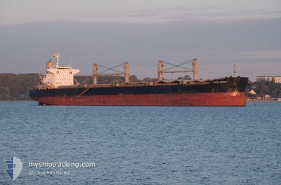
ULTRA INFINITY
Cargo
Current Trip
| Time Travelled | 18 days |
|---|---|
| Remaining Time | 1 day |
| Distance Travelled | 4496.61 nm |
| Remaining Distance | 446.56 nm |
| AVG Speed | 9.8 Noeuds |
| MAX Speed | 13.2 Noeuds |
| AVG Wind | 10.8 knots |
| MAX Wind | 24 knots |
| MIN Temp | 13.8°C / 56.84°F |
| MAX Temp | 29.1°C / 84.38°F |
| Tirant d eau | 13 m |
| Position reçue | 6 d depuis |
Current Position
| Longitude | -17.90591° |
|---|---|
| Latitude | 21.19621° |
| Etat | Under way using engine |
| Vitesse | 10 Noeuds |
| Parcours | 195.3° |
| Zone | North Atlantic Ocean |
| Station | T-AIS |
| Position reçue | 6 d depuis |
Info
Information
The current position of ULTRA INFINITY is in North Atlantic Ocean with coordinates 21.19621° / -17.90591° as reported on 2025-01-29 11:07 by AIS to our vessel tracker app. The vessel's current speed is 10 Noeuds and is heading at the port of TAKORADI. The estimated time of arrival as calculated by MyShipTracking vessel tracking app is 2025-02-05 17:53 LT
The vessel ULTRA INFINITY (IMO: 9767481, MMSI: 563094500) is a Cargo It's sailing under the flag of [SG] Singapore.
In this page you can find informations about the vessels current position, last detected port calls, and current voyage information. If the vessels is not in coverage by AIS you will find the latest position.
The current position of ULTRA INFINITY is detected by our AIS receivers and we are not responsible for the reliability of the data. The last position was recorded while the vessel was in Coverage by the Ais receivers of our vessel tracking app.
The current draught of ULTRA INFINITY as reported by AIS is 13 meters
Weather
| Temperature | 29.1°C / 84.38°F |
|---|---|
| Wind Speed | 2 knots |
| Direction | 357° N |
| Pressure | 1008.5 hPa |
| Humidity | 62.2 % |
| Cloud Coverage | 99 % |
Featured Company
Last Port Calls
| Port | Arrival | Departure | Time In Port |
|---|---|---|---|
| 2025-01-12 18:34 | 2025-01-16 15:19 | 3 d | |
| 2024-12-25 15:00 | 2024-12-30 09:53 | 4 d | |
| 2024-12-08 14:22 | 2024-12-10 02:05 | 1 d | |
| 2024-12-04 04:30 |
Last Trips
| Origin | Departure | Destination | Arrival | Distance | |
|---|---|---|---|---|---|
| 2024-12-30 11:53 | 2025-01-12 20:34 | 877.13 nm | |||
| 2024-12-10 02:05 | 2024-12-25 17:00 | 3420.13 nm | |||
| 2024-12-04 04:30 | 2024-12-08 14:22 | 909.50 nm |
Events
| Heure | Evenement | Détails | Position/ Destination | Info |
|---|---|---|---|---|
| 2025-01-29 11:12 | Etat Changé | Default Under way using engine |
21.18277 / -17.91020
GH TKD
|
Vitesse: 10 kn Parcours: 195.3° |
| 2025-01-29 11:07 | Hors de la zone couverte |
21.19621 / -17.90591
North Atlantic Ocean
GH TKD
|
Vitesse: 10 kn Parcours: 195.3° |
|
| 2025-01-29 11:06 | Etat Changé | Under way using engine Default |
21.20072 / -17.90450
GH TKD
|
Vitesse: 10.1 kn Parcours: 198° |
| 2025-01-29 11:03 | Etat Changé | Default Under way using engine |
21.20828 / -17.90196
GH TKD
|
Vitesse: 10.1 kn Parcours: 195.7° |
| 2025-01-29 10:57 | Etat Changé | Under way using engine Default |
21.22303 / -17.89728
GH TKD
|
Vitesse: 9.9 kn Parcours: 197° |
| 2025-01-29 10:54 | Etat Changé | Default Under way using engine |
21.23248 / -17.89427
GH TKD
|
Vitesse: 9.9 kn Parcours: 194.2° |
| 2025-01-29 10:49 | Etat Changé | Under way using engine Default |
21.24545 / -17.89042
GH TKD
|
Vitesse: 9.8 kn Parcours: 194° |
| 2025-01-29 10:47 | Etat Changé | Default Under way using engine |
21.24987 / -17.88921
GH TKD
|
Vitesse: 9.7 kn Parcours: 192.3° |
| 2025-01-29 09:22 | Etat Changé | Under way using engine Default |
21.47150 / -17.85014
GH TKD
|
Vitesse: 10 kn Parcours: 192° |
| 2025-01-29 09:19 | Etat Changé | Default Under way using engine |
21.48128 / -17.84798
GH TKD
|
Vitesse: 10 kn Parcours: 192.1° |