
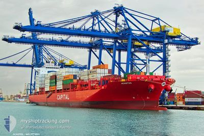
ACASTOS
Cargo
Current Trip
| Trip Time | 3 days |
|---|---|
| Trip Distance | 608.87 nm |
| AVG Speed | 8.5 Knopen |
| MAX Speed | 15.2 Knopen |
| Diepgang | 9 M |
| AVG Wind | 17.7 knots |
| MAX Wind | 33 knots |
| MIN Temp | 25.7°C / 78.26°F |
| MAX Temp | 28.9°C / 84.02°F |
| Positie ontvangen | 1 d geleden |
Current Position
| Lengtegraad | -69.62378° |
|---|---|
| Breedtegraat | 18.43141° |
| Status | Under way using engine |
| Snelheid | 4.7 Knopen |
| Koers | 109° |
| Gebied | Caribbean Sea |
| Station | T-AIS |
| Positie ontvangen | 1 d geleden |
Info
Information
The current position of ACASTOS is in Caribbean Sea with coordinates 18.43141° / -69.62378° as reported on 2025-02-11 14:52 by AIS to our vessel tracker app. The vessel's current speed is 4.7 Knopen and is currently inside the port of BOCA CHIKA.
The vessel ACASTOS (IMO: 9973004, MMSI: 538011021) is a Cargo It's sailing under the flag of [MH] Marshall Is.
In this page you can find informations about the vessels current position, last detected port calls, and current voyage information. If the vessels is not in coverage by AIS you will find the latest position.
The current position of ACASTOS is detected by our AIS receivers and we are not responsible for the reliability of the data. The last position was recorded while the vessel was in Coverage by the Ais receivers of our vessel tracking app.
The current draught of ACASTOS as reported by AIS is 9 meters
Weather
| Temperature | 25.8°C / 78.44°F |
|---|---|
| Wind Speed | 8 knots |
| Direction | 62° ENE |
| Pressure | 1019.2 hPa |
| Humidity | 69.3 % |
| Cloud Coverage | 100 % |
Featured Company
Last Port Calls
| Port | Arrival | Departure | Time In Port |
|---|---|---|---|
| 2025-02-10 14:23 | |||
| 2025-02-06 20:10 | 2025-02-07 10:45 | 14 h | |
| 2025-01-22 20:15 | 2025-01-23 11:01 | 14 h | |
| 2025-01-19 02:25 | 2025-01-19 18:38 | 16 h | |
| 2025-01-05 18:11 | 2025-01-06 10:05 | 15 h | |
| 2025-01-03 14:25 | 2025-01-04 13:44 | 23 h | |
| 2024-12-31 12:49 | 2025-01-02 14:37 | 2 d | |
| 2024-12-26 21:24 | 2024-12-27 17:32 | 20 h | |
| 2024-12-21 16:24 | 2024-12-22 07:19 | 14 h | |
| 2024-12-16 18:42 | 2024-12-17 11:11 | 16 h |
Most Visited Ports (Last year)
| Port | Arrivals | |
|---|---|---|
| 2 | ||
| 2 | ||
| 1 | ||
| 1 | ||
| 1 | ||
| 1 |
Last Trips
| Origin | Departure | Destination | Arrival | Distance | |
|---|---|---|---|---|---|
| 2025-02-07 10:45 | 2025-02-10 14:23 | 608.87 nm | |||
| 2025-01-23 11:01 | 2025-02-06 20:10 | 689.71 nm | |||
| 2025-01-19 18:38 | 2025-01-22 20:15 | 671.90 nm | |||
| 2025-01-06 10:05 | 2025-01-19 02:25 | 4718.56 nm | |||
| 2025-01-04 13:44 | 2025-01-05 18:11 | 389.75 nm | |||
| 2025-01-02 14:37 | 2025-01-03 14:25 | 93.37 nm | |||
| 2024-12-27 17:32 | 2024-12-31 12:49 | 1085.86 nm | |||
| 2024-12-22 07:19 | 2024-12-26 21:24 | 965.81 nm | |||
| 2024-12-17 11:11 | 2024-12-21 16:24 | 874.94 nm | |||
| 2024-12-14 00:51 | 2024-12-16 18:42 | 333.19 nm |
Events
| Tijd | Evenement | Details | Positie / Bestemming | Info |
|---|---|---|---|---|
| 2025-02-11 14:52 | Buitenbereik |
18.43141 / -69.62378
Caribbean Sea
[DO] BOCA CHIKA
|
Snelheid: 4.7 kn Koers: 82° |
|
| 2025-02-11 14:51 | Start beweging |
18.43109 / -69.62486
[DO] BOCA CHIKA
|
Snelheid: 5 kn Koers: 90° |
|
| 2025-02-11 14:43 | Status Changed | Under way using engine Moored |
18.42291 / -69.62934
[DO] BOCA CHIKA
|
Snelheid: Koers: 348° |
| 2025-02-10 18:44 | Status Changed | Moored Under way using engine |
18.42177 / -69.62966
[DO] BOCA CHIKA
|
Snelheid: 0.3 kn Koers: 347° |
| 2025-02-10 18:41 | Stop beweging |
18.42188 / -69.62955
[DO] BOCA CHIKA
|
Snelheid: 0.3 kn Koers: 347° |
|
| 2025-02-10 18:23 | Aankomsthaven |
|
18.42777 / -69.62424
[DO] BOCA CHIKA
|
Snelheid: 5.6 kn Koers: 318.6° |
| 2025-02-10 17:01 | ETA Changed | 2025/02/10 18:00 2025/02/10 21:00 |
18.24009 / -69.67969
DOCAU
|
Snelheid: 14.2 kn Koers: 40.3° |
| 2025-02-10 16:17 | Wijzig zee gebeid | Domican Republic part of the Caribbean Sea Colombian part of the Caribbean Sea |
18.10300 / -69.80055
Caribbean Sea
DOCAU
|
Snelheid: 14.8 kn Koers: 38.8° |
| 2025-02-10 16:17 | Binnenbereik |
18.10300 / -69.80055
Caribbean Sea
DOCAU
|
Snelheid: 14.8 kn Koers: 38.8° |
|
| 2025-02-08 04:14 | Buitenbereik |
11.51972 / -75.06654
Caribbean Sea
DOCAU
|
Snelheid: 7.3 kn Koers: 36.8° |