
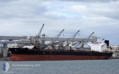
AFRICAN CHEETAH
Bulk Carrier
Current Trip
| Time Travelled | 4 days |
|---|---|
| Remaining Time | 12 days |
| Distance Travelled | 872.32 nm |
| Remaining Distance | 3489.25 nm |
| AVG Speed | 10.3 Knopen |
| MAX Speed | 13.4 Knopen |
| AVG Wind | 11.8 knots |
| MAX Wind | 25 knots |
| MIN Temp | 13.1°C / 55.58°F |
| MAX Temp | 24.2°C / 75.56°F |
| Diepgang | 12.9 M |
| Positie ontvangen | 1 h, 7 m geleden |
Current Position
| Lengtegraad | 60.38123° |
|---|---|
| Breedtegraat | 22.39499° |
| Status | Under way using engine |
| Snelheid | 12.3 Knopen |
| Koers | 177° |
| Gebied | Arabian Sea |
| Station | T-AIS |
| Positie ontvangen | 1 h, 7 m geleden |
Info
Information
The current position of AFRICAN CHEETAH is in Arabian Sea with coordinates 22.39499° / 60.38123° as reported on 2025-02-12 10:18 by AIS to our vessel tracker app. The vessel's current speed is 12.3 Knopen and is heading at the port of RICHARDS BAY. The estimated time of arrival as calculated by MyShipTracking vessel tracking app is 2025-02-24 22:46 LT
The vessel AFRICAN CHEETAH (IMO: 9636462, MMSI: 351754000) is a Bulk Carrier that was built in 2014 ( 11 Jaar oud ). It's sailing under the flag of [PA] Panama.
In this page you can find informations about the vessels current position, last detected port calls, and current voyage information. If the vessels is not in coverage by AIS you will find the latest position.
The current position of AFRICAN CHEETAH is detected by our AIS receivers and we are not responsible for the reliability of the data. The last position was recorded while the vessel was in Coverage by the Ais receivers of our vessel tracking app.
The current draught of AFRICAN CHEETAH as reported by AIS is 12.9 meters
Weather
| Temperature | 23.4°C / 74.12°F |
|---|---|
| Wind Speed | 8 knots |
| Direction | 29° NNE |
| Pressure | 1016.5 hPa |
| Humidity | 63.6 % |
| Cloud Coverage | --- |
Featured Company
Last Port Calls
| Port | Arrival | Departure | Time In Port |
|---|---|---|---|
| 2025-02-03 17:18 | 2025-02-08 03:36 | 4 d | |
| 2025-01-07 22:33 | 2025-01-21 22:29 | 13 d |
Most Visited Ports (Last year)
| Port | Arrivals | |
|---|---|---|
| 2 | ||
| 2 | ||
| 1 | ||
| 1 | ||
| 1 | ||
| 1 |
Last Trips
| Origin | Departure | Destination | Arrival | Distance | |
|---|---|---|---|---|---|
| 2025-01-21 22:29 | 2025-02-03 17:18 | 328.82 nm |
Events
| Tijd | Evenement | Details | Positie / Bestemming | Info |
|---|---|---|---|---|
| 2025-02-12 10:24 | Status Changed | Default Under way using engine |
22.37567 / 60.38218
ZARCB
|
Snelheid: 12.3 kn Koers: 177° |
| 2025-02-12 10:18 | Buitenbereik |
22.39499 / 60.38123
Arabian Sea
ZARCB
|
Snelheid: 12.3 kn Koers: 177° |
|
| 2025-02-12 07:58 | Status Changed | Under way using engine Default |
22.79138 / 60.20255
ZARCB
|
Snelheid: 11.5 kn Koers: 134° |
| 2025-02-12 07:48 | Status Changed | Default Under way using engine |
22.81354 / 60.17838
ZARCB
|
Snelheid: 11.5 kn Koers: 135° |
| 2025-02-12 07:09 | Wijzig zee gebeid | Omani part of the Arabian Sea Omani part of the Gulf of Oman |
22.90036 / 60.08132
Arabian Sea
ZARCB
|
Snelheid: 11 kn Koers: 134° |
| 2025-02-12 06:49 | Status Changed | Under way using engine Default |
22.94466 / 60.03251
ZARCB
|
Snelheid: 11.6 kn Koers: 135° |
| 2025-02-12 06:14 | Status Changed | Default Under way using engine |
23.02497 / 59.94111
ZARCB
|
Snelheid: 11.7 kn Koers: 130° |
| 2025-02-12 06:08 | Status Changed | Under way using engine Default |
23.03795 / 59.92510
ZARCB
|
Snelheid: 11.8 kn Koers: 131° |
| 2025-02-12 05:59 | Status Changed | Default Under way using engine |
23.05723 / 59.90154
ZARCB
|
Snelheid: 12 kn Koers: 131° |
| 2025-02-12 05:10 | Status Changed | Under way using engine Default |
23.16030 / 59.76563
ZARCB
|
Snelheid: 11.9 kn Koers: 128° |