

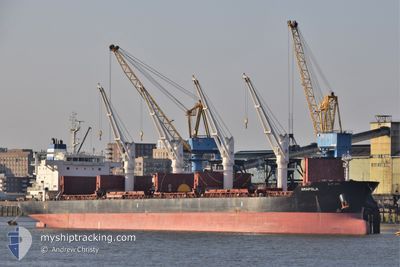
AMAPOLA
Bulk Carrier

Current Trip
CNTNG
| Time Travelled | 9 days |
|---|---|
| Remaining Time | --- |
| Distance Travelled | 1401.76 nm |
| Remaining Distance | --- |
| AVG Speed | 11.5 Knopen |
| MAX Speed | 14.5 Knopen |
| AVG Wind | 11.6 knots |
| MAX Wind | 26.9 knots |
| MIN Temp | -3.9°C / 24.98°F |
| MAX Temp | 16.7°C / 62.06°F |
| Diepgang | 6.2 M |
| Positie ontvangen | 9 d geleden |
Current Position
| Lengtegraad | 139.70745° |
|---|---|
| Breedtegraat | 35.08824° |
| Status | Under way using engine |
| Snelheid | 12.3 Knopen |
| Koers | 229.3° |
| Gebied | North Pacific Ocean |
| Station | T-AIS |
| Positie ontvangen | 9 d geleden |
Information
The current position of AMAPOLA is in North Pacific Ocean with coordinates 35.08824° / 139.70745° as reported on 2025-02-14 12:44 by AIS to our vessel tracker app. The vessel's current speed is 12.3 Knopen
The vessel AMAPOLA (IMO: 9588342, MMSI: 215226000) is a Bulk Carrier that was built in 2011 ( 14 Jaar oud ). It's sailing under the flag of [MT] Malta.
In this page you can find informations about the vessels current position, last detected port calls, and current voyage information. If the vessels is not in coverage by AIS you will find the latest position.
The current position of AMAPOLA is detected by our AIS receivers and we are not responsible for the reliability of the data. The last position was recorded while the vessel was in Coverage by the Ais receivers of our vessel tracking app.
The current draught of AMAPOLA as reported by AIS is 6.2 meters
Weather
| Temperature | 0.6°C / 33.08°F |
|---|---|
| Wind Speed | 14 knots |
| Direction | 255° WSW |
| Pressure | 1034.6 hPa |
| Humidity | 39.6 % |
| Cloud Coverage | --- |


Featured Company
Last Port Calls
| Port | Arrival | Departure | Time In Port |
|---|---|---|---|
| 2025-02-11 21:29 | 2025-02-14 10:25 | 2 d | |
| 2025-02-09 04:18 | 2025-02-10 07:23 | 1 d | |
| 2025-02-01 20:46 | 2025-02-04 22:05 | 3 d | |
| 2025-01-26 00:21 | 2025-01-31 07:57 | 5 d | |
| 2025-01-16 12:49 | 2025-01-18 23:53 | 2 d | |
| 2024-12-09 00:32 | 2024-12-16 18:24 | 7 d | |
| 2024-12-03 17:29 |
Most Visited Ports (Last year)
| Port | Arrivals | |
|---|---|---|
| 2 | ||
| 2 | ||
| 1 | ||
| 1 | ||
| 1 | ||
| 1 |
Last Trips
| Origin | Departure | Destination | Arrival | Distance | |
|---|---|---|---|---|---|
| 2025-02-10 16:23 | 2025-02-12 06:29 | 369.84 nm | |||
| 2025-02-05 07:05 | 2025-02-09 13:18 | 856.09 nm | |||
| 2025-01-31 15:57 | 2025-02-02 05:46 | 331.21 nm | |||
| 2025-01-19 07:53 | 2025-01-26 08:21 | 1577.74 nm | |||
| 2024-12-16 20:24 | 2025-01-16 20:49 | 6211.75 nm | |||
| 2024-12-03 19:29 | 2024-12-09 02:32 | 38.34 nm |
Events
| Tijd | Evenement | Details | Positie / Bestemming | Info |
|---|---|---|---|---|
| 2025-02-19 14:40 | Stop beweging | 15.02 nm, East of TIANJIN |
38.90822 / 118.05463
CNTNG
|
Snelheid: 0.3 kn Koers: 282° |
| 2025-02-14 12:49 | Status Changed | Default Under way using engine |
35.07595 / 139.69020
CNTNG
|
Snelheid: 12.3 kn Koers: 229.3° |
| 2025-02-14 12:44 | Buitenbereik |
35.08824 / 139.70745
North Pacific Ocean
CNTNG
|
Snelheid: 12.3 kn Koers: 229.3° |
|
| 2025-02-14 12:32 | Status Changed | Under way using engine Default |
35.12060 / 139.73444
CNTNG
|
Snelheid: 12.3 kn Koers: 198° |
| 2025-02-14 12:29 | Status Changed | Default Under way using engine |
35.12923 / 139.73793
CNTNG
|
Snelheid: 12.5 kn Koers: 198.7° |
| 2025-02-14 10:25 | Vertrekhaven |
|
35.36653 / 139.83476
CNTNG
|
Snelheid: 8.5 kn Koers: 310° |
| 2025-02-14 10:19 | ETA Changed | 2025/02/19 21:00 2025/02/14 21:00 |
35.36001 / 139.84567
[JP] KIMITSU
|
Snelheid: 4.2 kn Koers: 305° |
| 2025-02-14 10:19 | Start beweging |
35.35978 / 139.84606
[JP] KIMITSU
|
Snelheid: 3.8 kn Koers: 305° |
|
| 2025-02-14 10:09 | Draught Changed | 6.2 5.6 |
35.35995 / 139.84842
[JP] KIMITSU
|
Snelheid: Koers: 125° |
| 2025-02-14 10:09 | Destination Changed | CNTNG KIMITSU |
35.35995 / 139.84842
[JP] KIMITSU
|
Snelheid: Koers: 125° |