
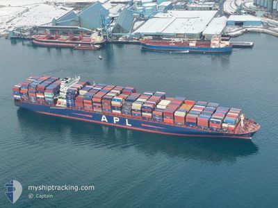
APL CHONGQING
Container Ship
Current Trip
| Time Travelled | 22 h, 16 mins |
|---|---|
| Remaining Time | --- |
| Distance Travelled | 311.09 nm |
| Remaining Distance | --- |
| AVG Speed | 16.2 Knopen |
| MAX Speed | 19.3 Knopen |
| AVG Wind | 4.7 knots |
| MAX Wind | 14 knots |
| MIN Temp | -2.7°C / 27.14°F |
| MAX Temp | 4°C / 39.2°F |
| Diepgang | 12.7 M |
| Positie ontvangen | 8 h, 50 m geleden |
Current Position
| Lengtegraad | -126.23925° |
|---|---|
| Breedtegraat | 48.48241° |
| Status | Under way using engine |
| Snelheid | 12.8 Knopen |
| Koers | 271.4° |
| Gebied | North Pacific Ocean |
| Station | T-AIS |
| Positie ontvangen | 8 h, 50 m geleden |
Info
Information
The current position of APL CHONGQING is in North Pacific Ocean with coordinates 48.48241° / -126.23925° as reported on 2025-02-12 07:36 by AIS to our vessel tracker app. The vessel's current speed is 12.8 Knopen and is heading at the port of GWANGYANG. The estimated time of arrival as calculated by MyShipTracking vessel tracking app is 2025-02-28 12:00 LT
The vessel APL CHONGQING (IMO: 9461867, MMSI: 566318000) is a Container Ship that was built in 2011 ( 14 Jaar oud ). It's sailing under the flag of [SG] Singapore.
In this page you can find informations about the vessels current position, last detected port calls, and current voyage information. If the vessels is not in coverage by AIS you will find the latest position.
The current position of APL CHONGQING is detected by our AIS receivers and we are not responsible for the reliability of the data. The last position was recorded while the vessel was in Coverage by the Ais receivers of our vessel tracking app.
The current draught of APL CHONGQING as reported by AIS is 12.7 meters
Weather
| Temperature | 4°C / 39.2°F |
|---|---|
| Wind Speed | 14 knots |
| Direction | 92° E |
| Pressure | 1013.8 hPa |
| Humidity | 61 % |
| Cloud Coverage | 31 % |
Featured Company
Last Port Calls
| Port | Arrival | Departure | Time In Port |
|---|---|---|---|
| 2025-02-06 13:51 | 2025-02-11 10:11 | 4 d | |
| 2025-02-01 15:40 | 2025-02-06 00:59 | 4 d | |
| 2025-01-14 02:24 | 2025-01-15 13:46 | 1 d | |
| 2025-01-11 12:48 | 2025-01-12 11:24 | 22 h | |
| 2025-01-04 01:19 | 2025-01-04 11:51 | 10 h | |
| 2024-12-12 04:24 | 2024-12-16 08:58 | 4 d | |
| 2024-12-08 05:08 | 2024-12-10 22:57 | 2 d |
Last Trips
| Origin | Departure | Destination | Arrival | Distance | |
|---|---|---|---|---|---|
| 2025-02-06 00:59 | 2025-02-06 13:51 | 187.85 nm | |||
| 2025-01-15 13:46 | 2025-02-01 15:40 | 5345.36 nm | |||
| 2025-01-12 11:24 | 2025-01-14 02:24 | 498.37 nm | |||
| 2025-01-04 11:51 | 2025-01-11 12:48 | 1552.27 nm | |||
| 2024-12-16 08:58 | 2025-01-04 01:19 | 5171.83 nm | |||
| 2024-12-10 22:57 | 2024-12-12 04:24 | 411.74 nm | |||
| 2024-11-27 10:31 | 2024-12-08 05:08 | 4823.35 nm |
Events
| Tijd | Evenement | Details | Positie / Bestemming | Info |
|---|---|---|---|---|
| 2025-02-12 07:52 | Status Changed | Default Under way using engine |
48.48279 / -126.31873
KRKAN
|
Snelheid: 12.8 kn Koers: 271.4° |
| 2025-02-12 07:36 | Buitenbereik |
48.48241 / -126.23925
North Pacific Ocean
KRKAN
|
Snelheid: 12.8 kn Koers: 271.4° |
|
| 2025-02-12 07:25 | Status Changed | Under way using engine Default |
48.48271 / -126.18083
KRKAN
|
Snelheid: 12.7 kn Koers: 266° |
| 2025-02-12 07:17 | Status Changed | Default Under way using engine |
48.48439 / -126.13481
KRKAN
|
Snelheid: 12.8 kn Koers: 267.6° |
| 2025-02-12 06:48 | Status Changed | Under way using engine Default |
48.48958 / -125.98331
KRKAN
|
Snelheid: 12.9 kn Koers: 267° |
| 2025-02-12 06:41 | Status Changed | Default Under way using engine |
48.49103 / -125.94334
KRKAN
|
Snelheid: 12.9 kn Koers: 266.9° |
| 2025-02-12 04:24 | Wijzig zee gebeid | Canadian part of the North Pacific Ocean Canadian part of the The Coastal Waters of Southeast Alaska and British Columbia |
48.51675 / -125.19612
North Pacific Ocean
KRKAN
|
Snelheid: 13.7 kn Koers: 266.5° |
| 2025-02-12 04:24 | Status Changed | Under way using engine Default |
48.51675 / -125.19612
KRKAN
|
Snelheid: 13.7 kn Koers: 266° |
| 2025-02-12 04:13 | Binnenbereik |
48.51675 / -125.19612
North Pacific Ocean
KRKAN
|
Snelheid: 13.7 kn Koers: 266.5° |
|
| 2025-02-12 02:52 | Buitenbereik |
48.49409 / -124.67088
The Coastal Waters of Southeast Alaska and British Columbia
KRKAN
|
Snelheid: 14.6 kn Koers: 293.4° |