
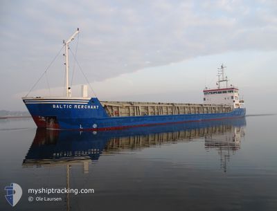
BALTIC MERCHANT
General Cargo
Current Trip
| Trip Time | 4 days |
|---|---|
| Trip Distance | 982.33 nm |
| AVG Speed | 9.1 Knopen |
| MAX Speed | 11.9 Knopen |
| Diepgang | 5 M |
| AVG Wind | 12.4 knots |
| MAX Wind | 22.4 knots |
| MIN Temp | 7.6°C / 45.68°F |
| MAX Temp | 16.3°C / 61.34°F |
| Positie ontvangen | 2 d geleden |
Current Position
| Lengtegraad | -6.02530° |
|---|---|
| Breedtegraat | 37.30572° |
| Status | Under way using engine |
| Snelheid | 6.6 Knopen |
| Koers | 43.3° |
| Gebied | North Atlantic Ocean |
| Station | T-AIS |
| Positie ontvangen | 2 d geleden |
Info
Information
The current position of BALTIC MERCHANT is in North Atlantic Ocean with coordinates 37.30572° / -6.02530° as reported on 2025-02-13 06:00 by AIS to our vessel tracker app. The vessel's current speed is 6.6 Knopen and is currently inside the port of SEVILLA.
The vessel BALTIC MERCHANT (IMO: 9138202, MMSI: 275516000) is a General Cargo that was built in 1997 ( 28 Jaar oud ). It's sailing under the flag of [LV] Latvia.
In this page you can find informations about the vessels current position, last detected port calls, and current voyage information. If the vessels is not in coverage by AIS you will find the latest position.
The current position of BALTIC MERCHANT is detected by our AIS receivers and we are not responsible for the reliability of the data. The last position was recorded while the vessel was in Coverage by the Ais receivers of our vessel tracking app.
The current draught of BALTIC MERCHANT as reported by AIS is 5 meters
Weather
| Temperature | 9.3°C / 48.74°F |
|---|---|
| Wind Speed | 5 knots |
| Direction | 60° ENE |
| Pressure | 1014.9 hPa |
| Humidity | 90.6 % |
| Cloud Coverage | 88 % |
Featured Company
Last Port Calls
| Port | Arrival | Departure | Time In Port |
|---|---|---|---|
| 2025-02-13 07:27 | |||
| 2025-02-08 09:36 | 2025-02-08 17:27 | 7 h | |
| 2025-01-30 09:29 | 2025-02-03 17:54 | 4 d | |
| 2025-01-22 13:13 | 2025-01-24 18:09 | 2 d | |
| 2025-01-21 21:16 | 2025-01-21 21:36 | 20 m | |
| 2025-01-18 08:30 | 2025-01-20 21:17 | 2 d | |
| 2025-01-16 00:45 | 2025-01-17 14:13 | 1 d | |
| 2025-01-09 22:27 | 2025-01-13 04:40 | 3 d | |
| 2024-12-31 13:34 | 2024-12-31 15:56 | 2 h | |
| 2024-12-21 09:10 | 2024-12-23 16:41 | 2 d |
Last Trips
| Origin | Departure | Destination | Arrival | Distance | |
|---|---|---|---|---|---|
| 2025-02-08 17:27 | 2025-02-13 07:27 | 982.33 nm | |||
| 2025-02-03 17:54 | 2025-02-08 09:36 | 779.21 nm | |||
| 2025-01-24 18:09 | 2025-01-30 09:29 | 382.80 nm | |||
| 2025-01-21 21:36 | 2025-01-22 13:13 | 96.73 nm | |||
| 2025-01-20 21:17 | 2025-01-21 21:16 | 231.85 nm | |||
| 2025-01-17 14:13 | 2025-01-18 08:30 | 166.52 nm | |||
| 2025-01-13 04:40 | 2025-01-16 00:45 | 614.95 nm | |||
| 2024-12-31 15:56 | 2025-01-09 22:27 | 733.54 nm | |||
| 2024-12-23 16:41 | 2024-12-31 13:34 | 1071.18 nm | |||
| 2024-12-15 09:29 | 2024-12-21 09:10 | 540.55 nm |
Events
| Tijd | Evenement | Details | Positie / Bestemming | Info |
|---|---|---|---|---|
| 2025-02-15 05:54 | Start beweging |
37.34570 / -5.99357
[ES] SEVILLA
|
Snelheid: 4.1 kn Koers: 5° |
|
| 2025-02-13 06:33 | Stop beweging |
37.31870 / -6.00617
[ES] SEVILLA
|
Snelheid: Koers: 67° |
|
| 2025-02-13 06:27 | Status Changed | Default Under way using engine |
37.31858 / -6.00672
[ES] SEVILLA
|
Snelheid: 6.6 kn Koers: 43.3° |
| 2025-02-13 06:27 | Aankomsthaven |
|
37.31858 / -6.00672
[ES] SEVILLA
|
Snelheid: 6.6 kn Koers: 43.3° |
| 2025-02-13 06:00 | Status Changed | Under way using engine Default |
37.30572 / -6.02530
ES SVQ
|
Snelheid: 7.7 kn Koers: 25° |
| 2025-02-13 06:00 | Buitenbereik |
37.30572 / -6.02530
North Atlantic Ocean
[ES] SEVILLA
|
Snelheid: 6.6 kn Koers: 43.3° |
|
| 2025-02-13 05:45 | Status Changed | Default Under way using engine |
37.28124 / -6.04833
ES SVQ
|
Snelheid: 6.3 kn Koers: 21.8° |
| 2025-02-13 05:30 | Status Changed | Under way using engine Default |
37.24810 / -6.06198
ES SVQ
|
Snelheid: 10.4 kn Koers: 39° |
| 2025-02-13 05:30 | Binnenbereik |
37.24810 / -6.06198
North Atlantic Ocean
ES SVQ
|
Snelheid: 9.9 kn Koers: 359.8° |
|
| 2025-02-13 03:12 | Buitenbereik |
36.89685 / -6.23142
North Atlantic Ocean
ES SVQ
|
Snelheid: 11.6 kn Koers: 67.9° |