
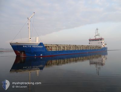
BALTIC MERCHANT
General Cargo
Current Trip
| Time Travelled | 4 days |
|---|---|
| Remaining Time | 4 h, 46 mins |
| Distance Travelled | 935.71 nm |
| Remaining Distance | 97.54 nm |
| AVG Speed | 9 Knots |
| MAX Speed | 11.3 Knots |
| AVG Wind | 13.1 knots |
| MAX Wind | 22.4 knots |
| MIN Temp | 7.6°C / 45.68°F |
| MAX Temp | 16.3°C / 61.34°F |
| Draught | 5 m |
| Position Received | 1 m ago |
Current Position
| Longitude | -6.43738° |
|---|---|
| Latitude | 36.76830° |
| Status | Under way using engine |
| Speed | 9.4 Knots |
| Course | 83.2° |
| Area | North Atlantic Ocean |
| Station | T-AIS |
| Position Received | 1 m ago |
Info
Information
The current position of BALTIC MERCHANT is in North Atlantic Ocean with coordinates 36.76830° / -6.43738° as reported on 2025-02-13 01:39 by AIS to our vessel tracker app. The vessel's current speed is 9.4 Knots and is heading at the port of SEVILLA. The estimated time of arrival as calculated by MyShipTracking vessel tracking app is 2025-02-13 07:27 LT
The vessel BALTIC MERCHANT (IMO: 9138202, MMSI: 275516000) is a General Cargo that was built in 1997 ( 28 years old ). It's sailing under the flag of [LV] Latvia.
In this page you can find informations about the vessels current position, last detected port calls, and current voyage information. If the vessels is not in coverage by AIS you will find the latest position.
The current position of BALTIC MERCHANT is detected by our AIS receivers and we are not responsible for the reliability of the data. The last position was recorded while the vessel was in Coverage by the Ais receivers of our vessel tracking app.
The current draught of BALTIC MERCHANT as reported by AIS is 5 meters
Weather
| Temperature | 14°C / 57.2°F |
|---|---|
| Wind Speed | 10 knots |
| Direction | 4° N |
| Pressure | 1022.4 hPa |
| Humidity | 69.7 % |
| Cloud Coverage | 53 % |
Featured Company
Last Port Calls
| Port | Arrival | Departure | Time In Port |
|---|---|---|---|
| 2025-02-08 09:36 | 2025-02-08 17:27 | 7 h | |
| 2025-01-30 09:29 | 2025-02-03 17:54 | 4 d | |
| 2025-01-22 13:13 | 2025-01-24 18:09 | 2 d | |
| 2025-01-21 21:16 | 2025-01-21 21:36 | 20 m | |
| 2025-01-18 08:30 | 2025-01-20 21:17 | 2 d | |
| 2025-01-16 00:45 | 2025-01-17 14:13 | 1 d | |
| 2025-01-09 22:27 | 2025-01-13 04:40 | 3 d | |
| 2024-12-31 13:34 | 2024-12-31 15:56 | 2 h | |
| 2024-12-21 09:10 | 2024-12-23 16:41 | 2 d | |
| 2024-12-15 08:39 | 2024-12-15 09:29 | 49 m |
Last Trips
| Origin | Departure | Destination | Arrival | Distance | |
|---|---|---|---|---|---|
| 2025-02-03 17:54 | 2025-02-08 09:36 | 779.21 nm | |||
| 2025-01-24 18:09 | 2025-01-30 09:29 | 382.80 nm | |||
| 2025-01-21 21:36 | 2025-01-22 13:13 | 96.73 nm | |||
| 2025-01-20 21:17 | 2025-01-21 21:16 | 231.85 nm | |||
| 2025-01-17 14:13 | 2025-01-18 08:30 | 166.52 nm | |||
| 2025-01-13 04:40 | 2025-01-16 00:45 | 614.95 nm | |||
| 2024-12-31 15:56 | 2025-01-09 22:27 | 733.54 nm | |||
| 2024-12-23 16:41 | 2024-12-31 13:34 | 1071.18 nm | |||
| 2024-12-15 09:29 | 2024-12-21 09:10 | 540.55 nm | |||
| 2024-12-14 17:09 | 2024-12-15 08:39 | 99.23 nm |
Events
| Time | Event | Details | Position / Dest | Info |
|---|---|---|---|---|
| 2025-02-13 01:38 | ETA Changed | 2025/02/13 01:35 2025/02/12 23:00 |
36.76758 / -6.44687
ES SVQ
|
Speed: 8.4 kn Course: 85.6° |
| 2025-02-13 01:27 | Status Changed | Under way using engine Default |
36.77320 / -6.46803
ES SVQ
|
Speed: 9.6 kn Course: 95° |
| 2025-02-13 00:42 | Status Changed | Default Under way using engine |
36.76623 / -6.61883
ES SVQ
|
Speed: 9.8 kn Course: 80.9° |
| 2025-02-13 00:36 | Change Sea Area | Spanish part of the North Atlantic Ocean Portuguese part of the North Atlantic Ocean |
36.76402 / -6.63915
North Atlantic Ocean
ES SVQ
|
Speed: 9.8 kn Course: 80.9° |
| 2025-02-13 00:36 | Status Changed | Under way using engine Default |
36.76402 / -6.63915
ES SVQ
|
Speed: 9 kn Course: 81° |
| 2025-02-13 00:34 | IN Coverage |
36.76402 / -6.63915
North Atlantic Ocean
ES SVQ
|
Speed: 9.8 kn Course: 80.9° |
|
| 2025-02-12 03:21 | Status Changed | Default Under way using engine |
37.73310 / -9.81295
ES SVQ
|
Speed: 8.8 kn Course: 165.5° |
| 2025-02-12 03:15 | Status Changed | Under way using engine Default |
37.74747 / -9.81722
ES SVQ
|
Speed: 8.7 kn Course: 167° |
| 2025-02-12 03:15 | OUT of Coverage |
37.74747 / -9.81722
North Atlantic Ocean
ES SVQ
|
Speed: 8.8 kn Course: 165.5° |
|
| 2025-02-12 03:09 | Status Changed | Default Under way using engine |
37.76190 / -9.82160
ES SVQ
|
Speed: 8.8 kn Course: 165.8° |