
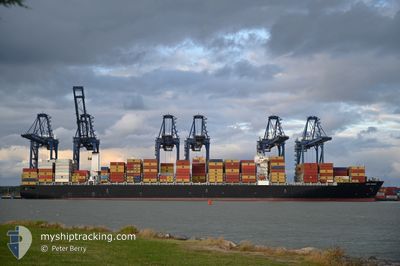
CAPE TAINARO
Cargo
Current Trip
| Trip Time | 6 days |
|---|---|
| Trip Distance | 1252.79 nm |
| AVG Speed | 10.5 Knopen |
| MAX Speed | 10.5 Knopen |
| Diepgang | 9.7 M |
| AVG Wind | 11 knots |
| MAX Wind | 34 knots |
| MIN Temp | 3.9°C / 39.02°F |
| MAX Temp | 11.4°C / 52.52°F |
| Positie ontvangen | 2 m geleden |
Current Position
| Lengtegraad | -123.07345° |
|---|---|
| Breedtegraat | 49.28911° |
| Status | Moored |
| Snelheid | |
| Koers | 108° |
| Gebied | The Coastal Waters of Southeast Alaska and British Columbia |
| Station | T-AIS |
| Positie ontvangen | 2 m geleden |
Info
Information
The current position of CAPE TAINARO is in The Coastal Waters of Southeast Alaska and British Columbia with coordinates 49.28911° / -123.07345° as reported on 2025-02-24 23:39 by AIS to our vessel tracker app. The vessel's current speed is 0 Knopen and is currently inside the port of VANCOUVER.
The vessel CAPE TAINARO (IMO: 9706205, MMSI: 249982000) is a Cargo It's sailing under the flag of [MT] Malta.
In this page you can find informations about the vessels current position, last detected port calls, and current voyage information. If the vessels is not in coverage by AIS you will find the latest position.
The current position of CAPE TAINARO is detected by our AIS receivers and we are not responsible for the reliability of the data. The last position was recorded while the vessel was in Coverage by the Ais receivers of our vessel tracking app.
The current draught of CAPE TAINARO as reported by AIS is 9.7 meters
Weather
| Temperature | 8.7°C / 47.66°F |
|---|---|
| Wind Speed | 5 knots |
| Direction | 81° E |
| Pressure | 1004.3 hPa |
| Humidity | 79.7 % |
| Cloud Coverage | 100 % |
Featured Company
Last Port Calls
| Port | Arrival | Departure | Time In Port |
|---|---|---|---|
| 2025-02-24 12:58 | |||
| 2025-02-16 11:07 | 2025-02-17 19:41 | 1 d | |
| 2025-02-10 15:04 | 2025-02-12 05:26 | 1 d | |
| 2025-02-06 10:48 | 2025-02-07 13:28 | 1 d | |
| 2025-01-31 10:06 | 2025-02-02 09:37 | 1 d | |
| 2025-01-16 15:02 | 2025-01-18 02:15 | 1 d | |
| 2025-01-13 23:32 | 2025-01-15 00:16 | 1 d | |
| 2025-01-12 04:10 | 2025-01-13 09:13 | 1 d | |
| 2025-01-10 07:15 | 2025-01-11 03:43 | 20 h | |
| 2025-01-06 17:25 | 2025-01-08 08:57 | 1 d |
Most Visited Ports (Last year)
| Port | Arrivals | |
|---|---|---|
| 11 | ||
| 7 | ||
| 6 | ||
| 5 | ||
| 4 | ||
| 4 |
Last Trips
| Origin | Departure | Destination | Arrival | Distance | |
|---|---|---|---|---|---|
| 2025-02-17 19:41 | 2025-02-24 12:58 | 1252.79 nm | |||
| 2025-02-12 05:26 | 2025-02-16 11:07 | 406.00 nm | |||
| 2025-02-07 13:28 | 2025-02-10 15:04 | 1215.68 nm | |||
| 2025-02-02 09:37 | 2025-02-06 10:48 | 1749.99 nm | |||
| 2025-01-18 02:15 | 2025-01-31 10:06 | 4544.31 nm | |||
| 2025-01-15 00:16 | 2025-01-16 15:02 | 669.88 nm | |||
| 2025-01-13 09:13 | 2025-01-13 23:32 | 168.51 nm | |||
| 2025-01-11 03:43 | 2025-01-12 04:10 | 416.87 nm | |||
| 2025-01-08 08:57 | 2025-01-10 07:15 | 548.66 nm | |||
| 2025-01-03 22:28 | 2025-01-06 17:25 | 1109.81 nm |
Events
| Tijd | Evenement | Details | Positie / Bestemming | Info |
|---|---|---|---|---|
| 2025-02-24 21:51 | Status Changed | Moored Under way using engine |
49.28917 / -123.07353
[CA] VANCOUVER
|
Snelheid: 0.1 kn Koers: 109° |
| 2025-02-24 21:44 | Stop beweging |
49.28959 / -123.07371
[CA] VANCOUVER
|
Snelheid: 0.3 kn Koers: 110° |
|
| 2025-02-24 20:58 | Aankomsthaven |
|
49.31688 / -123.14610
[CA] VANCOUVER
|
Snelheid: 8.9 kn Koers: 103.8° |
| 2025-02-24 19:17 | Wijzig zee gebeid | Canadian part of the The Coastal Waters of Southeast Alaska and British Columbia United States part of the The Coastal Waters of Southeast Alaska and British Columbia |
49.00956 / -123.25782
The Coastal Waters of Southeast Alaska and British Columbia
CAVAN
|
Snelheid: 18.1 kn Koers: 315.2° |
| 2025-02-24 18:32 | Wijzig zee gebeid | United States part of the The Coastal Waters of Southeast Alaska and British Columbia Canadian part of the The Coastal Waters of Southeast Alaska and British Columbia |
48.84413 / -123.03253
The Coastal Waters of Southeast Alaska and British Columbia
CAVAN
|
Snelheid: 17.4 kn Koers: 326° |
| 2025-02-24 18:26 | Wijzig zee gebeid | Canadian part of the The Coastal Waters of Southeast Alaska and British Columbia United States part of the The Coastal Waters of Southeast Alaska and British Columbia |
48.82026 / -123.01079
The Coastal Waters of Southeast Alaska and British Columbia
CAVAN
|
Snelheid: 15.3 kn Koers: 335.5° |
| 2025-02-24 18:23 | Wijzig zee gebeid | United States part of the The Coastal Waters of Southeast Alaska and British Columbia Canadian part of the The Coastal Waters of Southeast Alaska and British Columbia |
48.80759 / -123.00716
The Coastal Waters of Southeast Alaska and British Columbia
CAVAN
|
Snelheid: 15.8 kn Koers: 3.2° |
| 2025-02-24 17:59 | Wijzig zee gebeid | Canadian part of the The Coastal Waters of Southeast Alaska and British Columbia United States part of the The Coastal Waters of Southeast Alaska and British Columbia |
48.73445 / -123.12231
The Coastal Waters of Southeast Alaska and British Columbia
CAVAN
|
Snelheid: 15.6 kn Koers: 57.6° |
| 2025-02-24 16:50 | Wijzig zee gebeid | United States part of the The Coastal Waters of Southeast Alaska and British Columbia Canadian part of the The Coastal Waters of Southeast Alaska and British Columbia |
48.47589 / -123.17495
The Coastal Waters of Southeast Alaska and British Columbia
CAVAN
|
Snelheid: 16.2 kn Koers: 342.4° |
| 2025-02-24 13:56 | Wijzig zee gebeid | Canadian part of the The Coastal Waters of Southeast Alaska and British Columbia United States part of the The Coastal Waters of Southeast Alaska and British Columbia |
48.22343 / -123.54525
The Coastal Waters of Southeast Alaska and British Columbia
CAVAN
|
Snelheid: 6.8 kn Koers: 89.7° |