

CAPILANO SUN
Tanker B

Current Trip
| Time Travelled | 43 days |
|---|---|
| Remaining Time | 9 h, 29 mins |
| Distance Travelled | 10037.76 nm |
| Remaining Distance | 163.33 nm |
| AVG Speed | 11.3 Knopen |
| MAX Speed | 15.3 Knopen |
| AVG Wind | 12.9 knots |
| MAX Wind | 28 knots |
| MIN Temp | 12.7°C / 54.86°F |
| MAX Temp | 30°C / 86°F |
| Diepgang | 11.8 M |
| Positie ontvangen | 2 d geleden |
Current Position
| Lengtegraad | 141.63829° |
|---|---|
| Breedtegraat | 33.12403° |
| Status | Under way using engine |
| Snelheid | 12.4 Knopen |
| Koers | 258.9° |
| Gebied | North Pacific Ocean |
| Station | T-AIS |
| Positie ontvangen | 2 d geleden |
Information
The current position of CAPILANO SUN is in North Pacific Ocean with coordinates 33.12403° / 141.63829° as reported on 2025-06-06 06:18 by AIS to our vessel tracker app. The vessel's current speed is 12.4 Knopen and is heading at the port of ULSAN. The estimated time of arrival as calculated by MyShipTracking vessel tracking app is 2025-06-09 22:33 LT
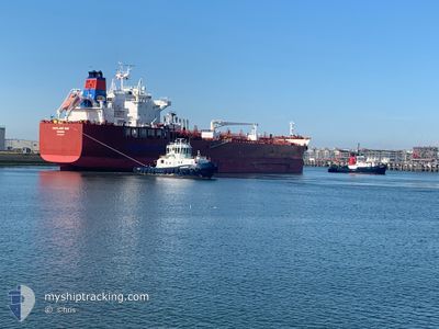
The vessel CAPILANO SUN (IMO: 9909584, MMSI: 352980843) is a Tanker B It's sailing under the flag of [PA] Panama.
In this page you can find informations about the vessels current position, last detected port calls, and current voyage information. If the vessels is not in coverage by AIS you will find the latest position.
The current position of CAPILANO SUN is detected by our AIS receivers and we are not responsible for the reliability of the data. The last position was recorded while the vessel was in Coverage by the Ais receivers of our vessel tracking app.
The current draught of CAPILANO SUN as reported by AIS is 11.8 meters
Weather
| Temperature | 20.6°C / 69.08°F |
|---|---|
| Wind Speed | 7 knots |
| Direction | 100° E |
| Pressure | 1007.4 hPa |
| Humidity | 86.7 % |
| Cloud Coverage | 98 % |


Featured Company
Last Port Calls
| Port | Arrival | Departure | Time In Port |
|---|---|---|---|
| 2025-04-26 16:00 | 2025-04-26 21:28 | 5 h | |
| 2025-04-14 21:46 | 2025-04-18 03:06 | 3 d |
Most Visited Ports (Last year)
| Port | Arrivals | |
|---|---|---|
| 4 | ||
| 3 | ||
| 2 | ||
| 2 | ||
| 1 | ||
| 1 |
Last Trips
| Origin | Departure | Destination | Arrival | Distance | |
|---|---|---|---|---|---|
| 2025-04-18 03:06 | 2025-04-26 16:00 | 995.56 nm | |||
| 2025-03-08 07:21 | 2025-04-14 21:46 | 10332.79 nm |
Events
| Tijd | Evenement | Details | Positie / Bestemming | Info |
|---|---|---|---|---|
| 2025-06-06 06:28 | Status Changed | Default Under way using engine |
33.11694 / 141.59798
KRUSN
|
Snelheid: 12.4 kn Koers: 258.9° |
| 2025-06-06 06:18 | Buitenbereik |
33.12403 / 141.63829
North Pacific Ocean
KRUSN
|
Snelheid: 12.4 kn Koers: 258.9° |
|
| 2025-06-06 06:16 | Status Changed | Under way using engine Default |
33.12557 / 141.64701
KRUSN
|
Snelheid: 12.3 kn Koers: 257° |
| 2025-06-06 05:46 | Status Changed | Default Under way using engine |
33.14623 / 141.76694
KRUSN
|
Snelheid: 12.2 kn Koers: 259.4° |
| 2025-06-06 05:20 | Status Changed | Under way using engine Default |
33.16464 / 141.87376
KRUSN
|
Snelheid: 12.5 kn Koers: 258° |
| 2025-06-06 05:01 | Status Changed | Default Under way using engine |
33.17673 / 141.94852
KRUSN
|
Snelheid: 12.4 kn Koers: 259.7° |
| 2025-06-06 04:35 | Status Changed | Under way using engine Default |
33.19874 / 142.05531
KRUSN
|
Snelheid: 12.3 kn Koers: 255° |
| 2025-06-06 04:24 | Binnenbereik |
33.19874 / 142.05531
North Pacific Ocean
KRUSN
|
Snelheid: 12.6 kn Koers: 254.2° |
|
| 2025-06-06 00:48 | Status Changed | Default Under way using engine |
33.38315 / 142.98416
KRUSN
|
Snelheid: 12.7 kn Koers: 259.3° |
| 2025-06-06 00:31 | Buitenbereik |
33.39455 / 143.05293
North Pacific Ocean
KRUSN
|
Snelheid: 12.7 kn Koers: 259.3° |