

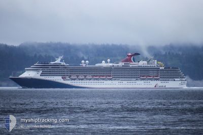
CARNIVAL SPIRIT
Passengers Ship

Current Trip
US,SEA>US,TAF
| Time Travelled | 1 day |
|---|---|
| Remaining Time | --- |
| Distance Travelled | 605.62 nm |
| Remaining Distance | --- |
| AVG Speed | 17.3 Knopen |
| MAX Speed | 22.2 Knopen |
| AVG Wind | 11 knots |
| MAX Wind | 30 knots |
| MIN Temp | 9.3°C / 48.74°F |
| MAX Temp | 29.5°C / 85.1°F |
| Diepgang | 8.2 M |
| Positie ontvangen | 4 h, 57 m geleden |
Current Position
| Lengtegraad | -132.27704° |
|---|---|
| Breedtegraat | 52.41169° |
| Status | Under way using engine |
| Snelheid | 20 Knopen |
| Koers | 318.5° |
| Gebied | North Pacific Ocean |
| Station | T-AIS |
| Positie ontvangen | 4 h, 57 m geleden |
Information
The current position of CARNIVAL SPIRIT is in North Pacific Ocean with coordinates 52.41169° / -132.27704° as reported on 2025-06-12 01:30 by AIS to our vessel tracker app. The vessel's current speed is 20 Knopen
The vessel CARNIVAL SPIRIT (IMO: 9188647, MMSI: 311001095) is a Passengers Ship that was built in 2001 ( 24 Jaar oud ). It's sailing under the flag of [BS] Bahamas.
In this page you can find informations about the vessels current position, last detected port calls, and current voyage information. If the vessels is not in coverage by AIS you will find the latest position.
The current position of CARNIVAL SPIRIT is detected by our AIS receivers and we are not responsible for the reliability of the data. The last position was recorded while the vessel was in Coverage by the Ais receivers of our vessel tracking app.
The current draught of CARNIVAL SPIRIT as reported by AIS is 8.2 meters
Weather
| Temperature | 9.3°C / 48.74°F |
|---|---|
| Wind Speed | 13 knots |
| Direction | 293° WNW |
| Pressure | 1021.1 hPa |
| Humidity | 76.2 % |
| Cloud Coverage | 23 % |


Featured Company
Last Port Calls
| Port | Arrival | Departure | Time In Port |
|---|---|---|---|
| 2025-06-10 05:39 | 2025-06-10 15:38 | 9 h | |
| 2025-06-09 19:15 | 2025-06-09 23:56 | 4 h | |
| 2025-06-08 05:40 | 2025-06-08 13:28 | 7 h | |
| 2025-06-07 05:52 | 2025-06-07 15:24 | 9 h | |
| 2025-06-06 05:12 | 2025-06-06 20:12 | 15 h | |
| 2025-06-03 05:35 | 2025-06-03 15:52 | 10 h | |
| 2025-06-02 19:28 | 2025-06-02 23:52 | 4 h | |
| 2025-06-01 05:48 | 2025-06-01 13:24 | 7 h | |
| 2025-05-31 05:52 | 2025-05-31 15:28 | 9 h | |
| 2025-05-30 04:40 | 2025-05-30 20:16 | 15 h |
Last Trips
| Origin | Departure | Destination | Arrival | Distance | |
|---|---|---|---|---|---|
| 2025-06-09 23:56 | 2025-06-10 05:39 | 83.81 nm | |||
| 2025-06-08 13:28 | 2025-06-09 19:15 | 590.15 nm | |||
| 2025-06-07 15:24 | 2025-06-08 05:40 | 280.29 nm | |||
| 2025-06-06 20:12 | 2025-06-07 05:52 | 101.04 nm | |||
| 2025-06-03 15:52 | 2025-06-06 05:12 | 1034.60 nm | |||
| 2025-06-02 23:52 | 2025-06-03 05:35 | 83.49 nm | |||
| 2025-06-01 13:24 | 2025-06-02 19:28 | 592.28 nm | |||
| 2025-05-31 15:28 | 2025-06-01 05:48 | 280.36 nm | |||
| 2025-05-30 20:16 | 2025-05-31 05:52 | 100.43 nm | |||
| 2025-05-27 15:36 | 2025-05-30 04:40 | 1034.85 nm |
Events
| Tijd | Evenement | Details | Positie / Bestemming | Info |
|---|---|---|---|---|
| 2025-06-12 01:35 | Status Changed | Default Under way using engine |
52.43127 / -132.30547
US,SEA>US,TAF
|
Snelheid: 20 kn Koers: 318.5° |
| 2025-06-12 01:30 | Buitenbereik |
52.41169 / -132.27704
North Pacific Ocean
US,SEA>US,TAF
|
Snelheid: 20 kn Koers: 318.5° |
|
| 2025-06-12 01:15 | Status Changed | Under way using engine Default |
52.34835 / -132.18447
US,SEA>US,TAF
|
Snelheid: 20 kn Koers: 318° |
| 2025-06-12 01:05 | Status Changed | Default Under way using engine |
52.30854 / -132.12633
US,SEA>US,TAF
|
Snelheid: 20.2 kn Koers: 317.8° |
| 2025-06-12 01:03 | Status Changed | Under way using engine Default |
52.30019 / -132.11415
US,SEA>US,TAF
|
Snelheid: 20.2 kn Koers: 319° |
| 2025-06-12 00:58 | Status Changed | Default Under way using engine |
52.27770 / -132.08231
US,SEA>US,TAF
|
Snelheid: 20.3 kn Koers: 319° |
| 2025-06-12 00:54 | Status Changed | Under way using engine Default |
52.26328 / -132.06184
US,SEA>US,TAF
|
Snelheid: 20.4 kn Koers: 320° |
| 2025-06-12 00:22 | Status Changed | Default Under way using engine |
52.13009 / -131.86455
US,SEA>US,TAF
|
Snelheid: 20.3 kn Koers: 319° |
| 2025-06-12 00:17 | Status Changed | Under way using engine Default |
52.10713 / -131.83105
US,SEA>US,TAF
|
Snelheid: 20.2 kn Koers: 320° |
| 2025-06-12 00:17 | Binnenbereik |
52.10713 / -131.83105
North Pacific Ocean
US,SEA>US,TAF
|
Snelheid: 20.3 kn Koers: 319° |