

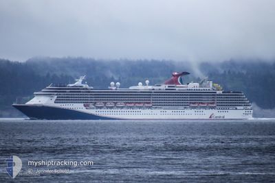
CARNIVAL SPIRIT
Passengers Ship

Current Trip
US,KTN>CA,VIC
| Time Travelled | 16 h, 23 mins |
|---|---|
| Remaining Time | --- |
| Distance Travelled | 347.55 nm |
| Remaining Distance | --- |
| AVG Speed | 21.8 Knots |
| MAX Speed | 23.1 Knots |
| AVG Wind | 16.2 knots |
| MAX Wind | 30 knots |
| MIN Temp | 10.3°C / 50.54°F |
| MAX Temp | 12.7°C / 54.86°F |
| Draught | 8.2 m |
| Position Received | 1 h, 32 m ago |
Current Position
| Longitude | -128.89642° |
|---|---|
| Latitude | 50.35729° |
| Status | Under way using engine |
| Speed | 22.1 Knots |
| Course | 136.2° |
| Area | North Pacific Ocean |
| Station | T-AIS |
| Position Received | 1 h, 32 m ago |
Information
The current position of CARNIVAL SPIRIT is in North Pacific Ocean with coordinates 50.35729° / -128.89642° as reported on 2025-06-09 12:19 by AIS to our vessel tracker app. The vessel's current speed is 22.1 Knots
The vessel CARNIVAL SPIRIT (IMO: 9188647, MMSI: 311001095) is a Passengers Ship that was built in 2001 ( 24 years old ). It's sailing under the flag of [BS] Bahamas.
In this page you can find informations about the vessels current position, last detected port calls, and current voyage information. If the vessels is not in coverage by AIS you will find the latest position.
The current position of CARNIVAL SPIRIT is detected by our AIS receivers and we are not responsible for the reliability of the data. The last position was recorded while the vessel was in Coverage by the Ais receivers of our vessel tracking app.
The current draught of CARNIVAL SPIRIT as reported by AIS is 8.2 meters
Weather
| Temperature | 10.9°C / 51.62°F |
|---|---|
| Wind Speed | 32 knots |
| Direction | 345° NNW |
| Pressure | 1021 hPa |
| Humidity | 80.5 % |
| Cloud Coverage | --- |


Featured Company
Last Port Calls
| Port | Arrival | Departure | Time In Port |
|---|---|---|---|
| 2025-06-08 05:40 | 2025-06-08 13:28 | 7 h | |
| 2025-06-07 05:52 | 2025-06-07 15:24 | 9 h | |
| 2025-06-06 05:12 | 2025-06-06 20:12 | 15 h | |
| 2025-06-03 05:35 | 2025-06-03 15:52 | 10 h | |
| 2025-06-02 19:28 | 2025-06-02 23:52 | 4 h | |
| 2025-06-01 05:48 | 2025-06-01 13:24 | 7 h | |
| 2025-05-31 05:52 | 2025-05-31 15:28 | 9 h | |
| 2025-05-30 04:40 | 2025-05-30 20:16 | 15 h | |
| 2025-05-27 05:39 | 2025-05-27 15:36 | 9 h | |
| 2025-05-26 19:24 | 2025-05-26 23:50 | 4 h |
Last Trips
| Origin | Departure | Destination | Arrival | Distance | |
|---|---|---|---|---|---|
| 2025-06-07 15:24 | 2025-06-08 05:40 | 280.29 nm | |||
| 2025-06-06 20:12 | 2025-06-07 05:52 | 101.04 nm | |||
| 2025-06-03 15:52 | 2025-06-06 05:12 | 1034.60 nm | |||
| 2025-06-02 23:52 | 2025-06-03 05:35 | 83.49 nm | |||
| 2025-06-01 13:24 | 2025-06-02 19:28 | 592.28 nm | |||
| 2025-05-31 15:28 | 2025-06-01 05:48 | 280.36 nm | |||
| 2025-05-30 20:16 | 2025-05-31 05:52 | 100.43 nm | |||
| 2025-05-27 15:36 | 2025-05-30 04:40 | 1034.85 nm | |||
| 2025-05-26 23:50 | 2025-05-27 05:39 | 84.63 nm | |||
| 2025-05-25 13:28 | 2025-05-26 19:24 | 591.33 nm |
Events
| Time | Event | Details | Position / Dest | Info |
|---|---|---|---|---|
| 2025-06-09 12:22 | Status Changed | Default Under way using engine |
50.34145 / -128.87245
US,KTN>CA,VIC
|
Speed: 22.1 kn Course: 136.2° |
| 2025-06-09 12:19 | Change Sea Area | Canadian part of the North Pacific Ocean Canadian part of the The Coastal Waters of Southeast Alaska and British Columbia |
50.35729 / -128.89642
North Pacific Ocean
|
Speed: 22.1 kn Course: 136.2° |
| 2025-06-09 12:19 | OUT of Coverage |
50.35729 / -128.89642
North Pacific Ocean
|
Speed: 22.1 kn Course: 136.2° |
|
| 2025-06-09 12:18 | Status Changed | Under way using engine Default |
50.36169 / -128.90303
US,KTN>CA,VIC
|
Speed: 22.1 kn Course: 137° |
| 2025-06-09 12:04 | IN Coverage |
50.35729 / -128.89642
North Pacific Ocean
|
Speed: 22.1 kn Course: 136.2° |
|
| 2025-06-09 06:59 | Status Changed | Default Under way using engine |
52.14748 / -130.12614
US,KTN>CA,VIC
|
Speed: 22.1 kn Course: 164.3° |
| 2025-06-09 06:59 | OUT of Coverage |
52.14973 / -130.12715
The Coastal Waters of Southeast Alaska and British Columbia
|
Speed: 22.1 kn Course: 164.3° |
|
| 2025-06-09 04:26 | Status Changed | Under way using engine Default |
53.04387 / -130.56490
US,KTN>CA,VIC
|
Speed: 21.6 kn Course: 162° |
| 2025-06-09 04:26 | IN Coverage |
53.03274 / -130.55930
The Coastal Waters of Southeast Alaska and British Columbia
US,KTN>CA,VIC
|
Speed: 22.1 kn Course: 163.1° |
|
| 2025-06-09 02:46 | OUT of Coverage |
53.62901 / -130.85595
The Coastal Waters of Southeast Alaska and British Columbia
US,KTN>CA,VIC
|
Speed: 21.6 kn Course: 168.3° |