
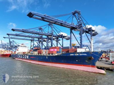
CMA CGM EIFFEL
Container Ship
Current Trip
| Trip Time | 1 day |
|---|---|
| Trip Distance | 729.28 nm |
| AVG Speed | 15.2 Knopen |
| MAX Speed | 17.2 Knopen |
| Diepgang | 9.4 M |
| AVG Wind | 15.4 knots |
| MAX Wind | 29 knots |
| MIN Temp | -2.3°C / 27.86°F |
| MAX Temp | 9.2°C / 48.56°F |
| Positie ontvangen | 13 d geleden |
Current Position
| Lengtegraad | 104.32829° |
|---|---|
| Breedtegraat | 1.29488° |
| Status | Under way using engine |
| Snelheid | 14.5 Knopen |
| Koers | 65.4° |
| Gebied | Singapore Strait |
| Station | T-AIS |
| Positie ontvangen | 13 d geleden |
Info
Information
The current position of CMA CGM EIFFEL is in Singapore Strait with coordinates 1.29488° / 104.32829° as reported on 2025-12-01 10:48 by AIS to our vessel tracker app. The vessel's current speed is 14.5 Knopen and is currently inside the port of BUSAN NEW PORT.
The vessel CMA CGM EIFFEL (IMO: 9248112, MMSI: 248455000) is a Container Ship that was built in 2002 ( 23 Jaar oud ). It's sailing under the flag of [MT] Malta.
In this page you can find informations about the vessels current position, last detected port calls, and current voyage information. If the vessels is not in coverage by AIS you will find the latest position.
The current position of CMA CGM EIFFEL is detected by our AIS receivers and we are not responsible for the reliability of the data. The last position was recorded while the vessel was in Coverage by the Ais receivers of our vessel tracking app.
The current draught of CMA CGM EIFFEL as reported by AIS is 9.4 meters
Weather
| Temperature | 4.9°C / 40.82°F |
|---|---|
| Wind Speed | 12 knots |
| Direction | 301° WNW |
| Pressure | 1022.8 hPa |
| Humidity | 57.1 % |
| Cloud Coverage | 1 % |
Featured Company
Last Port Calls
| Port | Arrival | Departure | Time In Port |
|---|---|---|---|
| 2025-12-14 20:41 | |||
| 2025-12-11 10:33 | 2025-12-12 20:25 | 1 d | |
| 2025-10-28 20:20 | 2025-11-02 00:04 | 4 d | |
| 2025-10-24 10:32 | 2025-10-25 07:36 | 21 h | |
| 2025-10-06 15:18 | 2025-10-14 13:52 | 7 d | |
| 2025-10-06 02:07 | 2025-10-06 15:13 | 13 h | |
| 2025-10-04 13:26 | 2025-10-05 23:23 | 1 d |
Last Trips
| Origin | Departure | Destination | Arrival | Distance | |
|---|---|---|---|---|---|
| 2025-12-12 20:25 | 2025-12-14 20:41 | 729.28 nm | |||
| 2025-11-02 00:04 | 2025-12-11 10:33 | 11169.84 nm | |||
| 2025-10-25 07:36 | 2025-10-28 20:20 | 389.58 nm | |||
| 2025-10-14 13:52 | 2025-10-24 10:32 | 3132.02 nm | |||
| 2025-10-06 15:13 | 2025-10-06 15:18 | 0.18 nm | |||
| 2025-10-05 23:23 | 2025-10-06 02:07 | 17.02 nm | |||
| 2025-09-30 04:40 | 2025-10-04 13:26 | 1569.56 nm |
Events
| Tijd | Evenement | Details | Positie / Bestemming | Info |
|---|---|---|---|---|
| 2025-12-14 11:45 | Stop beweging |
35.06742 / 128.80815
[KR] BUSAN NEW PORT
|
Snelheid: 0.2 kn Koers: 80° |
|
| 2025-12-14 11:41 | Aankomsthaven |
|
35.06772 / 128.80789
[KR] BUSAN NEW PORT
|
Snelheid: 2.3 kn Koers: 83° |
| 2025-12-12 12:25 | Vertrekhaven |
|
38.95655 / 117.87612
CNTXG
|
Snelheid: 12.3 kn Koers: 101° |
| 2025-12-12 11:49 | Start beweging |
39.00337 / 117.77969
[CN] TIANJIN
|
Snelheid: 4 kn Koers: 171° |
|
| 2025-12-11 03:31 | Stop beweging |
39.00272 / 117.77490
[CN] TIANJIN
|
Snelheid: Koers: 348° |
|
| 2025-12-11 02:33 | Aankomsthaven |
|
38.95905 / 117.86329
[CN] TIANJIN
|
Snelheid: 12.3 kn Koers: 280° |
| 2025-12-11 01:25 | Start beweging | 16.63 nm, East of TIANJIN |
38.88619 / 118.08145
CNTXG
|
Snelheid: 3.4 kn Koers: 3° |
| 2025-12-10 10:20 | Stop beweging | 17.08 nm, East of TIANJIN |
38.88353 / 118.09026
CNTXG
|
Snelheid: 0.2 kn Koers: 1° |
| 2025-12-09 07:58 | Start beweging |
36.37415 / 123.11548
CNTXG
|
Snelheid: 3.1 kn Koers: 321° |
|
| 2025-12-09 03:17 | Stop beweging |
36.33400 / 123.06064
CNTXG
|
Snelheid: Koers: 293° |