
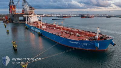
COSDIGNITY LAKE
Tanker
Current Trip
| Time Travelled | --- |
|---|---|
| Remaining Time | --- |
| Distance Travelled | 12527.28 nm |
| Remaining Distance | --- |
| AVG Speed | 11.7 Knopen |
| MAX Speed | 17 Knopen |
| AVG Wind | 9.3 knots |
| MAX Wind | 23 knots |
| MIN Temp | 22.7°C / 72.86°F |
| MAX Temp | 33.9°C / 93.02°F |
| Diepgang | 21.1 M |
| Positie ontvangen | 22 h, 5 m geleden |
Current Position
| Lengtegraad | 57.27217° |
|---|---|
| Breedtegraat | 25.31023° |
| Status | Under way using engine |
| Snelheid | 12.8 Knopen |
| Koers | 115.4° |
| Gebied | Gulf of Oman |
| Station | T-AIS |
| Positie ontvangen | 22 h, 5 m geleden |
Info
Information
The current position of COSDIGNITY LAKE is in Gulf of Oman with coordinates 25.31023° / 57.27217° as reported on 2025-12-14 21:54 by AIS to our vessel tracker app. The vessel's current speed is 12.8 Knopen and is heading at the port of DURBAN. The estimated time of arrival as calculated by MyShipTracking vessel tracking app is 2025-12-31 18:00 LT
The vessel COSDIGNITY LAKE (IMO: 9727209, MMSI: 477884300) is a Tanker It's sailing under the flag of [HK] Hong Kong.
In this page you can find informations about the vessels current position, last detected port calls, and current voyage information. If the vessels is not in coverage by AIS you will find the latest position.
The current position of COSDIGNITY LAKE is detected by our AIS receivers and we are not responsible for the reliability of the data. The last position was recorded while the vessel was in Coverage by the Ais receivers of our vessel tracking app.
The current draught of COSDIGNITY LAKE as reported by AIS is 21.1 meters
Weather
| Temperature | 24.2°C / 75.56°F |
|---|---|
| Wind Speed | 11 knots |
| Direction | 101° E |
| Pressure | 1015.3 hPa |
| Humidity | 60.6 % |
| Cloud Coverage | 7 % |
Featured Company
Last Port Calls
Last Trips
| Origin | Departure | Destination | Arrival | Distance |
|---|
Events
| Tijd | Evenement | Details | Positie / Bestemming | Info |
|---|---|---|---|---|
| 2025-12-14 21:57 | Status Changed | Default Under way using engine |
25.30489 / 57.28496
DURBAN
|
Snelheid: 12.8 kn Koers: 115.4° |
| 2025-12-14 21:54 | Buitenbereik |
25.31023 / 57.27217
Gulf of Oman
DURBAN
|
Snelheid: 12.8 kn Koers: 115.4° |
|
| 2025-12-14 21:48 | Status Changed | Under way using engine Default |
25.31937 / 57.25079
DURBAN
|
Snelheid: 12.8 kn Koers: 115° |
| 2025-12-14 21:38 | Status Changed | Default Under way using engine |
25.33358 / 57.21754
DURBAN
|
Snelheid: 12.8 kn Koers: 114.9° |
| 2025-12-14 21:27 | Status Changed | Under way using engine Default |
25.35078 / 57.17676
DURBAN
|
Snelheid: 12.7 kn Koers: 115° |
| 2025-12-14 21:26 | Status Changed | Default Under way using engine |
25.35274 / 57.17210
DURBAN
|
Snelheid: 12.8 kn Koers: 115.7° |
| 2025-12-14 19:40 | Wijzig zee gebeid | Iranian part of the Gulf of Oman United Arab Emirates part of the Gulf of Oman |
25.58438 / 56.86311
Gulf of Oman
DURBAN
|
Snelheid: 13 kn Koers: 154.9° |
| 2025-12-14 19:20 | Gevonden in zee | United Arab Emirates part of the Gulf of Oman |
25.65131 / 56.83109
Gulf of Oman
DURBAN
|
Snelheid: 13.1 kn Koers: 159.2° |
| 2025-12-14 18:02 | Wijzig zee gebeid | Omani part of the Gulf of Oman Omani part of the Persian Gulf |
25.91010 / 56.72090
Gulf of Oman
DURBAN
|
Snelheid: 12.6 kn Koers: 160° |
| 2025-12-14 17:58 | Status Changed | Under way using engine Default |
25.92155 / 56.71631
DURBAN
|
Snelheid: 12.6 kn Koers: 170° |