
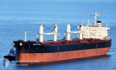
DARYA MIRA
Cargo
Current Trip
| Trip Time | 22 days |
|---|---|
| Trip Distance | 5426.18 nm |
| AVG Speed | 10.4 Knopen |
| MAX Speed | 10.4 Knopen |
| Diepgang | 11.6 M |
| AVG Wind | 12.7 knots |
| MAX Wind | 32.4 knots |
| MIN Temp | -5.4°C / 22.28°F |
| MAX Temp | 11.2°C / 52.16°F |
| Positie ontvangen | 7 d geleden |
Current Position
| Lengtegraad | 129.06320° |
|---|---|
| Breedtegraat | 35.00726° |
| Status | Under way using engine |
| Snelheid | 1.8 Knopen |
| Koers | 158° |
| Gebied | Japan Sea |
| Station | T-AIS |
| Positie ontvangen | 7 d geleden |
Info
Information
The current position of DARYA MIRA is in Japan Sea with coordinates 35.00726° / 129.06320° as reported on 2025-02-26 22:25 by AIS to our vessel tracker app. The vessel's current speed is 1.8 Knopen and is currently inside the port of YANTAI.
The vessel DARYA MIRA (IMO: 9909089, MMSI: 477714800) is a Cargo It's sailing under the flag of [HK] Hong Kong.
In this page you can find informations about the vessels current position, last detected port calls, and current voyage information. If the vessels is not in coverage by AIS you will find the latest position.
The current position of DARYA MIRA is detected by our AIS receivers and we are not responsible for the reliability of the data. The last position was recorded while the vessel was in Coverage by the Ais receivers of our vessel tracking app.
The current draught of DARYA MIRA as reported by AIS is 11.6 meters
Weather
| Temperature | 2.7°C / 36.86°F |
|---|---|
| Wind Speed | 13 knots |
| Direction | 332° NNW |
| Pressure | 1031.8 hPa |
| Humidity | 60.1 % |
| Cloud Coverage | --- |
Featured Company
Last Trips
Events
| Tijd | Evenement | Details | Positie / Bestemming | Info |
|---|---|---|---|---|
| 2025-03-01 04:01 | Stop beweging |
37.56775 / 121.38546
[CN] YANTAI
|
Snelheid: 0.2 kn Koers: 272° |
|
| 2025-03-01 03:25 | Aankomsthaven |
|
37.58010 / 121.42445
[CN] YANTAI
|
Snelheid: 8.6 kn Koers: 249° |
| 2025-02-26 22:34 | Status Changed | Default Under way using engine |
34.99936 / 129.06233
CN YNT
|
Snelheid: 1.8 kn Koers: 158° |
| 2025-02-26 22:34 | Start beweging | 6.21 nm, South of BUSAN |
34.99936 / 129.06233
CN YNT
|
Snelheid: 5.1 kn Koers: 178° |
| 2025-02-26 22:25 | Buitenbereik |
35.00726 / 129.06320
Japan Sea
CN YNT
|
Snelheid: 1.8 kn Koers: 167.7° |
|
| 2025-02-26 22:19 | Status Changed | Under way using engine At anchor |
35.00723 / 129.06150
CN YNT
|
Snelheid: 1.2 kn Koers: 33° |
| 2025-02-26 22:11 | Status Changed | At anchor Default |
35.00588 / 129.06223
CN YNT
|
Snelheid: 0.3 kn Koers: 71° |
| 2025-02-26 22:05 | Status Changed | Default At anchor |
35.00631 / 129.06155
CN YNT
|
Snelheid: 0.3 kn Koers: 71° |
| 2025-02-26 21:09 | Destination Changed | CN YNT KR PUS |
35.00625 / 129.06146
CN YNT
|
Snelheid: Koers: 45° |
| 2025-02-26 21:09 | ETA Changed | 2025/03/01 04:00 2025/02/26 16:00 |
35.00625 / 129.06146
CN YNT
|
Snelheid: Koers: 45° |