
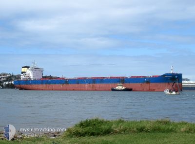
DARYA PREETI
Cargo
Current Trip
| Time Travelled | 3 days |
|---|---|
| Remaining Time | --- |
| Distance Travelled | 787.02 nm |
| Remaining Distance | --- |
| AVG Speed | 12 Knopen |
| MAX Speed | 15.3 Knopen |
| AVG Wind | 9.9 knots |
| MAX Wind | 27 knots |
| MIN Temp | -1.4°C / 29.48°F |
| MAX Temp | 6.4°C / 43.52°F |
| Diepgang | 11.8 M |
| Positie ontvangen | 2 d geleden |
Current Position
| Lengtegraad | -126.81855° |
|---|---|
| Breedtegraat | 48.52320° |
| Status | Under way using engine |
| Snelheid | 10.9 Knopen |
| Koers | 266.2° |
| Gebied | North Pacific Ocean |
| Station | T-AIS |
| Positie ontvangen | 2 d geleden |
Info
Information
The current position of DARYA PREETI is in North Pacific Ocean with coordinates 48.52320° / -126.81855° as reported on 2025-02-10 07:29 by AIS to our vessel tracker app. The vessel's current speed is 10.9 Knopen and is heading at the port of NANTONG. The estimated time of arrival as calculated by MyShipTracking vessel tracking app is 2025-03-04 08:00 LT
The vessel DARYA PREETI (IMO: 9843376, MMSI: 538009750) is a Cargo It's sailing under the flag of [MH] Marshall Is.
In this page you can find informations about the vessels current position, last detected port calls, and current voyage information. If the vessels is not in coverage by AIS you will find the latest position.
The current position of DARYA PREETI is detected by our AIS receivers and we are not responsible for the reliability of the data. The last position was recorded while the vessel was in Coverage by the Ais receivers of our vessel tracking app.
The current draught of DARYA PREETI as reported by AIS is 11.8 meters
Weather
| Temperature | 5.9°C / 42.62°F |
|---|---|
| Wind Speed | 22 knots |
| Direction | 119° ESE |
| Pressure | 1006.7 hPa |
| Humidity | 92 % |
| Cloud Coverage | 100 % |
Featured Company
Most Visited Ports (Last year)
| Port | Arrivals | |
|---|---|---|
| 5 | ||
| 2 | ||
| 2 | ||
| 1 | ||
| 1 | ||
| 1 |
Last Trips
Events
| Tijd | Evenement | Details | Positie / Bestemming | Info |
|---|---|---|---|---|
| 2025-02-10 07:33 | Status Changed | Default Under way using engine |
48.52293 / -126.83851
CN NTG
|
Snelheid: 10.9 kn Koers: 266.2° |
| 2025-02-10 07:29 | Buitenbereik |
48.52320 / -126.81855
North Pacific Ocean
CN NTG
|
Snelheid: 10.9 kn Koers: 266.2° |
|
| 2025-02-10 06:08 | Status Changed | Under way using engine Default |
48.52931 / -126.44804
CN NTG
|
Snelheid: 11 kn Koers: 272° |
| 2025-02-10 05:53 | Status Changed | Default Under way using engine |
48.52794 / -126.37766
CN NTG
|
Snelheid: 11.2 kn Koers: 272.3° |
| 2025-02-10 05:41 | Status Changed | Under way using engine Default |
48.52726 / -126.32242
CN NTG
|
Snelheid: 11.4 kn Koers: 269° |
| 2025-02-10 05:38 | Status Changed | Default Under way using engine |
48.52735 / -126.30897
CN NTG
|
Snelheid: 11.3 kn Koers: 266.1° |
| 2025-02-10 01:09 | Status Changed | Under way using engine Default |
48.52259 / -125.04687
CN NTG
|
Snelheid: 11.3 kn Koers: 269° |
| 2025-02-10 01:07 | Status Changed | Default Under way using engine |
48.52277 / -125.03665
CN NTG
|
Snelheid: 11.4 kn Koers: 269° |
| 2025-02-10 01:02 | Status Changed | Under way using engine Default |
48.52319 / -125.01377
CN NTG
|
Snelheid: 11.4 kn Koers: 269° |
| 2025-02-10 00:55 | Status Changed | Default Under way using engine |
48.52319 / -124.97942
CN NTG
|
Snelheid: 11.3 kn Koers: 270.2° |