

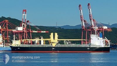
DENEB TWIN
Cargo

Current Trip
| Time Travelled | 27 days |
|---|---|
| Remaining Time | --- |
| Distance Travelled | 3063.41 nm |
| Remaining Distance | --- |
| AVG Speed | 11 Knopen |
| MAX Speed | 14.4 Knopen |
| AVG Wind | 7.1 knots |
| MAX Wind | 15.7 knots |
| MIN Temp | 15.2°C / 59.36°F |
| MAX Temp | 29.2°C / 84.56°F |
| Diepgang | 9 M |
| Positie ontvangen | 4 d geleden |
Current Position
| Lengtegraad | 140.97193° |
|---|---|
| Breedtegraat | 35.82039° |
| Status | Under way using engine |
| Snelheid | 11.8 Knopen |
| Koers | 347.7° |
| Gebied | North Pacific Ocean |
| Station | T-AIS |
| Positie ontvangen | 4 d geleden |
Information
The current position of DENEB TWIN is in North Pacific Ocean with coordinates 35.82039° / 140.97193° as reported on 2025-03-27 05:56 by AIS to our vessel tracker app. The vessel's current speed is 11.8 Knopen
The vessel DENEB TWIN (IMO: 9989883, MMSI: 352003726) is a Cargo It's sailing under the flag of [PA] Panama.
In this page you can find informations about the vessels current position, last detected port calls, and current voyage information. If the vessels is not in coverage by AIS you will find the latest position.
The current position of DENEB TWIN is detected by our AIS receivers and we are not responsible for the reliability of the data. The last position was recorded while the vessel was in Coverage by the Ais receivers of our vessel tracking app.
The current draught of DENEB TWIN as reported by AIS is 9 meters
Weather
| Temperature | 16.7°C / 62.06°F |
|---|---|
| Wind Speed | 11 knots |
| Direction | 186° S |
| Pressure | 1007.2 hPa |
| Humidity | 90.8 % |
| Cloud Coverage | 32 % |


Featured Company
Last Trips
Events
| Tijd | Evenement | Details | Positie / Bestemming | Info |
|---|---|---|---|---|
| 2025-03-27 05:56 | Buitenbereik |
35.82039 / 140.97193
North Pacific Ocean
JP KUH
|
Snelheid: 11.8 kn Koers: 347.7° |
|
| 2025-03-26 21:39 | Gevonden in zee | Japanese part of the North Pacific Ocean |
34.71426 / 139.66712
North Pacific Ocean
JP KUH
|
Snelheid: 10.2 kn Koers: 58.2° |
| 2025-03-26 20:59 | Binnenbereik |
34.64665 / 139.53552
Philippine Sea
JP KUH
|
Snelheid: 12.5 kn Koers: 56.9° |
|
| 2025-03-26 14:59 | Buitenbereik |
34.36830 / 138.13947
Philippine Sea
JP KUH
|
Snelheid: 11.9 kn Koers: 61.9° |
|
| 2025-03-26 13:35 | Draught Changed | 9 9.1 |
34.23768 / 137.83816
JP KUH
|
Snelheid: 12 kn Koers: 59.8° |
| 2025-03-26 13:35 | ETA Changed | 2025/03/28 16:00 2025/03/27 10:00 |
34.23768 / 137.83816
JP KUH
|
Snelheid: 12 kn Koers: 59.8° |
| 2025-03-26 12:01 | Wijzig zee gebeid | Japanese part of the Philippine Sea Indonesian part of the Singapore Strait |
34.09588 / 137.50535
Philippine Sea
JP KUH
|
Snelheid: 11.8 kn Koers: 62.2° |
| 2025-03-26 11:59 | Binnenbereik |
34.09588 / 137.50535
Philippine Sea
JP KUH
|
Snelheid: 11.8 kn Koers: 62.2° |