
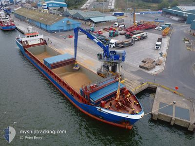
ELENORA
General Cargo
Current Trip
| Time Travelled | 3 days |
|---|---|
| Remaining Time | 45 mins |
| Distance Travelled | 591.77 nm |
| Remaining Distance | 44.55 nm |
| AVG Speed | 6 Knopen |
| MAX Speed | 11.7 Knopen |
| AVG Wind | 29.4 knots |
| MAX Wind | 37 knots |
| MIN Temp | 5.8°C / 42.44°F |
| MAX Temp | 11.4°C / 52.52°F |
| Diepgang | 4.5 M |
| Positie ontvangen | 3 m geleden |
Current Position
| Lengtegraad | 3.77853° |
|---|---|
| Breedtegraat | 51.93606° |
| Status | At anchor |
| Snelheid | 0.2 Knopen |
| Koers | 221° |
| Gebied | North Sea |
| Station | T-AIS |
| Positie ontvangen | 3 m geleden |
Info
Information
The current position of ELENORA is in North Sea with coordinates 51.93606° / 3.77853° as reported on 2025-02-26 12:54 by AIS to our vessel tracker app. The vessel's current speed is 0.2 Knopen and is heading at the port of MOERDIJK. The estimated time of arrival as calculated by MyShipTracking vessel tracking app is 2025-02-26 13:43 LT
The vessel ELENORA (IMO: 9184421, MMSI: 255924000) is a General Cargo that was built in 2000 ( 25 Jaar oud ). It's sailing under the flag of [PT] Portugal.
In this page you can find informations about the vessels current position, last detected port calls, and current voyage information. If the vessels is not in coverage by AIS you will find the latest position.
The current position of ELENORA is detected by our AIS receivers and we are not responsible for the reliability of the data. The last position was recorded while the vessel was in Coverage by the Ais receivers of our vessel tracking app.
The current draught of ELENORA as reported by AIS is 4.5 meters
Weather
| Temperature | 6°C / 42.8°F |
|---|---|
| Wind Speed | 15 knots |
| Direction | 198° SSW |
| Pressure | 1015 hPa |
| Humidity | 90.6 % |
| Cloud Coverage | 16 % |
Featured Company
Last Port Calls
| Port | Arrival | Departure | Time In Port |
|---|---|---|---|
| 2025-02-20 22:40 | 2025-02-22 23:00 | 2 d | |
| 2025-02-19 21:42 | 2025-02-20 21:26 | 23 h | |
| 2025-02-17 19:25 | 2025-02-19 20:20 | 2 d | |
| 2025-02-14 00:47 | 2025-02-14 20:10 | 19 h | |
| 2025-02-13 23:49 | 2025-02-14 00:29 | 39 m | |
| 2025-02-04 13:16 | 2025-02-05 11:55 | 22 h | |
| 2025-01-29 11:58 | 2025-01-31 02:22 | 1 d | |
| 2025-01-25 21:23 | 2025-01-29 00:15 | 3 d | |
| 2025-01-22 06:21 | 2025-01-22 15:56 | 9 h | |
| 2025-01-13 16:04 | 2025-01-22 04:43 | 8 d |
Last Trips
| Origin | Departure | Destination | Arrival | Distance | |
|---|---|---|---|---|---|
| 2025-02-20 21:26 | 2025-02-20 22:40 | 11.07 nm | |||
| 2025-02-19 20:20 | 2025-02-19 21:42 | 11.14 nm | |||
| 2025-02-14 21:10 | 2025-02-17 19:25 | 573.78 nm | |||
| 2025-02-14 01:29 | 2025-02-14 01:47 | 0.66 nm | |||
| 2025-02-05 11:55 | 2025-02-14 00:49 | 187.06 nm | |||
| 2025-01-31 02:22 | 2025-02-04 13:16 | 411.61 nm | |||
| 2025-01-29 00:15 | 2025-01-29 11:58 | 110.48 nm | |||
| 2025-01-22 15:56 | 2025-01-25 21:23 | 450.43 nm | |||
| 2025-01-22 04:43 | 2025-01-22 06:21 | 3.97 nm | |||
| 2025-01-08 14:27 | 2025-01-13 16:04 | 950.62 nm |
Events
| Tijd | Evenement | Details | Positie / Bestemming | Info |
|---|---|---|---|---|
| 2025-02-26 12:54 | Status Changed | At anchor Default |
51.93606 / 3.77853
NLMOE
|
Snelheid: 0.1 kn Koers: 217° |
| 2025-02-26 12:42 | Status Changed | Default At anchor |
51.93606 / 3.77837
NLMOE
|
Snelheid: 0.5 kn Koers: 229° |
| 2025-02-26 12:27 | Status Changed | At anchor Default |
51.93584 / 3.77864
NLMOE
|
Snelheid: 0.4 kn Koers: 217° |
| 2025-02-26 11:45 | Status Changed | Default At anchor |
51.93563 / 3.77840
NLMOE
|
Snelheid: 0.2 kn Koers: 223° |
| 2025-02-26 11:39 | Status Changed | At anchor Default |
51.93556 / 3.77844
NLMOE
|
Snelheid: 0.2 kn Koers: 215° |
| 2025-02-26 11:36 | Binnenbereik |
51.93556 / 3.77844
North Sea
NLMOE
|
Snelheid: 0.2 kn Koers: 334.1° |
|
| 2025-02-26 10:30 | Status Changed | Default At anchor |
51.93539 / 3.77824
NLMOE
|
Snelheid: 0.4 kn Koers: 181° |
| 2025-02-26 10:24 | Status Changed | At anchor Default |
51.93542 / 3.77743
NLMOE
|
Snelheid: 0.5 kn Koers: 153° |
| 2025-02-26 10:24 | Buitenbereik |
51.93542 / 3.77743
North Sea
NLMOE
|
Snelheid: 0.4 kn Koers: 48.5° |
|
| 2025-02-26 10:18 | Status Changed | Default At anchor |
51.93504 / 3.77672
NLMOE
|
Snelheid: 0.4 kn Koers: 131° |