

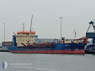
EMBLA R
Dredging or underwater ops

Current Trip
DKCPH=KRIEGERS FLAK
| Time Travelled | 17 h, 48 mins |
|---|---|
| Remaining Time | --- |
| Distance Travelled | 139.89 nm |
| Remaining Distance | --- |
| AVG Speed | 9.8 Knopen |
| MAX Speed | 11.7 Knopen |
| AVG Wind | 9 knots |
| MAX Wind | 13 knots |
| MIN Temp | 12.2°C / 53.96°F |
| MAX Temp | 15.1°C / 59.18°F |
| Diepgang | 3.1 M |
| Positie ontvangen | 2 h, 17 m geleden |
Current Position
| Lengtegraad | 12.76968° |
|---|---|
| Breedtegraat | 55.13003° |
| Status | Under way using engine |
| Snelheid | 11.7 Knopen |
| Koers | 143.7° |
| Gebied | Baltic Sea |
| Station | T-AIS |
| Positie ontvangen | 2 h, 17 m geleden |
Information
The current position of EMBLA R is in Baltic Sea with coordinates 55.13003° / 12.76968° as reported on 2025-06-08 05:07 by AIS to our vessel tracker app. The vessel's current speed is 11.7 Knopen
The vessel EMBLA R (IMO: 9896048, MMSI: 219027309) is a Dredging or underwater ops It's sailing under the flag of [DK] Denmark.
In this page you can find informations about the vessels current position, last detected port calls, and current voyage information. If the vessels is not in coverage by AIS you will find the latest position.
The current position of EMBLA R is detected by our AIS receivers and we are not responsible for the reliability of the data. The last position was recorded while the vessel was in Coverage by the Ais receivers of our vessel tracking app.
The current draught of EMBLA R as reported by AIS is 3.1 meters
Weather
| Temperature | 12.5°C / 54.5°F |
|---|---|
| Wind Speed | 11 knots |
| Direction | 177° S |
| Pressure | 1003.8 hPa |
| Humidity | 93.4 % |
| Cloud Coverage | 100 % |


Featured Company
Last Port Calls
| Port | Arrival | Departure | Time In Port |
|---|---|---|---|
| 2025-06-07 14:16 | 2025-06-07 15:37 | 1 h | |
| 2025-06-07 02:47 | 2025-06-07 03:41 | 53 m | |
| 2025-06-06 13:17 | 2025-06-06 14:39 | 1 h | |
| 2025-06-06 01:49 | 2025-06-06 02:40 | 50 m | |
| 2025-06-05 13:20 | 2025-06-05 14:43 | 1 h | |
| 2025-06-04 02:11 | 2025-06-04 02:16 | 5 m | |
| 2025-05-31 14:17 | 2025-05-31 14:26 | 8 m | |
| 2025-05-31 02:28 | 2025-05-31 03:44 | 1 h | |
| 2025-05-30 14:16 | 2025-05-30 15:09 | 52 m | |
| 2025-05-30 02:06 | 2025-05-30 03:00 | 54 m |
Most Visited Ports (Last year)
| Port | Arrivals | |
|---|---|---|
| 128 | ||
| 2 | ||
| 1 | ||
| 1 |
Last Trips
| Origin | Departure | Destination | Arrival | Distance | |
|---|---|---|---|---|---|
| 2025-06-07 03:41 | 2025-06-07 14:16 | 92.53 nm | |||
| 2025-06-06 14:39 | 2025-06-07 02:47 | 92.25 nm | |||
| 2025-06-06 02:40 | 2025-06-06 13:17 | 92.20 nm | |||
| 2025-06-05 14:43 | 2025-06-06 01:49 | 92.38 nm | |||
| 2025-06-04 02:16 | 2025-06-05 13:20 | 276.90 nm | |||
| 2025-05-31 14:26 | 2025-06-04 02:11 | 647.70 nm | |||
| 2025-05-31 03:44 | 2025-05-31 14:17 | 92.27 nm | |||
| 2025-05-30 15:09 | 2025-05-31 02:28 | 92.20 nm | |||
| 2025-05-30 03:00 | 2025-05-30 14:16 | 92.32 nm | |||
| 2025-05-29 15:31 | 2025-05-30 02:06 | 92.33 nm |
Events
| Tijd | Evenement | Details | Positie / Bestemming | Info |
|---|---|---|---|---|
| 2025-06-08 05:14 | Status Changed | Default Under way using engine |
55.11004 / 12.79520
DKCPH=KRIEGERS FLAK
|
Snelheid: 11.7 kn Koers: 143.7° |
| 2025-06-08 05:07 | Buitenbereik |
55.13003 / 12.76968
Baltic Sea
DKCPH=KRIEGERS FLAK
|
Snelheid: 11.7 kn Koers: 143.7° |
|
| 2025-06-08 04:56 | Status Changed | Under way using engine Default |
55.15750 / 12.73311
DKCPH=KRIEGERS FLAK
|
Snelheid: 11.8 kn Koers: 141° |
| 2025-06-08 04:54 | Status Changed | Default Under way using engine |
55.16176 / 12.72714
DKCPH=KRIEGERS FLAK
|
Snelheid: 11.7 kn Koers: 141.3° |
| 2025-06-08 04:07 | Wijzig zee gebeid | Danish part of the Baltic Sea Swedish part of the Baltic Sea |
55.29466 / 12.64318
Baltic Sea
DKCPH=KRIEGERS FLAK
|
Snelheid: 11.3 kn Koers: 183.5° |
| 2025-06-08 03:58 | Wijzig zee gebeid | Swedish part of the Baltic Sea Swedish part of the Kattegat |
55.32226 / 12.64706
Baltic Sea
DKCPH=KRIEGERS FLAK
|
Snelheid: 11 kn Koers: 184.7° |
| 2025-06-08 03:10 | Wijzig zee gebeid | Swedish part of the Kattegat Danish part of the Kattegat |
55.46507 / 12.67862
Kattegat
DKCPH=KRIEGERS FLAK
|
Snelheid: 10.8 kn Koers: 189.6° |
| 2025-06-08 01:37 | Draught Changed | 3.1 5.1 |
55.71852 / 12.64123
DKCPH=KRIEGERS FLAK
|
Snelheid: 10.7 kn Koers: 57.5° |
| 2025-06-08 01:37 | ETA Changed | 2025/06/08 05:30 2025/06/08 00:30 |
55.71852 / 12.64123
DKCPH=KRIEGERS FLAK
|
Snelheid: 10.7 kn Koers: 57.5° |
| 2025-06-08 01:34 | Status Changed | Under way using engine Restricted manoeuverability |
55.71437 / 12.63297
DKCPH=KRIEGERS FLAK
|
Snelheid: 4.9 kn Koers: 23° |