
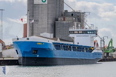
EMMA F
General Cargo
Current Trip
| Time Travelled | 1 day |
|---|---|
| Remaining Time | --- |
| Distance Travelled | 252.08 nm |
| Remaining Distance | --- |
| AVG Speed | 8.3 Knopen |
| MAX Speed | 10.3 Knopen |
| AVG Wind | 9.4 knots |
| MAX Wind | 15.3 knots |
| MIN Temp | 1°C / 33.8°F |
| MAX Temp | 3.9°C / 39.02°F |
| Diepgang | 4.8 M |
| Positie ontvangen | 1 m geleden |
Current Position
| Lengtegraad | 7.78896° |
|---|---|
| Breedtegraat | 56.78346° |
| Status | Under way using engine |
| Snelheid | 9.2 Knopen |
| Koers | 207.2° |
| Gebied | North Sea |
| Station | T-AIS |
| Positie ontvangen | 1 m geleden |
Info
Information
The current position of EMMA F is in North Sea with coordinates 56.78346° / 7.78896° as reported on 2025-03-14 21:02 by AIS to our vessel tracker app. The vessel's current speed is 9.2 Knopen and is heading at the port of GOOLE. The estimated time of arrival as calculated by MyShipTracking vessel tracking app is 2025-03-16 20:30 LT
The vessel EMMA F (IMO: 8609618, MMSI: 305190000) is a General Cargo that was built in 1986 ( 39 Jaar oud ). It's sailing under the flag of [AG] Antigua Barbuda.
In this page you can find informations about the vessels current position, last detected port calls, and current voyage information. If the vessels is not in coverage by AIS you will find the latest position.
The current position of EMMA F is detected by our AIS receivers and we are not responsible for the reliability of the data. The last position was recorded while the vessel was in Coverage by the Ais receivers of our vessel tracking app.
The current draught of EMMA F as reported by AIS is 4.8 meters
Weather
| Temperature | 3.5°C / 38.3°F |
|---|---|
| Wind Speed | 5 knots |
| Direction | 314° NW |
| Pressure | 1018.1 hPa |
| Humidity | 59 % |
| Cloud Coverage | --- |
Featured Company
Last Port Calls
| Port | Arrival | Departure | Time In Port |
|---|---|---|---|
| 2025-03-13 06:10 | 2025-03-13 18:17 | 12 h | |
| 2025-03-11 18:13 | 2025-03-12 16:33 | 22 h | |
| 2025-03-04 08:55 | 2025-03-10 18:02 | 6 d | |
| 2025-03-02 22:32 | 2025-03-03 14:13 | 15 h | |
| 2025-03-01 22:12 | 2025-03-01 22:16 | 3 m | |
| 2025-02-28 20:51 | 2025-03-01 08:26 | 11 h | |
| 2025-02-24 22:08 | 2025-02-25 18:09 | 20 h | |
| 2025-02-22 18:13 | 2025-02-22 19:06 | 53 m | |
| 2025-02-18 10:56 | 2025-02-21 14:12 | 3 d | |
| 2025-02-17 19:57 | 2025-02-18 07:57 | 12 h |
Last Trips
| Origin | Departure | Destination | Arrival | Distance | |
|---|---|---|---|---|---|
| 2025-03-12 16:33 | 2025-03-13 06:10 | 103.21 nm | |||
| 2025-03-10 18:02 | 2025-03-11 18:13 | 247.04 nm | |||
| 2025-03-03 14:13 | 2025-03-04 08:55 | 86.05 nm | |||
| 2025-03-01 22:16 | 2025-03-02 22:32 | 218.31 nm | |||
| 2025-03-01 08:26 | 2025-03-01 22:12 | 86.81 nm | |||
| 2025-02-25 18:09 | 2025-02-28 20:51 | 312.20 nm | |||
| 2025-02-22 19:06 | 2025-02-24 22:08 | 349.82 nm | |||
| 2025-02-21 14:12 | 2025-02-22 18:13 | 217.06 nm | |||
| 2025-02-18 07:57 | 2025-02-18 10:56 | 29.66 nm | |||
| 2025-02-16 08:36 | 2025-02-17 19:57 | 282.55 nm |
Events
| Tijd | Evenement | Details | Positie / Bestemming | Info |
|---|---|---|---|---|
| 2025-03-14 17:26 | Gevonden in zee | Danish part of the North Sea |
57.15430 / 8.54089
North Sea
GBGOO
|
Snelheid: 9.7 kn Koers: 239.2° |
| 2025-03-14 08:26 | Wijzig zee gebeid | Danish part of the Skaggerak Danish part of the Kattegat |
57.77463 / 10.77991
Skaggerak
GBGOO
|
Snelheid: 9.1 kn Koers: 343.9° |
| 2025-03-13 22:53 | ETA Changed | 2025/03/16 20:30 2025/03/16 14:30 |
56.41284 / 11.10580
GBGOO
|
Snelheid: 8.8 kn Koers: 350.5° |
| 2025-03-13 17:17 | Vertrekhaven |
|
55.95715 / 12.00630
GBGOO
|
Snelheid: 4.6 kn Koers: 221° |
| 2025-03-13 17:14 | Start beweging |
55.95996 / 12.01103
[DK] FREDERIKSVAERK
|
Snelheid: 3.1 kn Koers: 225° |
|
| 2025-03-13 17:06 | Status Changed | Under way using engine Moored |
55.96099 / 12.01380
[DK] FREDERIKSVAERK
|
Snelheid: Koers: 225° |
| 2025-03-13 16:46 | Draught Changed | 4.8 3.2 |
55.96100 / 12.01386
[DK] FREDERIKSVAERK
|
Snelheid: Koers: 224° |
| 2025-03-13 16:46 | Destination Changed | GBGOO DKFDV |
55.96100 / 12.01386
[DK] FREDERIKSVAERK
|
Snelheid: Koers: 224° |
| 2025-03-13 16:46 | ETA Changed | 2025/03/16 14:30 2025/03/13 05:30 |
55.96100 / 12.01386
[DK] FREDERIKSVAERK
|
Snelheid: Koers: 224° |
| 2025-03-13 05:32 | Status Changed | Moored Under way using engine |
55.96096 / 12.01384
[DK] FREDERIKSVAERK
|
Snelheid: Koers: 224° |