
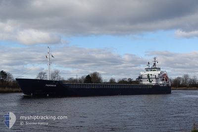
FAROMAR
General Cargo
Current Trip
| Time Travelled | 3 days |
|---|---|
| Remaining Time | 18 h, 27 mins |
| Distance Travelled | 796.76 nm |
| Remaining Distance | 185.06 nm |
| AVG Speed | 9.3 Knopen |
| MAX Speed | 14 Knopen |
| AVG Wind | 19.3 knots |
| MAX Wind | 26.9 knots |
| MIN Temp | -1.1°C / 30.02°F |
| MAX Temp | 3.3°C / 37.94°F |
| Diepgang | 6.2 M |
| Positie ontvangen | Nu |
Current Position
| Lengtegraad | 5.05732° |
|---|---|
| Breedtegraat | 53.55656° |
| Status | Under way using engine |
| Snelheid | 9.5 Knopen |
| Koers | 246.1° |
| Gebied | North Sea |
| Station | T-AIS |
| Positie ontvangen | Nu |
Info
Information
The current position of FAROMAR is in North Sea with coordinates 53.55656° / 5.05732° as reported on 2025-02-12 07:39 by AIS to our vessel tracker app. The vessel's current speed is 9.5 Knopen and is heading at the port of ZEEBRUGGE. The estimated time of arrival as calculated by MyShipTracking vessel tracking app is 2025-02-13 03:07 LT
The vessel FAROMAR (IMO: 9552070, MMSI: 253377000) is a General Cargo that was built in 2012 ( 13 Jaar oud ). It's sailing under the flag of [LU] Luxembourg.
In this page you can find informations about the vessels current position, last detected port calls, and current voyage information. If the vessels is not in coverage by AIS you will find the latest position.
The current position of FAROMAR is detected by our AIS receivers and we are not responsible for the reliability of the data. The last position was recorded while the vessel was in Coverage by the Ais receivers of our vessel tracking app.
The current draught of FAROMAR as reported by AIS is 6.2 meters
Weather
| Temperature | 2.6°C / 36.68°F |
|---|---|
| Wind Speed | 12 knots |
| Direction | 84° E |
| Pressure | 1017.9 hPa |
| Humidity | 97.4 % |
| Cloud Coverage | 100 % |
Featured Company
Last Port Calls
| Port | Arrival | Departure | Time In Port |
|---|---|---|---|
| 2025-02-06 02:17 | 2025-02-08 21:16 | 2 d | |
| 2025-02-03 06:33 | 2025-02-04 20:17 | 1 d | |
| 2025-01-31 10:53 | 2025-02-01 09:41 | 22 h | |
| 2025-01-28 21:42 | 2025-01-29 16:03 | 18 h | |
| 2025-01-24 19:27 | 2025-01-27 20:12 | 3 d | |
| 2025-01-16 23:21 | 2025-01-21 00:02 | 4 d | |
| 2025-01-11 14:11 | 2025-01-14 16:46 | 3 d | |
| 2025-01-06 23:03 | 2025-01-08 06:38 | 1 d | |
| 2024-12-30 14:58 | 2025-01-02 16:09 | 3 d | |
| 2024-12-18 22:33 | 2024-12-20 19:18 | 1 d |
Last Trips
| Origin | Departure | Destination | Arrival | Distance | |
|---|---|---|---|---|---|
| 2025-02-04 20:17 | 2025-02-06 02:17 | 226.33 nm | |||
| 2025-02-01 09:41 | 2025-02-03 06:33 | 429.20 nm | |||
| 2025-01-29 16:03 | 2025-01-31 10:53 | 462.52 nm | |||
| 2025-01-27 20:12 | 2025-01-28 21:42 | 303.89 nm | |||
| 2025-01-21 00:02 | 2025-01-24 19:27 | 827.67 nm | |||
| 2025-01-14 16:46 | 2025-01-16 23:21 | 150.63 nm | |||
| 2025-01-08 06:38 | 2025-01-11 14:11 | 772.92 nm | |||
| 2025-01-02 16:09 | 2025-01-06 23:03 | 520.27 nm | |||
| 2024-12-20 19:18 | 2024-12-30 14:58 | 894.74 nm | |||
| 2024-12-13 17:36 | 2024-12-18 22:33 | 1091.12 nm |
Events
| Tijd | Evenement | Details | Positie / Bestemming | Info |
|---|---|---|---|---|
| 2025-02-12 04:03 | Gevonden in zee | Dutch part of the North Sea |
53.75733 / 6.03336
North Sea
BEZEE
|
Snelheid: 11.6 kn Koers: 251.2° |
| 2025-02-12 04:03 | Status Changed | Under way using engine Default |
53.75733 / 6.03336
BEZEE
|
Snelheid: 11.6 kn Koers: 250° |
| 2025-02-12 03:43 | Binnenbereik |
53.75733 / 6.03336
North Sea
BEZEE
|
Snelheid: 11.6 kn Koers: 251.2° |
|
| 2025-02-12 02:09 | Status Changed | Default Under way using engine |
53.86611 / 6.65880
BEZEE
|
Snelheid: 12.2 kn Koers: 256.7° |
| 2025-02-12 02:01 | Buitenbereik |
53.87215 / 6.70250
North Sea
BEZEE
|
Snelheid: 12.2 kn Koers: 256.7° |
|
| 2025-02-11 23:51 | Status Changed | Under way using engine Default |
53.97775 / 7.40995
BEZEE
|
Snelheid: 11.2 kn Koers: 256° |
| 2025-02-11 23:51 | Binnenbereik |
53.97669 / 7.40247
North Sea
BEZEE
|
Snelheid: 11.4 kn Koers: 256.8° |
|
| 2025-02-11 22:28 | Status Changed | Default Under way using engine |
54.01884 / 7.82866
BEZEE
|
Snelheid: 10.9 kn Koers: 271.8° |
| 2025-02-11 22:19 | Status Changed | Under way using engine Default |
54.01737 / 7.87439
BEZEE
|
Snelheid: 10.9 kn Koers: 274° |
| 2025-02-11 22:19 | Buitenbereik |
54.01737 / 7.87439
North Sea
BEZEE
|
Snelheid: 10.9 kn Koers: 271.8° |