
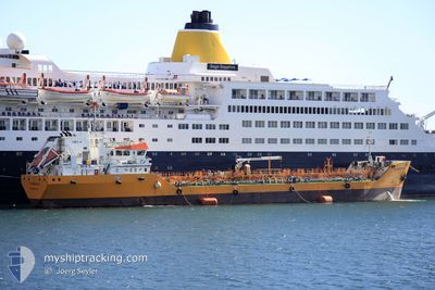
FLORENCE B
Oil/Chemical Tanker
Current Trip
| Trip Time | 6 h, 41 mins |
|---|---|
| Trip Distance | 68.80 nm |
| AVG Speed | 10.3 Knopen |
| MAX Speed | 13 Knopen |
| Diepgang | 3.5 M |
| AVG Wind | 23.7 knots |
| MAX Wind | 27 knots |
| MIN Temp | 4.9°C / 40.82°F |
| MAX Temp | 11°C / 51.8°F |
| Positie ontvangen | 4 h, 53 m geleden |
Current Position
| Lengtegraad | 5.15292° |
|---|---|
| Breedtegraat | 43.08632° |
| Status | Under way using engine |
| Snelheid | 10.1 Knopen |
| Koers | 321.6° |
| Gebied | Mediterranean Sea - Western Basin |
| Station | T-AIS |
| Positie ontvangen | 4 h, 53 m geleden |
Info
Information
The current position of FLORENCE B is in Mediterranean Sea - Western Basin with coordinates 43.08632° / 5.15292° as reported on 2026-01-03 15:17 by AIS to our vessel tracker app. The vessel's current speed is 10.1 Knopen and is currently inside the port of LAVERA.
The vessel FLORENCE B (IMO: 9406984, MMSI: 228292700) is a Oil/Chemical Tanker that was built in 2008 ( 18 Jaar oud ). It's sailing under the flag of [FR] France.
In this page you can find informations about the vessels current position, last detected port calls, and current voyage information. If the vessels is not in coverage by AIS you will find the latest position.
The current position of FLORENCE B is detected by our AIS receivers and we are not responsible for the reliability of the data. The last position was recorded while the vessel was in Coverage by the Ais receivers of our vessel tracking app.
The current draught of FLORENCE B as reported by AIS is 3.5 meters
Weather
| Temperature | 3.9°C / 39.02°F |
|---|---|
| Wind Speed | 19 knots |
| Direction | 334° NNW |
| Pressure | 1007.1 hPa |
| Humidity | 40.3 % |
| Cloud Coverage | 100 % |
Featured Company
Last Port Calls
| Port | Arrival | Departure | Time In Port |
|---|---|---|---|
| 2026-01-03 18:20 | |||
| 2026-01-03 08:20 | 2026-01-03 11:39 | 3 h | |
| 2026-01-03 08:20 | |||
| 2026-01-02 13:04 | |||
| 2026-01-02 13:04 | |||
| 2026-01-02 09:31 | |||
| 2026-01-02 08:59 | |||
| 2026-01-01 18:20 | |||
| 2026-01-01 18:20 | |||
| 2026-01-01 13:51 |
Last Trips
| Origin | Departure | Destination | Arrival | Distance | |
|---|---|---|---|---|---|
| 2026-01-03 11:39 | 2026-01-03 18:20 | 68.80 nm | |||
| 2026-01-02 13:04 | 2026-01-03 08:20 | 2.70 nm | |||
| 2026-01-02 09:31 | 2026-01-02 13:04 | 3.71 nm | |||
| 2026-01-01 18:20 | 2026-01-02 08:59 | 3.79 nm | |||
| 2026-01-01 18:20 | 2026-01-01 18:20 | --- | |||
| 2026-01-01 06:56 | 2026-01-01 13:51 | 73.18 nm | |||
| 2025-12-31 08:17 | 2025-12-31 16:08 | 0.53 nm | |||
| 2025-12-30 09:20 | 2025-12-30 11:12 | 18.16 nm | |||
| 2025-12-28 14:00 | 2025-12-28 15:54 | 20.96 nm | |||
| 2025-12-27 22:24 | 2025-12-28 09:28 | 6.31 nm |
Events
| Tijd | Evenement | Details | Positie / Bestemming | Info |
|---|---|---|---|---|
| 2026-01-03 17:21 | Stop beweging |
43.39554 / 4.98986
[FR] LAVERA
|
Snelheid: Koers: 139° |
|
| 2026-01-03 17:20 | Aankomsthaven |
|
43.39554 / 4.98986
[FR] LAVERA
|
Snelheid: 2.5 kn Koers: 142° |
| 2026-01-03 15:20 | Status Changed | Default Under way using engine |
43.09467 / 5.14467
FRFOS
|
Snelheid: 10.1 kn Koers: 321.6° |
| 2026-01-03 15:17 | Status Changed | Under way using engine Default |
43.08632 / 5.15292
FRFOS
|
Snelheid: 10.3 kn Koers: 289° |
| 2026-01-03 15:17 | Buitenbereik |
43.08632 / 5.15292
Mediterranean Sea - Western Basin
|
Snelheid: 10.1 kn Koers: 321.6° |
|
| 2026-01-03 14:36 | Status Changed | Default Under way using engine |
43.04794 / 5.30294
FRFOS
|
Snelheid: 10.3 kn Koers: 288.2° |
| 2026-01-03 14:34 | Status Changed | Under way using engine Default |
43.04579 / 5.31161
FRFOS
|
Snelheid: 10 kn Koers: 288° |
| 2026-01-03 14:19 | Binnenbereik |
43.04579 / 5.31161
Mediterranean Sea - Western Basin
|
Snelheid: 10.3 kn Koers: 288.2° |
|
| 2026-01-03 10:39 | Start beweging | 0.84 nm, North of SAINT MANDRIER |
43.09679 / 5.91847
FRFOS
|
Snelheid: 11.4 kn Koers: 168° |
| 2026-01-03 10:39 | Vertrekhaven |
|
43.09679 / 5.91847
FRFOS
|
Snelheid: 8.1 kn Koers: 224° |