

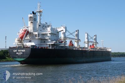
STEEL MAXIMUS
Cargo

Current Trip
| Trip Time | 2 days |
|---|---|
| Trip Distance | 786.98 nm |
| AVG Speed | 11.8 Knopen |
| MAX Speed | 15.3 Knopen |
| Diepgang | 9.8 M |
| AVG Wind | 7.3 knots |
| MAX Wind | 14 knots |
| MIN Temp | 21°C / 69.8°F |
| MAX Temp | 29.7°C / 85.46°F |
| Positie ontvangen | 2 d geleden |
Current Position
| Lengtegraad | -90.00823° |
|---|---|
| Breedtegraat | 29.79682° |
| Status | Under way using engine |
| Snelheid | 15 Knopen |
| Koers | 210° |
| Gebied | Gulf of Mexico |
| Station | T-AIS |
| Positie ontvangen | 2 d geleden |
Information
The current position of STEEL MAXIMUS is in Gulf of Mexico with coordinates 29.79682° / -90.00823° as reported on 2025-05-31 12:23 by AIS to our vessel tracker app. The vessel's current speed is 15 Knopen and is currently inside the port of COATZACOALCOS.
The vessel STEEL MAXIMUS (IMO: 9764013, MMSI: 538010309) is a Cargo It's sailing under the flag of [MH] Marshall Is.
In this page you can find informations about the vessels current position, last detected port calls, and current voyage information. If the vessels is not in coverage by AIS you will find the latest position.
The current position of STEEL MAXIMUS is detected by our AIS receivers and we are not responsible for the reliability of the data. The last position was recorded while the vessel was in Coverage by the Ais receivers of our vessel tracking app.
The current draught of STEEL MAXIMUS as reported by AIS is 9.8 meters
Weather
| Temperature | 27.4°C / 81.32°F |
|---|---|
| Wind Speed | 4 knots |
| Direction | 61° ENE |
| Pressure | 1009.7 hPa |
| Humidity | 83.7 % |
| Cloud Coverage | 88 % |


Featured Company
Last Port Calls
| Port | Arrival | Departure | Time In Port |
|---|---|---|---|
| 2025-06-03 02:20 | |||
| 2025-05-26 04:36 | 2025-05-31 07:36 | 5 d | |
| 2025-05-19 12:24 | 2025-05-22 21:17 | 3 d | |
| 2025-05-14 23:08 | 2025-05-17 20:39 | 2 d | |
| 2025-04-23 22:50 | 2025-04-27 18:12 | 3 d | |
| 2025-04-06 08:53 | 2025-04-11 19:09 | 5 d | |
| 2025-04-01 22:15 |
Most Visited Ports (Last year)
| Port | Arrivals | |
|---|---|---|
| 3 | ||
| 2 | ||
| 2 | ||
| 1 | ||
| 1 | ||
| 1 |
Last Trips
| Origin | Departure | Destination | Arrival | Distance | |
|---|---|---|---|---|---|
| 2025-05-31 07:36 | 2025-06-03 02:20 | 786.98 nm | |||
| 2025-05-22 21:17 | 2025-05-26 04:36 | 932.99 nm | |||
| 2025-05-17 20:39 | 2025-05-19 12:24 | 1.74 nm | |||
| 2025-04-27 18:12 | 2025-05-14 23:08 | 1016.88 nm | |||
| 2025-04-11 19:09 | 2025-04-23 22:50 | 2020.40 nm | |||
| 2025-04-01 22:15 | 2025-04-06 08:53 | 579.71 nm |
Events
| Tijd | Evenement | Details | Positie / Bestemming | Info |
|---|---|---|---|---|
| 2025-06-03 07:49 | Stop beweging |
18.13003 / -94.41637
[MX] COATZACOALCOS
|
Snelheid: Koers: 202° |
|
| 2025-06-03 07:20 | Aankomsthaven |
|
18.14838 / -94.40828
[MX] COATZACOALCOS
|
Snelheid: 8.4 kn Koers: 165° |
| 2025-05-31 12:36 | Vertrekhaven |
|
29.74628 / -90.01635
MX COA
|
Snelheid: 14.7 kn Koers: 172° |
| 2025-05-31 12:29 | Status Changed | Default Under way using engine |
29.77529 / -90.02196
[US] NEW ORLEANS
|
Snelheid: 15 kn Koers: 210° |
| 2025-05-31 12:23 | Buitenbereik |
29.79682 / -90.00823
Gulf of Mexico
MX COA
|
Snelheid: 15 kn Koers: 205.3° |
|
| 2025-05-31 10:39 | Draught Changed | 9.8 6.5 |
29.91301 / -90.08972
[US] NEW ORLEANS
|
Snelheid: 14.1 kn Koers: 71° |
| 2025-05-31 10:39 | Destination Changed | MX COA US MSY |
29.91301 / -90.08972
[US] NEW ORLEANS
|
Snelheid: 14.1 kn Koers: 71° |
| 2025-05-31 10:39 | ETA Changed | 2025/06/03 12:00 2025/05/26 02:00 |
29.91301 / -90.08972
[US] NEW ORLEANS
|
Snelheid: 14.1 kn Koers: 71° |
| 2025-05-31 10:34 | Status Changed | Under way using engine Default |
29.90894 / -90.11344
[US] NEW ORLEANS
|
Snelheid: 12.5 kn Koers: 100° |
| 2025-05-31 10:29 | Status Changed | Default Under way using engine |
29.91380 / -90.13376
[US] NEW ORLEANS
|
Snelheid: 12.8 kn Koers: 183° |