
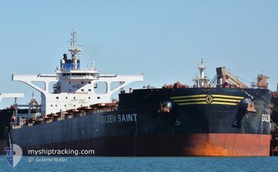
GOLDEN SAINT
Cargo
Current Trip
| Time Travelled | 9 days |
|---|---|
| Remaining Time | 2 days |
| Distance Travelled | 2795.98 nm |
| Remaining Distance | 762.67 nm |
| AVG Speed | 11.4 Knopen |
| MAX Speed | 14.7 Knopen |
| AVG Wind | 12.7 knots |
| MAX Wind | 36 knots |
| MIN Temp | 16.6°C / 61.88°F |
| MAX Temp | 35.2°C / 95.36°F |
| Diepgang | 18.6 M |
| Positie ontvangen | 9 d geleden |
Current Position
| Lengtegraad | 118.42632° |
|---|---|
| Breedtegraat | -19.78049° |
| Status | Under way using engine |
| Snelheid | 12.3 Knopen |
| Koers | 346.8° |
| Gebied | Indian Ocean |
| Station | T-AIS |
| Positie ontvangen | 9 d geleden |
Info
Information
The current position of GOLDEN SAINT is in Indian Ocean with coordinates -19.78049° / 118.42632° as reported on 2025-12-25 08:23 by AIS to our vessel tracker app. The vessel's current speed is 12.3 Knopen and is heading at the port of LIANYUNGANG. The estimated time of arrival as calculated by MyShipTracking vessel tracking app is 2026-01-06 23:35 LT
The vessel GOLDEN SAINT (IMO: 9847982, MMSI: 538008660) is a Cargo It's sailing under the flag of [MH] Marshall Is.
In this page you can find informations about the vessels current position, last detected port calls, and current voyage information. If the vessels is not in coverage by AIS you will find the latest position.
The current position of GOLDEN SAINT is detected by our AIS receivers and we are not responsible for the reliability of the data. The last position was recorded while the vessel was in Coverage by the Ais receivers of our vessel tracking app.
The current draught of GOLDEN SAINT as reported by AIS is 18.6 meters
Weather
| Temperature | 18.8°C / 65.84°F |
|---|---|
| Wind Speed | 8 knots |
| Direction | 130° SE |
| Pressure | 1024.4 hPa |
| Humidity | 58.9 % |
| Cloud Coverage | 6 % |
Featured Company
Last Port Calls
| Port | Arrival | Departure | Time In Port |
|---|---|---|---|
| 2025-12-24 06:23 | 2025-12-25 12:41 | 1 d | |
| 2025-12-04 02:17 | 2025-12-05 20:17 | 1 d | |
| 2025-12-01 21:57 | 2025-12-03 04:35 | 1 d |
Most Visited Ports (Last year)
| Port | Arrivals | |
|---|---|---|
| 2 | ||
| 2 | ||
| 2 | ||
| 1 | ||
| 1 | ||
| 1 |
Last Trips
| Origin | Departure | Destination | Arrival | Distance | |
|---|---|---|---|---|---|
| 2025-12-05 20:17 | 2025-12-24 06:23 | 3988.83 nm | |||
| 2025-12-03 04:35 | 2025-12-04 02:17 | 110.46 nm | |||
| 2025-10-10 01:19 | 2025-12-01 21:57 | 6143.17 nm |
Events
| Tijd | Evenement | Details | Positie / Bestemming | Info |
|---|---|---|---|---|
| 2025-12-25 08:25 | Status Changed | Default Under way using engine |
-19.77382 / 118.42463
CN LYG
|
Snelheid: 12.3 kn Koers: 346.8° |
| 2025-12-25 08:23 | Buitenbereik |
-19.78049 / 118.42632
Indian Ocean
CN LYG
|
Snelheid: 12.3 kn Koers: 346.8° |
|
| 2025-12-25 07:45 | Status Changed | Under way using engine Default |
-19.90270 / 118.45845
CN LYG
|
Snelheid: 10.5 kn Koers: 358° |
| 2025-12-25 07:33 | Status Changed | Default Under way using engine |
-19.93894 / 118.46008
CN LYG
|
Snelheid: 10.5 kn Koers: 23.6° |
| 2025-12-25 06:57 | Draught Changed | 18.6 9 |
-20.03864 / 118.41744
CN LYG
|
Snelheid: 10.6 kn Koers: 9.4° |
| 2025-12-25 05:58 | Status Changed | Under way using engine Default |
-20.16991 / 118.50770
CN LYG
|
Snelheid: 8.1 kn Koers: 332° |
| 2025-12-25 05:57 | Status Changed | Default Under way using engine |
-20.17131 / 118.50850
CN LYG
|
Snelheid: 7.8 kn Koers: 331.1° |
| 2025-12-25 04:41 | Vertrekhaven |
|
-20.30347 / 118.57945
CN LYG
|
Snelheid: 6 kn Koers: 47° |
| 2025-12-25 04:21 | Start beweging |
-20.32451 / 118.57672
[AU] PORT HEDLAND
|
Snelheid: 3.4 kn Koers: 317° |
|
| 2025-12-25 03:49 | Status Changed | Under way using engine Default |
-20.32859 / 118.57940
[AU] PORT HEDLAND
|
Snelheid: Koers: 305° |