
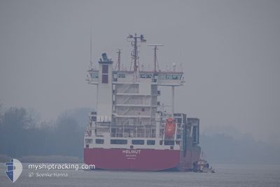
HELMUT
Container Ship
Current Trip
| Time Travelled | 1 day |
|---|---|
| Remaining Time | 12 h, 16 mins |
| Distance Travelled | 364.51 nm |
| Remaining Distance | 147.21 nm |
| AVG Speed | 12.8 Knopen |
| MAX Speed | 14.3 Knopen |
| AVG Wind | 8.2 knots |
| MAX Wind | 21.2 knots |
| MIN Temp | 10.1°C / 50.18°F |
| MAX Temp | 16.6°C / 61.88°F |
| Diepgang | 8.9 M |
| Positie ontvangen | 8 h, 4 m geleden |
Current Position
| Lengtegraad | 15.44338° |
|---|---|
| Breedtegraat | 36.29094° |
| Status | Under way using engine |
| Snelheid | 11.7 Knopen |
| Koers | 183° |
| Gebied | Mediterranean Sea - Eastern Basin |
| Station | T-AIS |
| Positie ontvangen | 8 h, 4 m geleden |
Info
Information
The current position of HELMUT is in Mediterranean Sea - Eastern Basin with coordinates 36.29094° / 15.44338° as reported on 2025-03-01 11:29 by AIS to our vessel tracker app. The vessel's current speed is 11.7 Knopen and is heading at the port of MISURATA. The estimated time of arrival as calculated by MyShipTracking vessel tracking app is 2025-03-02 07:50 LT
The vessel HELMUT (IMO: 9354466, MMSI: 255806016) is a Container Ship that was built in 2006 ( 19 Jaar oud ). It's sailing under the flag of [PT] Portugal.
In this page you can find informations about the vessels current position, last detected port calls, and current voyage information. If the vessels is not in coverage by AIS you will find the latest position.
The current position of HELMUT is detected by our AIS receivers and we are not responsible for the reliability of the data. The last position was recorded while the vessel was in Coverage by the Ais receivers of our vessel tracking app.
The current draught of HELMUT as reported by AIS is 8.9 meters
Weather
| Temperature | 16.6°C / 61.88°F |
|---|---|
| Wind Speed | 21 knots |
| Direction | 138° SE |
| Pressure | 1019.2 hPa |
| Humidity | 77.3 % |
| Cloud Coverage | 100 % |
Featured Company
Last Port Calls
| Port | Arrival | Departure | Time In Port |
|---|---|---|---|
| 2025-02-27 11:20 | 2025-02-28 13:52 | 1 d | |
| 2025-02-25 13:26 | 2025-02-26 08:22 | 18 h | |
| 2025-02-23 09:26 | 2025-02-24 03:18 | 17 h | |
| 2025-02-22 14:28 | 2025-02-23 05:07 | 14 h | |
| 2025-02-18 08:26 | 2025-02-20 20:22 | 2 d | |
| 2025-02-08 21:31 | 2025-02-11 16:38 | 2 d | |
| 2025-02-04 07:17 | 2025-02-05 20:22 | 1 d | |
| 2025-02-03 07:36 | 2025-02-03 07:42 | 6 m | |
| 2025-02-03 00:56 | 2025-02-03 07:24 | 6 h | |
| 2025-01-30 14:12 | 2025-01-30 23:02 | 8 h |
Last Trips
| Origin | Departure | Destination | Arrival | Distance | |
|---|---|---|---|---|---|
| 2025-02-26 09:22 | 2025-02-27 12:20 | 373.95 nm | |||
| 2025-02-24 04:18 | 2025-02-25 14:26 | 487.55 nm | |||
| 2025-02-23 06:07 | 2025-02-23 10:26 | 42.27 nm | |||
| 2025-02-20 21:22 | 2025-02-22 15:28 | 594.49 nm | |||
| 2025-02-11 17:38 | 2025-02-18 09:26 | 848.47 nm | |||
| 2025-02-05 21:22 | 2025-02-08 22:31 | 179.41 nm | |||
| 2025-02-03 08:42 | 2025-02-04 08:17 | 313.56 nm | |||
| 2025-02-03 08:24 | 2025-02-03 08:36 | 1.21 nm | |||
| 2025-01-31 02:02 | 2025-02-03 01:56 | 797.31 nm | |||
| 2025-01-29 21:21 | 2025-01-30 17:12 | 280.69 nm |
Events
| Tijd | Evenement | Details | Positie / Bestemming | Info |
|---|---|---|---|---|
| 2025-03-01 11:29 | Status Changed | Default Under way using engine |
36.29044 / 15.44338
LYMRA
|
Snelheid: 11.7 kn Koers: 183° |
| 2025-03-01 11:29 | Buitenbereik |
36.29094 / 15.44338
Mediterranean Sea - Eastern Basin
LYMRA
|
Snelheid: 11.7 kn Koers: 183° |
|
| 2025-03-01 09:50 | Wijzig zee gebeid | Italian part of the Mediterranean Sea - Eastern Basin Italian part of the Ionian Sea |
36.62010 / 15.45335
Mediterranean Sea - Eastern Basin
LYMRA
|
Snelheid: 12.1 kn Koers: 178.4° |
| 2025-03-01 09:15 | Status Changed | Under way using engine Default |
36.73693 / 15.45135
LYMRA
|
Snelheid: 12.1 kn Koers: 181° |
| 2025-03-01 09:15 | Binnenbereik |
36.73693 / 15.45135
Ionian Sea
LYMRA
|
Snelheid: 12.2 kn Koers: 178.9° |
|
| 2025-03-01 05:53 | Status Changed | Default Under way using engine |
37.44224 / 15.48385
LYMRA
|
Snelheid: 12.9 kn Koers: 178.8° |
| 2025-03-01 05:48 | Buitenbereik |
37.46308 / 15.48352
Ionian Sea
LYMRA
|
Snelheid: 12.9 kn Koers: 178.8° |
|
| 2025-03-01 05:47 | Status Changed | Under way using engine Default |
37.46591 / 15.48350
LYMRA
|
Snelheid: 12.9 kn Koers: 179° |
| 2025-03-01 05:41 | Status Changed | Default Under way using engine |
37.48541 / 15.48350
LYMRA
|
Snelheid: 13 kn Koers: 180.2° |
| 2025-03-01 03:37 | Status Changed | Under way using engine Default |
37.93743 / 15.51086
LYMRA
|
Snelheid: 13.5 kn Koers: 186° |