
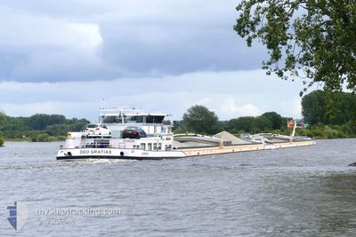
KVB DEO GRATIAS
Cargo
Current Trip
MARCKOLSHEIM
| Time Travelled | 22 h, 59 mins |
|---|---|
| Remaining Time | --- |
| Distance Travelled | 49.28 nm |
| Remaining Distance | --- |
| AVG Speed | 5.3 Knopen |
| MAX Speed | 9.2 Knopen |
| AVG Wind | 4.6 knots |
| MAX Wind | 6.7 knots |
| MIN Temp | 2.8°C / 37.04°F |
| MAX Temp | 7.3°C / 45.14°F |
| Diepgang | 3.6 M |
| Positie ontvangen | 13 h, 28 m geleden |
Current Position
| Lengtegraad | 7.98948° |
|---|---|
| Breedtegraat | 48.76058° |
| Status | Under way using engine |
| Snelheid | 8.4 Knopen |
| Koers | 286° |
| Gebied | North Sea |
| Station | T-AIS |
| Positie ontvangen | 13 h, 28 m geleden |
Info
Information
The current position of KVB DEO GRATIAS is in North Sea with coordinates 48.76058° / 7.98948° as reported on 2025-02-28 22:05 by AIS to our vessel tracker app. The vessel's current speed is 8.4 Knopen
The vessel KVB DEO GRATIAS (MMSI: 244660035) is a Cargo It's sailing under the flag of [NL] Netherlands.
In this page you can find informations about the vessels current position, last detected port calls, and current voyage information. If the vessels is not in coverage by AIS you will find the latest position.
The current position of KVB DEO GRATIAS is detected by our AIS receivers and we are not responsible for the reliability of the data. The last position was recorded while the vessel was in Coverage by the Ais receivers of our vessel tracking app.
The current draught of KVB DEO GRATIAS as reported by AIS is 3.6 meters
Weather
| Temperature | 4.2°C / 39.56°F |
|---|---|
| Wind Speed | 5 knots |
| Direction | 31° NNE |
| Pressure | 1026 hPa |
| Humidity | 80.7 % |
| Cloud Coverage | 94 % |
Featured Company
Last Port Calls
| Port | Arrival | Departure | Time In Port |
|---|---|---|---|
| 2025-02-27 23:34 | 2025-02-28 13:34 | 13 h | |
| 2025-02-27 21:38 | 2025-02-27 21:55 | 17 m | |
| 2025-02-25 14:49 | 2025-02-25 15:21 | 31 m | |
| 2025-02-25 05:39 | 2025-02-25 09:45 | 4 h | |
| 2025-02-24 23:30 | 2025-02-25 00:10 | 39 m | |
| 2025-02-22 18:22 | 2025-02-24 17:09 | 1 d | |
| 2025-02-22 14:47 | 2025-02-22 15:07 | 19 m | |
| 2025-02-21 09:11 | 2025-02-21 10:22 | 1 h | |
| 2025-02-17 21:37 | 2025-02-19 10:40 | 1 d | |
| 2025-02-17 20:27 | 2025-02-17 20:41 | 13 m |
Last Trips
| Origin | Departure | Destination | Arrival | Distance | |
|---|---|---|---|---|---|
| 2025-02-27 21:55 | 2025-02-27 23:34 | 4.63 nm | |||
| 2025-02-25 15:21 | 2025-02-27 21:38 | 253.13 nm | |||
| 2025-02-25 09:45 | 2025-02-25 14:49 | 31.08 nm | |||
| 2025-02-25 00:10 | 2025-02-25 05:39 | 38.70 nm | |||
| 2025-02-24 17:09 | 2025-02-24 23:30 | 35.80 nm | |||
| 2025-02-22 15:07 | 2025-02-22 18:22 | 13.52 nm | |||
| 2025-02-21 10:22 | 2025-02-22 14:47 | 230.93 nm | |||
| 2025-02-19 10:40 | 2025-02-21 09:11 | 107.11 nm | |||
| 2025-02-17 20:41 | 2025-02-17 21:37 | 4.52 nm | |||
| 2025-02-15 15:54 | 2025-02-17 20:27 | 256.50 nm |
Events
| Tijd | Evenement | Details | Positie / Bestemming | Info |
|---|---|---|---|---|
| 2025-02-28 22:05 | Buitenbereik |
48.76058 / 7.98948
North Sea
MARCKOLSHEIM
|
Snelheid: 8.4 kn Koers: 286° |
|
| 2025-02-28 14:47 | Destination Changed | MARCKOLSHEIM MANNHEIM |
49.25744 / 8.43097
MARCKOLSHEIM
|
Snelheid: 5.7 kn Koers: 233.5° |
| 2025-02-28 14:47 | ETA Changed | 2025/03/01 08:08 2025/02/27 21:06 |
49.25744 / 8.43097
MARCKOLSHEIM
|
Snelheid: 5.7 kn Koers: 233.5° |
| 2025-02-28 14:11 | Start beweging | 5.88 nm, North East of GERMERSHEIM |
49.29359 / 8.48916
MANNHEIM
|
Snelheid: 4.7 kn Koers: 182° |
| 2025-02-28 14:08 | Status Changed | Under way using engine Moored |
49.29537 / 8.48921
MANNHEIM
|
Snelheid: 0.1 kn Koers: 178° |
| 2025-02-28 14:05 | Status Changed | Moored Under way using engine |
49.29557 / 8.48927
MANNHEIM
|
Snelheid: 0.2 kn Koers: 177° |
| 2025-02-28 14:05 | Stop beweging | 5.97 nm, North East of GERMERSHEIM |
49.29556 / 8.48928
MANNHEIM
|
Snelheid: 0.2 kn Koers: 176° |
| 2025-02-28 12:34 | Vertrekhaven |
|
49.40991 / 8.49658
MANNHEIM
|
Snelheid: 5.4 kn Koers: 198° |
| 2025-02-28 12:10 | Binnenbereik |
49.44031 / 8.50628
North Sea
[DE] RHEINAU
|
Snelheid: 3.4 kn Koers: 306.1° |
|
| 2025-02-28 10:25 | Buitenbereik |
49.43839 / 8.51041
North Sea
[DE] RHEINAU
|
Snelheid: Koers: 157.8° |