

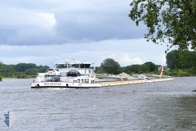
KVB DEO GRATIAS
Cargo

Current Trip
| Time Travelled | 16 h, 54 mins |
|---|---|
| Remaining Time | --- |
| Distance Travelled | 106.87 nm |
| Remaining Distance | --- |
| AVG Speed | 7 Knots |
| MAX Speed | 9.7 Knots |
| AVG Wind | 6.4 knots |
| MAX Wind | 13.9 knots |
| MIN Temp | 10.3°C / 50.54°F |
| MAX Temp | 14.6°C / 58.28°F |
| Draught | 3.6 m |
| Position Received | 1 h, 16 m ago |
Current Position
| Longitude | 6.24258° |
|---|---|
| Latitude | 51.82779° |
| Status | Under way using engine |
| Speed | 6.1 Knots |
| Course | 102.9° |
| Area | North Sea |
| Station | T-AIS |
| Position Received | 1 h, 16 m ago |
Information
The current position of KVB DEO GRATIAS is in North Sea with coordinates 51.82779° / 6.24258° as reported on 2025-05-29 13:19 by AIS to our vessel tracker app. The vessel's current speed is 6.1 Knots and is heading at the port of BASEL. The estimated time of arrival as calculated by MyShipTracking vessel tracking app is 2025-06-02 01:41 LT
The vessel KVB DEO GRATIAS (MMSI: 244660035) is a Cargo It's sailing under the flag of [NL] Netherlands.
In this page you can find informations about the vessels current position, last detected port calls, and current voyage information. If the vessels is not in coverage by AIS you will find the latest position.
The current position of KVB DEO GRATIAS is detected by our AIS receivers and we are not responsible for the reliability of the data. The last position was recorded while the vessel was in Coverage by the Ais receivers of our vessel tracking app.
The current draught of KVB DEO GRATIAS as reported by AIS is 3.6 meters
Weather
| Temperature | 14.6°C / 58.28°F |
|---|---|
| Wind Speed | 14 knots |
| Direction | 213° SSW |
| Pressure | 1020.7 hPa |
| Humidity | 85.4 % |
| Cloud Coverage | 100 % |


Featured Company
Last Port Calls
| Port | Arrival | Departure | Time In Port |
|---|---|---|---|
| 2025-05-28 23:04 | 2025-05-28 23:41 | 36 m | |
| 2025-05-28 19:47 | 2025-05-28 21:31 | 1 h | |
| 2025-05-27 08:11 | 2025-05-28 18:26 | 1 d | |
| 2025-05-27 01:36 | 2025-05-27 07:30 | 5 h | |
| 2025-05-26 23:28 | 2025-05-27 01:10 | 1 h | |
| 2025-05-26 21:43 | 2025-05-26 22:05 | 21 m | |
| 2025-05-25 19:52 | 2025-05-26 13:05 | 17 h | |
| 2025-05-25 17:08 | 2025-05-25 17:46 | 37 m | |
| 2025-05-24 23:34 | 2025-05-25 05:29 | 5 h | |
| 2025-05-21 14:18 | 2025-05-22 10:42 | 20 h |
Last Trips
| Origin | Departure | Destination | Arrival | Distance | |
|---|---|---|---|---|---|
| 2025-05-28 21:31 | 2025-05-28 23:04 | 10.64 nm | |||
| 2025-05-28 18:26 | 2025-05-28 19:47 | 8.15 nm | |||
| 2025-05-27 07:30 | 2025-05-27 08:11 | 5.72 nm | |||
| 2025-05-27 01:10 | 2025-05-27 01:36 | 2.44 nm | |||
| 2025-05-26 22:05 | 2025-05-26 23:28 | 10.68 nm | |||
| 2025-05-26 13:05 | 2025-05-26 21:43 | 54.61 nm | |||
| 2025-05-25 17:46 | 2025-05-25 19:52 | 16.72 nm | |||
| 2025-05-25 05:29 | 2025-05-25 17:08 | 97.31 nm | |||
| 2025-05-22 10:42 | 2025-05-24 23:34 | 310.71 nm | |||
| 2025-05-21 12:35 | 2025-05-21 14:18 | 3.60 nm |
Events
| Time | Event | Details | Position / Dest | Info |
|---|---|---|---|---|
| 2025-05-29 13:19 | OUT of Coverage |
51.82779 / 6.24258
North Sea
BASEL
|
Speed: 6.1 kn Course: 102.9° |
|
| 2025-05-29 05:57 | Status Changed | Under way using engine Default |
51.81043 / 5.19804
BASEL
|
Speed: 7.4 kn Course: 116° |
| 2025-05-29 05:33 | Status Changed | Default Under way using engine |
51.81494 / 5.12404
BASEL
|
Speed: 7.6 kn Course: 124.8° |
| 2025-05-29 05:28 | Status Changed | Under way using engine Default |
51.82049 / 5.10935
BASEL
|
Speed: 7.5 kn Course: 126° |
| 2025-05-29 05:10 | Status Changed | Default Under way using engine |
51.81851 / 5.05412
BASEL
|
Speed: 8.2 kn Course: 95.6° |
| 2025-05-29 04:19 | Status Changed | Under way using engine Default |
51.80722 / 4.87072
BASEL
|
Speed: 8 kn Course: 46° |
| 2025-05-29 04:14 | Status Changed | Default Under way using engine |
51.80040 / 4.85666
BASEL
|
Speed: 8 kn Course: 88° |
| 2025-05-29 04:08 | Status Changed | Under way using engine Default |
51.79678 / 4.83666
BASEL
|
Speed: 8 kn Course: 98° |
| 2025-05-29 03:59 | Status Changed | Default Under way using engine |
51.80045 / 4.80207
BASEL
|
Speed: 8.3 kn Course: 83.1° |
| 2025-05-29 03:51 | Status Changed | Under way using engine Default |
51.79450 / 4.77617
BASEL
|
Speed: 8.6 kn Course: 56° |