
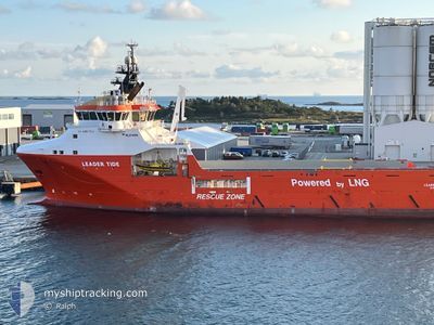
LEADER TIDE
Offshore Supply Ship
Current Trip
| Trip Time | 12 h, 9 mins |
|---|---|
| Trip Distance | 5.04 nm |
| AVG Speed | 6 Knopen |
| MAX Speed | 8.1 Knopen |
| Diepgang | 6.5 M |
| AVG Wind | 10.1 knots |
| MAX Wind | 10.8 knots |
| MIN Temp | 3°C / 37.4°F |
| MAX Temp | 4.8°C / 40.64°F |
| Positie ontvangen | 2 m geleden |
Current Position
| Lengtegraad | 7.77997° |
|---|---|
| Breedtegraat | 63.10377° |
| Status | Under way using engine |
| Snelheid | |
| Koers | 276° |
| Gebied | Norwegian Sea |
| Station | T-AIS |
| Positie ontvangen | 2 m geleden |
Info
Information
The current position of LEADER TIDE is in Norwegian Sea with coordinates 63.10377° / 7.77997° as reported on 2025-02-07 07:23 by AIS to our vessel tracker app. The vessel's current speed is 0 Knopen and is currently inside the port of KRISTIANSUND.
The vessel LEADER TIDE (IMO: 9627772, MMSI: 257793000) is a Offshore Supply Ship that was built in 2013 ( 12 Jaar oud ). It's sailing under the flag of [NO] Norway.
In this page you can find informations about the vessels current position, last detected port calls, and current voyage information. If the vessels is not in coverage by AIS you will find the latest position.
The current position of LEADER TIDE is detected by our AIS receivers and we are not responsible for the reliability of the data. The last position was recorded while the vessel was in Coverage by the Ais receivers of our vessel tracking app.
The current draught of LEADER TIDE as reported by AIS is 6.5 meters
Weather
| Temperature | 2.1°C / 35.78°F |
|---|---|
| Wind Speed | 8 knots |
| Direction | 168° SSE |
| Pressure | 1043.5 hPa |
| Humidity | 64.2 % |
| Cloud Coverage | 73 % |
Featured Company
Last Port Calls
| Port | Arrival | Departure | Time In Port |
|---|---|---|---|
| 2025-02-06 23:42 | |||
| 2025-02-03 23:57 | 2025-02-06 11:33 | 2 d | |
| 2025-01-31 11:42 | 2025-02-01 12:35 | 1 d | |
| 2025-01-27 14:44 | 2025-01-29 14:34 | 1 d |
Most Visited Ports (Last year)
| Port | Arrivals | |
|---|---|---|
| 61 | ||
| 4 | ||
| 4 | ||
| 3 | ||
| 1 | ||
| 1 |
Last Trips
| Origin | Departure | Destination | Arrival | Distance | |
|---|---|---|---|---|---|
| 2025-02-06 12:33 | 2025-02-07 00:42 | 5.04 nm | |||
| 2025-02-01 13:35 | 2025-02-04 00:57 | 118.04 nm | |||
| 2025-01-29 15:34 | 2025-01-31 12:42 | 129.50 nm | |||
| 2024-11-01 16:10 | 2025-01-27 15:44 | 3423.21 nm |
Events
| Tijd | Evenement | Details | Positie / Bestemming | Info |
|---|---|---|---|---|
| 2025-02-06 23:42 | Aankomsthaven |
|
63.10308 / 7.77874
[NO] KRISTIANSUND
|
Snelheid: 1 kn Koers: 266° |
| 2025-02-06 23:38 | Stop beweging | 1.16 nm, South East of KRISTIANSUND |
63.10209 / 7.77813
DP-TRIAL
|
Snelheid: 0.3 kn Koers: 168° |
| 2025-02-06 23:21 | Start beweging | 1.27 nm, South West of KRISTIANSUND |
63.09575 / 7.71791
DP-TRIAL
|
Snelheid: 3.9 kn Koers: 74° |
| 2025-02-06 13:07 | Stop beweging | 1.59 nm, South West of KRISTIANSUND |
63.09327 / 7.70550
DP-TRIAL
|
Snelheid: 0.3 kn Koers: 24° |
| 2025-02-06 13:05 | Start beweging | 1.53 nm, South West of KRISTIANSUND |
63.09432 / 7.70621
DP-TRIAL
|
Snelheid: 3.1 kn Koers: 26° |
| 2025-02-06 11:55 | Stop beweging | 1.69 nm, South West of KRISTIANSUND |
63.09383 / 7.69926
DP-TRIAL
|
Snelheid: Koers: 235° |
| 2025-02-06 11:33 | Vertrekhaven |
|
63.10113 / 7.76638
DP-TRIAL
|
Snelheid: 5.7 kn Koers: 255° |
| 2025-02-06 11:29 | Start beweging |
63.10247 / 7.78064
[NO] KRISTIANSUND
|
Snelheid: 4.4 kn Koers: 260° |
|
| 2025-02-06 11:04 | Destination Changed | DP-TRIAL KRISTIANSUND- VESTBA |
63.10270 / 7.78414
[NO] KRISTIANSUND
|
Snelheid: Koers: 271° |
| 2025-02-06 11:04 | ETA Changed | 2025/02/06 12:00 2025/02/04 01:00 |
63.10270 / 7.78414
[NO] KRISTIANSUND
|
Snelheid: Koers: 271° |