
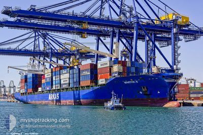
MARTHA A
Container Ship
Current Trip
| Time Travelled | 14 h, 20 mins |
|---|---|
| Remaining Time | 8 h, 40 mins |
| Distance Travelled | 181.35 nm |
| Remaining Distance | 131.86 nm |
| AVG Speed | 13.3 Knopen |
| MAX Speed | 15.8 Knopen |
| AVG Wind | 5.6 knots |
| MAX Wind | 9.4 knots |
| MIN Temp | 2.5°C / 36.5°F |
| MAX Temp | 7.3°C / 45.14°F |
| Diepgang | 9.2 M |
| Positie ontvangen | 1 m geleden |
Current Position
| Lengtegraad | 26.18391° |
|---|---|
| Breedtegraat | 40.02842° |
| Status | Under way using engine |
| Snelheid | 10.6 Knopen |
| Koers | 264° |
| Gebied | Sea of Marmara |
| Station | T-AIS |
| Positie ontvangen | 1 m geleden |
Info
Information
The current position of MARTHA A is in Sea of Marmara with coordinates 40.02842° / 26.18391° as reported on 2025-02-14 06:47 by AIS to our vessel tracker app. The vessel's current speed is 10.6 Knopen and is heading at the port of ALIAGA. The estimated time of arrival as calculated by MyShipTracking vessel tracking app is 2025-02-14 18:28 LT
The vessel MARTHA A (IMO: 9299484, MMSI: 271044070) is a Container Ship that was built in 2005 ( 20 Jaar oud ). It's sailing under the flag of [TR] Turkey.
In this page you can find informations about the vessels current position, last detected port calls, and current voyage information. If the vessels is not in coverage by AIS you will find the latest position.
The current position of MARTHA A is detected by our AIS receivers and we are not responsible for the reliability of the data. The last position was recorded while the vessel was in Coverage by the Ais receivers of our vessel tracking app.
The current draught of MARTHA A as reported by AIS is 9.2 meters
Weather
| Temperature | 6.4°C / 43.52°F |
|---|---|
| Wind Speed | 8 knots |
| Direction | 154° SSE |
| Pressure | 1021.2 hPa |
| Humidity | 66.7 % |
| Cloud Coverage | 73 % |
Featured Company
Last Port Calls
| Port | Arrival | Departure | Time In Port |
|---|---|---|---|
| 2025-02-13 01:54 | 2025-02-13 19:28 | 17 h | |
| 2025-02-12 13:49 | 2025-02-12 21:02 | 7 h | |
| 2025-02-11 07:51 | 2025-02-12 02:30 | 18 h | |
| 2025-02-05 01:39 | 2025-02-05 13:12 | 11 h | |
| 2025-01-30 00:07 | 2025-01-30 19:25 | 19 h | |
| 2025-01-27 10:57 | 2025-01-28 09:20 | 22 h | |
| 2025-01-24 10:15 | 2025-01-25 17:15 | 1 d | |
| 2025-01-23 00:52 | 2025-01-23 20:33 | 19 h | |
| 2025-01-19 09:57 | 2025-01-20 20:01 | 1 d | |
| 2025-01-11 13:19 | 2025-01-12 03:17 | 13 h |
Last Trips
| Origin | Departure | Destination | Arrival | Distance | |
|---|---|---|---|---|---|
| 2025-02-12 21:02 | 2025-02-13 01:54 | 57.22 nm | |||
| 2025-02-12 02:30 | 2025-02-12 13:49 | 19.73 nm | |||
| 2025-02-05 13:12 | 2025-02-11 07:51 | 1863.94 nm | |||
| 2025-01-30 19:25 | 2025-02-05 01:39 | 1690.39 nm | |||
| 2025-01-28 09:20 | 2025-01-30 00:07 | 647.56 nm | |||
| 2025-01-25 17:15 | 2025-01-27 10:57 | 117.07 nm | |||
| 2025-01-23 20:33 | 2025-01-24 10:15 | 191.79 nm | |||
| 2025-01-20 20:01 | 2025-01-23 00:52 | 380.54 nm | |||
| 2025-01-12 03:17 | 2025-01-19 09:57 | 2114.32 nm | |||
| 2025-01-07 01:25 | 2025-01-11 13:19 | 1662.00 nm |
Events
| Tijd | Evenement | Details | Positie / Bestemming | Info |
|---|---|---|---|---|
| 2025-02-14 04:49 | ETA Changed | 2025/02/14 16:00 2025/02/13 21:00 |
40.32190 / 26.60747
TRALI
|
Snelheid: 14.2 kn Koers: 230.7° |
| 2025-02-14 04:33 | Status Changed | Under way using engine Default |
40.36769 / 26.65791
TRALI
|
Snelheid: 9.2 kn Koers: 228° |
| 2025-02-14 04:07 | Status Changed | Default Under way using engine |
40.42560 / 26.73278
TRALI
|
Snelheid: 13.1 kn Koers: 250.1° |
| 2025-02-14 03:58 | Status Changed | Under way using engine Default |
40.44021 / 26.77031
TRALI
|
Snelheid: 11.5 kn Koers: 247° |
| 2025-02-14 03:41 | Binnenbereik |
40.44021 / 26.77031
Sea of Marmara
|
Snelheid: 11.8 kn Koers: 248.9° |
|
| 2025-02-14 01:59 | Status Changed | Default Under way using engine |
40.60146 / 27.20247
TRALI
|
Snelheid: 11.6 kn Koers: 242.7° |
| 2025-02-14 01:56 | Buitenbereik |
40.60540 / 27.21277
Sea of Marmara
|
Snelheid: 11.6 kn Koers: 242.7° |
|
| 2025-02-14 01:03 | Status Changed | Under way using engine Default |
40.68315 / 27.42162
TRALI
|
Snelheid: 15.5 kn Koers: 246° |
| 2025-02-14 00:57 | Status Changed | Default Under way using engine |
40.69420 / 27.45460
TRALI
|
Snelheid: 14.2 kn Koers: 245.9° |
| 2025-02-14 00:02 | Status Changed | Under way using engine Default |
40.77152 / 27.68689
TRALI
|
Snelheid: 12.2 kn Koers: 261° |