
MAX SCHULTE
Cargo
Current Trip
| Time Travelled | 5 days |
|---|---|
| Remaining Time | 7 h, 56 mins |
| Distance Travelled | 1808.50 nm |
| Remaining Distance | 279.51 nm |
| AVG Speed | 15 Knopen |
| MAX Speed | 18.5 Knopen |
| AVG Wind | 17.2 knots |
| MAX Wind | 38 knots |
| MIN Temp | 4.3°C / 39.74°F |
| MAX Temp | 28.7°C / 83.66°F |
| Diepgang | 8 M |
| Positie ontvangen | 2 d geleden |
Current Position
| Lengtegraad | -74.74630° |
|---|---|
| Breedtegraat | 24.53875° |
| Status | Under way using engine |
| Snelheid | 17.4 Knopen |
| Koers | 354° |
| Gebied | North Atlantic Ocean |
| Station | T-AIS |
| Positie ontvangen | 2 d geleden |
Info
Information
The current position of MAX SCHULTE is in North Atlantic Ocean with coordinates 24.53875° / -74.74630° as reported on 2025-01-30 08:30 by AIS to our vessel tracker app. The vessel's current speed is 17.4 Knopen and is heading at the port of PHILADELPHIA. The estimated time of arrival as calculated by MyShipTracking vessel tracking app is 2025-02-01 22:53 LT
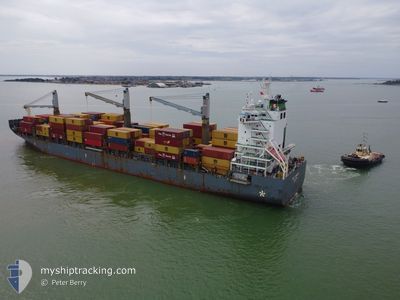
The vessel MAX SCHULTE (MMSI: 565380000) is a Cargo It's sailing under the flag of [SG] Singapore.
In this page you can find informations about the vessels current position, last detected port calls, and current voyage information. If the vessels is not in coverage by AIS you will find the latest position.
The current position of MAX SCHULTE is detected by our AIS receivers and we are not responsible for the reliability of the data. The last position was recorded while the vessel was in Coverage by the Ais receivers of our vessel tracking app.
The current draught of MAX SCHULTE as reported by AIS is 8 meters
Weather
| Temperature | 4.2°C / 39.56°F |
|---|---|
| Wind Speed | 26 knots |
| Direction | 342° NNW |
| Pressure | 1022.4 hPa |
| Humidity | 63.5 % |
| Cloud Coverage | 4 % |
Featured Company
Last Port Calls
| Port | Arrival | Departure | Time In Port |
|---|---|---|---|
| 2025-01-25 11:09 | 2025-01-27 12:04 | 2 d | |
| 2025-01-22 01:19 | 2025-01-22 23:27 | 22 h | |
| 2025-01-15 21:13 | 2025-01-16 23:51 | 1 d | |
| 2025-01-12 18:06 | 2025-01-13 23:31 | 1 d | |
| 2025-01-07 00:51 | 2025-01-07 21:39 | 20 h | |
| 2025-01-02 16:07 | 2025-01-03 05:07 | 13 h | |
| 2024-12-23 18:59 | 2024-12-25 11:19 | 1 d | |
| 2024-12-16 17:10 | 2024-12-17 19:06 | 1 d | |
| 2024-12-11 22:27 | 2024-12-12 11:51 | 13 h | |
| 2024-12-07 19:55 | 2024-12-08 12:28 | 16 h |
Last Trips
| Origin | Departure | Destination | Arrival | Distance | |
|---|---|---|---|---|---|
| 2025-01-22 23:27 | 2025-01-25 11:09 | 33.30 nm | |||
| 2025-01-16 23:51 | 2025-01-22 01:19 | 298.00 nm | |||
| 2025-01-13 23:31 | 2025-01-15 21:13 | 305.26 nm | |||
| 2025-01-07 21:39 | 2025-01-12 18:06 | 1242.15 nm | |||
| 2025-01-03 05:07 | 2025-01-07 00:51 | 910.27 nm | |||
| 2024-12-25 11:19 | 2025-01-02 16:07 | 2091.15 nm | |||
| 2024-12-17 19:06 | 2024-12-23 18:59 | 1624.37 nm | |||
| 2024-12-12 11:51 | 2024-12-16 17:10 | 1105.81 nm | |||
| 2024-12-08 12:28 | 2024-12-11 22:27 | 1350.18 nm | |||
| 2024-12-06 18:12 | 2024-12-07 19:55 | 71.22 nm |
Events
| Tijd | Evenement | Details | Positie / Bestemming | Info |
|---|---|---|---|---|
| 2025-01-30 08:35 | Status Changed | Default Under way using engine |
24.56199 / -74.74953
UUSPHL
|
Snelheid: 17.4 kn Koers: 354° |
| 2025-01-30 08:30 | Buitenbereik |
24.53875 / -74.74630
North Atlantic Ocean
|
Snelheid: 17.4 kn Koers: 354° |
|
| 2025-01-30 08:21 | Status Changed | Under way using engine Default |
24.49701 / -74.74056
UUSPHL
|
Snelheid: 17.5 kn Koers: 353° |
| 2025-01-30 07:39 | Status Changed | Default Under way using engine |
24.29229 / -74.71092
UUSPHL
|
Snelheid: 17.3 kn Koers: 352.5° |
| 2025-01-30 07:15 | Status Changed | Under way using engine Default |
24.17399 / -74.69504
UUSPHL
|
Snelheid: 17.2 kn Koers: 353° |
| 2025-01-30 06:59 | Binnenbereik |
24.17399 / -74.69504
North Atlantic Ocean
|
Snelheid: 17.2 kn Koers: 352.9° |
|
| 2025-01-30 06:15 | Status Changed | Default Under way using engine |
23.88959 / -74.65660
UUSPHL
|
Snelheid: 17.2 kn Koers: 356° |
| 2025-01-30 06:14 | Buitenbereik |
23.88432 / -74.65615
North Atlantic Ocean
|
Snelheid: 17.2 kn Koers: 356° |
|
| 2025-01-30 01:43 | Draught Changed | 8 8.4 |
22.59881 / -74.60900
UUSPHL
|
Snelheid: 17.2 kn Koers: 2° |
| 2025-01-30 01:43 | Destination Changed | UUSPHL PACTB |
22.59881 / -74.60900
UUSPHL
|
Snelheid: 17.2 kn Koers: 2° |