
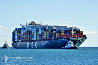
MSC GIULIA
Cargo D
Current Trip
| Trip Time | 1 day |
|---|---|
| Trip Distance | 687.05 nm |
| AVG Speed | 14.5 Knopen |
| MAX Speed | 14.5 Knopen |
| Diepgang | 11.8 M |
| AVG Wind | 7.7 knots |
| MAX Wind | 23.3 knots |
| MIN Temp | 6°C / 42.8°F |
| MAX Temp | 16.2°C / 61.16°F |
| Positie ontvangen | 1 m geleden |
Current Position
| Lengtegraad | -8.84630° |
|---|---|
| Breedtegraat | 37.93219° |
| Status | Moored |
| Snelheid | |
| Koers | 127° |
| Gebied | North Atlantic Ocean |
| Station | T-AIS |
| Positie ontvangen | 1 m geleden |
Info
Information
The current position of MSC GIULIA is in North Atlantic Ocean with coordinates 37.93219° / -8.84630° as reported on 2025-02-07 01:20 by AIS to our vessel tracker app. The vessel's current speed is 0 Knopen and is currently inside the port of SINES.
The vessel MSC GIULIA (IMO: 9770737, MMSI: 255805869) is a Cargo D It's sailing under the flag of [PT] Portugal.
In this page you can find informations about the vessels current position, last detected port calls, and current voyage information. If the vessels is not in coverage by AIS you will find the latest position.
The current position of MSC GIULIA is detected by our AIS receivers and we are not responsible for the reliability of the data. The last position was recorded while the vessel was in Coverage by the Ais receivers of our vessel tracking app.
The current draught of MSC GIULIA as reported by AIS is 11.8 meters
Weather
| Temperature | 8.9°C / 48.02°F |
|---|---|
| Wind Speed | 2 knots |
| Direction | 182° S |
| Pressure | 1025.7 hPa |
| Humidity | 74.5 % |
| Cloud Coverage | 100 % |
Featured Company
Last Port Calls
| Port | Arrival | Departure | Time In Port |
|---|---|---|---|
| 2025-02-06 08:01 | |||
| 2025-02-03 11:21 | 2025-02-04 16:17 | 1 d | |
| 2025-01-29 22:40 | 2025-02-01 00:38 | 2 d | |
| 2025-01-26 10:19 | 2025-01-27 07:38 | 21 h | |
| 2025-01-23 15:18 | 2025-01-25 13:33 | 1 d | |
| 2025-01-22 03:01 | 2025-01-23 04:40 | 1 d | |
| 2025-01-06 16:55 | 2025-01-08 23:02 | 2 d | |
| 2025-01-05 01:11 | 2025-01-05 22:42 | 21 h | |
| 2025-01-01 16:42 | 2025-01-04 12:11 | 2 d | |
| 2024-12-26 20:47 | 2024-12-27 10:11 | 13 h |
Most Visited Ports (Last year)
| Port | Arrivals | |
|---|---|---|
| 7 | ||
| 7 | ||
| 7 | ||
| 6 | ||
| 4 | ||
| 4 |
Last Trips
| Origin | Departure | Destination | Arrival | Distance | |
|---|---|---|---|---|---|
| 2025-02-04 17:17 | 2025-02-06 08:01 | 687.05 nm | |||
| 2025-02-01 01:38 | 2025-02-03 12:21 | 551.94 nm | |||
| 2025-01-27 08:38 | 2025-01-29 23:40 | 298.15 nm | |||
| 2025-01-25 14:33 | 2025-01-26 11:19 | 308.57 nm | |||
| 2025-01-23 05:40 | 2025-01-23 16:18 | 190.68 nm | |||
| 2025-01-08 18:02 | 2025-01-22 04:01 | 5458.20 nm | |||
| 2025-01-05 17:42 | 2025-01-06 11:55 | 25.60 nm | |||
| 2025-01-04 07:11 | 2025-01-04 20:11 | 49.59 nm | |||
| 2024-12-27 04:11 | 2025-01-01 11:42 | 1625.14 nm | |||
| 2024-12-21 21:58 | 2024-12-26 14:47 | 1874.63 nm |
Events
| Tijd | Evenement | Details | Positie / Bestemming | Info |
|---|---|---|---|---|
| 2025-02-06 08:32 | Status Changed | Moored Under way using engine |
37.93222 / -8.84627
[PT] SINES
|
Snelheid: Koers: 128° |
| 2025-02-06 08:24 | Stop beweging |
37.93209 / -8.84619
[PT] SINES
|
Snelheid: 0.3 kn Koers: 128° |
|
| 2025-02-06 08:01 | Aankomsthaven |
|
37.92287 / -8.83973
[PT] SINES
|
Snelheid: 4.9 kn Koers: 334° |
| 2025-02-05 19:50 | Status Changed | Under way using engine Default |
36.36897 / -7.77788
PTSIE
|
Snelheid: 18.4 kn Koers: 284° |
| 2025-02-05 19:39 | Status Changed | Default Under way using engine |
36.35507 / -7.71152
PTSIE
|
Snelheid: 18.4 kn Koers: 289.4° |
| 2025-02-05 18:55 | Wijzig zee gebeid | Portuguese part of the North Atlantic Ocean Spanish part of the North Atlantic Ocean |
36.28306 / -7.44671
North Atlantic Ocean
PTSIE
|
Snelheid: 18.7 kn Koers: 288.6° |
| 2025-02-05 18:49 | Status Changed | Under way using engine Default |
36.27366 / -7.41282
PTSIE
|
Snelheid: 18.8 kn Koers: 289° |
| 2025-02-05 18:49 | Binnenbereik |
36.27366 / -7.41282
North Atlantic Ocean
PTSIE
|
Snelheid: 18.5 kn Koers: 288.6° |
|
| 2025-02-05 17:43 | Status Changed | Default Under way using engine |
36.15971 / -7.01645
PTSIE
|
Snelheid: 18.4 kn Koers: 290.2° |
| 2025-02-05 17:35 | Buitenbereik |
36.14550 / -6.96768
North Atlantic Ocean
PTSIE
|
Snelheid: 18.4 kn Koers: 290.2° |