
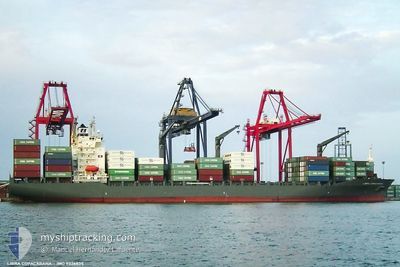
MSC HUSUM III
Container Ship
Current Trip
COCTG
| Time Travelled | 3 h, 53 mins |
|---|---|
| Remaining Time | --- |
| Distance Travelled | 34.60 nm |
| Remaining Distance | --- |
| AVG Speed | 10.9 Knopen |
| MAX Speed | 11.2 Knopen |
| AVG Wind | 14.3 knots |
| MAX Wind | 17 knots |
| MIN Temp | 28.8°C / 83.84°F |
| MAX Temp | 29.2°C / 84.56°F |
| Diepgang | 9.7 M |
| Positie ontvangen | 2 d geleden |
Current Position
| Lengtegraad | -88.15417° |
|---|---|
| Breedtegraat | 15.97292° |
| Status | Under way using engine |
| Snelheid | 0.6 Knopen |
| Koers | 159° |
| Gebied | Caribbean Sea |
| Station | T-AIS |
| Positie ontvangen | 2 d geleden |
Information
The current position of MSC HUSUM III is in Caribbean Sea with coordinates 15.97292° / -88.15417° as reported on 2025-06-09 11:45 by AIS to our vessel tracker app. The vessel's current speed is 0.6 Knopen
The vessel MSC HUSUM III (IMO: 9326835, MMSI: 636018561) is a Container Ship that was built in 2006 ( 19 Jaar oud ). It's sailing under the flag of [LR] Liberia.
In this page you can find informations about the vessels current position, last detected port calls, and current voyage information. If the vessels is not in coverage by AIS you will find the latest position.
The current position of MSC HUSUM III is detected by our AIS receivers and we are not responsible for the reliability of the data. The last position was recorded while the vessel was in Coverage by the Ais receivers of our vessel tracking app.
The current draught of MSC HUSUM III as reported by AIS is 9.7 meters
Weather
| Temperature | 29°C / 84.2°F |
|---|---|
| Wind Speed | 17 knots |
| Direction | 89° E |
| Pressure | 1012.1 hPa |
| Humidity | 79.5 % |
| Cloud Coverage | 70 % |
Featured Company
Last Port Calls
| Port | Arrival | Departure | Time In Port |
|---|---|---|---|
| 2025-06-10 15:57 | 2025-06-11 20:54 | 1 d | |
| 2025-06-04 21:25 | 2025-06-05 06:00 | 8 h | |
| 2025-06-02 19:11 | 2025-06-03 16:53 | 21 h | |
| 2025-05-19 05:15 | 2025-05-20 21:48 | 1 d | |
| 2025-05-15 18:52 | 2025-05-18 19:02 | 3 d | |
| 2025-05-11 06:58 | 2025-05-13 05:28 | 1 d | |
| 2025-05-07 09:20 | 2025-05-08 01:24 | 16 h | |
| 2025-05-05 14:51 | 2025-05-06 23:32 | 1 d | |
| 2025-05-02 20:24 | 2025-05-03 13:33 | 17 h | |
| 2025-04-28 10:04 | 2025-04-29 19:43 | 1 d |
Most Visited Ports (Last year)
| Port | Arrivals | |
|---|---|---|
| 15 | ||
| 13 | ||
| 8 | ||
| 6 | ||
| 5 | ||
| 3 |
Last Trips
| Origin | Departure | Destination | Arrival | Distance | |
|---|---|---|---|---|---|
| 2025-06-05 00:00 | 2025-06-10 09:57 | 276.43 nm | |||
| 2025-06-03 10:53 | 2025-06-04 15:25 | 75.41 nm | |||
| 2025-05-20 16:48 | 2025-06-02 13:11 | 1259.87 nm | |||
| 2025-05-18 14:02 | 2025-05-19 00:15 | 34.75 nm | |||
| 2025-05-12 23:28 | 2025-05-15 13:52 | 904.67 nm | |||
| 2025-05-07 20:24 | 2025-05-11 00:58 | 902.98 nm | |||
| 2025-05-06 18:32 | 2025-05-07 04:20 | 25.67 nm | |||
| 2025-05-03 08:33 | 2025-05-05 09:51 | 12.41 nm | |||
| 2025-04-29 14:43 | 2025-05-02 15:24 | 286.67 nm | |||
| 2025-04-27 00:37 | 2025-04-28 05:04 | 278.89 nm |
Events
| Tijd | Evenement | Details | Positie / Bestemming | Info |
|---|---|---|---|---|
| 2025-06-11 20:54 | Vertrekhaven |
|
15.84888 / -87.97043
COCTG
|
Snelheid: 6.3 kn Koers: 306° |
| 2025-06-11 20:44 | Start beweging |
15.83944 / -87.95739
[HN] PUERTO CORTES
|
Snelheid: 6.5 kn Koers: 288° |
|
| 2025-06-10 16:26 | Stop beweging |
15.83820 / -87.94089
[HN] PUERTO CORTES
|
Snelheid: Koers: 336° |
|
| 2025-06-10 15:57 | Aankomsthaven |
|
15.83689 / -87.95074
[HN] PUERTO CORTES
|
Snelheid: 3.5 kn Koers: 100° |
| 2025-06-10 12:26 | Start beweging | 14.91 nm, North of PUERTO CORTES |
16.07950 / -87.97132
COCTG
|
Snelheid: 3.3 kn Koers: 183° |
| 2025-06-10 05:09 | Stop beweging | 9.02 nm, North of PUERTO CORTES |
15.98092 / -87.92609
COCTG
|
Snelheid: 0.2 kn Koers: 143° |
| 2025-06-09 19:28 | Start beweging | 7.86 nm, North West of OMOA |
15.87994 / -88.14027
COCTG
|
Snelheid: 3.7 kn Koers: 86° |
| 2025-06-09 11:52 | Status Changed | Default Under way using engine |
15.97232 / -88.15449
COCTG
|
Snelheid: 0.6 kn Koers: 159° |
| 2025-06-09 11:45 | Status Changed | Under way using engine Default |
15.97292 / -88.15417
COCTG
|
Snelheid: 0.3 kn Koers: 159° |
| 2025-06-09 11:45 | Buitenbereik |
15.97292 / -88.15417
Caribbean Sea
|
Snelheid: 0.6 kn Koers: 198.5° |