
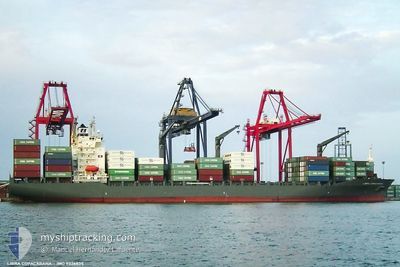
MSC HUSUM III
Container Ship
Current Trip
| Time Travelled | 1 day |
|---|---|
| Remaining Time | 19 h, 4 mins |
| Distance Travelled | 544.28 nm |
| Remaining Distance | 311.42 nm |
| AVG Speed | 16.5 Knots |
| MAX Speed | 18.8 Knots |
| AVG Wind | 14.1 knots |
| MAX Wind | 21.7 knots |
| MIN Temp | 26.5°C / 79.7°F |
| MAX Temp | 27.4°C / 81.32°F |
| Draught | 10.8 m |
| Position Received | 1 d ago |
Current Position
| Longitude | -79.31065° |
|---|---|
| Latitude | 9.86005° |
| Status | Under way using engine |
| Speed | 17.7 Knots |
| Course | 67.5° |
| Area | Caribbean Sea |
| Station | T-AIS |
| Position Received | 1 d ago |
Info
Information
The current position of MSC HUSUM III is in Caribbean Sea with coordinates 9.86005° / -79.31065° as reported on 2025-12-14 20:07 by AIS to our vessel tracker app. The vessel's current speed is 17.7 Knots and is heading at the port of LA GUAIRA. The estimated time of arrival as calculated by MyShipTracking vessel tracking app is 2025-12-16 17:24 LT
The vessel MSC HUSUM III (IMO: 9326835, MMSI: 636018561) is a Container Ship that was built in 2006 ( 19 years old ). It's sailing under the flag of [LR] Liberia.
In this page you can find informations about the vessels current position, last detected port calls, and current voyage information. If the vessels is not in coverage by AIS you will find the latest position.
The current position of MSC HUSUM III is detected by our AIS receivers and we are not responsible for the reliability of the data. The last position was recorded while the vessel was in Coverage by the Ais receivers of our vessel tracking app.
The current draught of MSC HUSUM III as reported by AIS is 10.8 meters
Weather
| Temperature | 26.9°C / 80.42°F |
|---|---|
| Wind Speed | 20 knots |
| Direction | 76° ENE |
| Pressure | 1012.1 hPa |
| Humidity | 82.9 % |
| Cloud Coverage | 25 % |
Featured Company
Last Port Calls
| Port | Arrival | Departure | Time In Port |
|---|---|---|---|
| 2025-12-12 22:50 | 2025-12-14 12:12 | 1 d | |
| 2025-12-09 15:59 | 2025-12-10 16:27 | 1 d | |
| 2025-12-07 00:43 | 2025-12-08 20:03 | 1 d | |
| 2025-12-03 16:47 | 2025-12-06 08:27 | 2 d | |
| 2025-12-01 18:39 | 2025-12-03 04:49 | 1 d | |
| 2025-11-29 19:54 | 2025-12-01 01:31 | 1 d | |
| 2025-11-26 09:46 | 2025-11-28 14:02 | 2 d | |
| 2025-11-24 21:50 | 2025-11-25 21:27 | 23 h | |
| 2025-11-22 02:03 | 2025-11-24 02:19 | 2 d | |
| 2025-11-19 05:38 | 2025-11-21 08:06 | 2 d |
Most Visited Ports (Last year)
| Port | Arrivals | |
|---|---|---|
| 34 | ||
| 29 | ||
| 21 | ||
| 14 | ||
| 3 | ||
| 2 |
Last Trips
| Origin | Departure | Destination | Arrival | Distance | |
|---|---|---|---|---|---|
| 2025-12-10 16:27 | 2025-12-12 22:50 | 330.17 nm | |||
| 2025-12-08 20:03 | 2025-12-09 15:59 | 279.89 nm | |||
| 2025-12-06 08:27 | 2025-12-07 00:43 | 248.98 nm | |||
| 2025-12-03 04:49 | 2025-12-03 16:47 | 185.50 nm | |||
| 2025-12-01 01:31 | 2025-12-01 18:39 | 279.58 nm | |||
| 2025-11-28 14:02 | 2025-11-29 19:54 | 270.35 nm | |||
| 2025-11-25 21:27 | 2025-11-26 09:46 | 184.96 nm | |||
| 2025-11-24 02:19 | 2025-11-24 21:50 | 279.45 nm | |||
| 2025-11-21 08:06 | 2025-11-22 02:03 | 247.92 nm | |||
| 2025-11-18 14:49 | 2025-11-19 05:38 | 185.24 nm |
Events
| Time | Event | Details | Position / Dest | Info |
|---|---|---|---|---|
| 2025-12-14 20:08 | Status Changed | Default Under way using engine |
9.86104 / -79.30827
VELAG
|
Speed: 17.7 kn Course: 67.5° |
| 2025-12-14 20:07 | OUT of Coverage |
9.86005 / -79.31065
Caribbean Sea
|
Speed: 17.7 kn Course: 67.5° |
|
| 2025-12-14 19:52 | Draught Changed | 10.8 7.7 |
9.83021 / -79.38215
VELAG
|
Speed: 17.5 kn Course: 68.1° |
| 2025-12-14 19:52 | Destination Changed | VELAG PACTB |
9.83021 / -79.38215
VELAG
|
Speed: 17.5 kn Course: 68.1° |
| 2025-12-14 17:37 | Status Changed | Under way using engine Default |
9.43704 / -79.91291
PACTB
|
Speed: 14.4 kn Course: 13° |
| 2025-12-14 17:36 | Status Changed | Default Under way using engine |
9.43389 / -79.91361
PACTB
|
Speed: 13.1 kn Course: 356.6° |
| 2025-12-14 17:27 | Status Changed | Under way using engine Default |
9.39981 / -79.91717
PACTB
|
Speed: 12.2 kn Course: 1° |
| 2025-12-14 17:20 | IN Coverage |
9.39981 / -79.91717
Caribbean Sea
|
Speed: 12.8 kn Course: 7° |
|
| 2025-12-14 17:12 | PORT DEPARTURE |
|
9.35878 / -79.91826
PACTB
|
Speed: 3.7 kn Course: 290° |
| 2025-12-14 16:14 | OUT of Coverage |
9.35226 / -79.90759
Caribbean Sea
|
Speed: Course: 157.1° |