

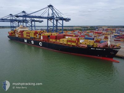
MSC RONIT R
Container Ship

Current Trip
| Trip Time | 4 h, 28 mins |
|---|---|
| Trip Distance | 19.83 nm |
| AVG Speed | 6.4 Knopen |
| MAX Speed | 6.4 Knopen |
| Diepgang | 12.1 M |
| AVG Wind | 5.1 knots |
| MAX Wind | 6 knots |
| MIN Temp | 27.2°C / 80.96°F |
| MAX Temp | 29.6°C / 85.28°F |
| Positie ontvangen | 10 h, 5 m geleden |
Current Position
| Lengtegraad | -79.91077° |
|---|---|
| Breedtegraat | 9.35242° |
| Status | Moored |
| Snelheid | |
| Koers | 53° |
| Gebied | South Pacific Ocean |
| Station | T-AIS |
| Positie ontvangen | 10 h, 5 m geleden |
Information
The current position of MSC RONIT R is in South Pacific Ocean with coordinates 9.35242° / -79.91077° as reported on 2025-06-07 15:18 by AIS to our vessel tracker app. The vessel's current speed is 0 Knopen and is currently inside the port of COLON.
The vessel MSC RONIT R (IMO: 9293167, MMSI: 636017000) is a Container Ship that was built in 2005 ( 20 Jaar oud ). It's sailing under the flag of [LR] Liberia.
In this page you can find informations about the vessels current position, last detected port calls, and current voyage information. If the vessels is not in coverage by AIS you will find the latest position.
The current position of MSC RONIT R is detected by our AIS receivers and we are not responsible for the reliability of the data. The last position was recorded while the vessel was in Coverage by the Ais receivers of our vessel tracking app.
The current draught of MSC RONIT R as reported by AIS is 12.1 meters
Weather
| Temperature | 25.8°C / 78.44°F |
|---|---|
| Wind Speed | 3 knots |
| Direction | 334° NNW |
| Pressure | 1009.9 hPa |
| Humidity | 91.2 % |
| Cloud Coverage | 100 % |


Featured Company
Last Port Calls
| Port | Arrival | Departure | Time In Port |
|---|---|---|---|
| 2025-06-07 17:48 | |||
| 2025-06-06 15:32 | 2025-06-07 13:20 | 21 h | |
| 2025-06-02 10:21 | 2025-06-04 06:42 | 1 d | |
| 2025-05-30 10:53 | 2025-06-01 20:49 | 2 d | |
| 2025-05-29 13:19 | 2025-05-29 20:25 | 7 h | |
| 2025-05-24 19:23 | 2025-05-25 20:08 | 1 d | |
| 2025-05-23 15:32 | 2025-05-24 08:48 | 17 h | |
| 2025-05-16 17:52 | 2025-05-17 02:08 | 8 h | |
| 2025-05-15 03:14 | 2025-05-15 21:45 | 18 h | |
| 2025-05-13 04:24 | 2025-05-13 23:33 | 19 h |
Most Visited Ports (Last year)
| Port | Arrivals | |
|---|---|---|
| 8 | ||
| 8 | ||
| 8 | ||
| 6 | ||
| 6 | ||
| 5 |
Last Trips
| Origin | Departure | Destination | Arrival | Distance | |
|---|---|---|---|---|---|
| 2025-06-07 13:20 | 2025-06-07 17:48 | 19.83 nm | |||
| 2025-06-04 06:42 | 2025-06-06 15:32 | 831.27 nm | |||
| 2025-06-01 20:49 | 2025-06-02 10:21 | 111.31 nm | |||
| 2025-05-29 20:25 | 2025-05-30 10:53 | 173.26 nm | |||
| 2025-05-25 20:08 | 2025-05-29 13:19 | 950.23 nm | |||
| 2025-05-24 08:48 | 2025-05-24 19:23 | 36.35 nm | |||
| 2025-05-17 02:08 | 2025-05-23 15:32 | 2182.54 nm | |||
| 2025-05-15 21:45 | 2025-05-16 17:52 | 290.26 nm | |||
| 2025-05-13 23:33 | 2025-05-15 03:14 | 290.83 nm | |||
| 2025-05-05 00:10 | 2025-05-13 04:24 | 3274.12 nm |
Events
| Tijd | Evenement | Details | Positie / Bestemming | Info |
|---|---|---|---|---|
| 2025-06-07 22:48 | Stop beweging |
9.37288 / -79.88929
[PA] COLON
|
Snelheid: 0.2 kn Koers: 144° |
|
| 2025-06-07 22:48 | Aankomsthaven |
|
9.37288 / -79.88929
[PA] COLON
|
Snelheid: 0.6 kn Koers: 138° |
| 2025-06-07 20:36 | Start beweging | 6.81 nm, North of COLON |
9.48450 / -79.90772
PEPAI!ISBURG TRIMODA
|
Snelheid: 4.2 kn Koers: 184° |
| 2025-06-07 19:51 | Stop beweging | 6.67 nm, North West of SAMBA BONITA |
9.48440 / -79.89766
PEPAI!ISBURG TRIMODA
|
Snelheid: Koers: 290° |
| 2025-06-07 18:20 | Vertrekhaven |
|
9.35731 / -79.91936
PEPAI!ISBURG TRIMODA
|
Snelheid: 5.4 kn Koers: 311° |
| 2025-06-07 18:17 | Start beweging |
9.35074 / -79.91600
[PA] CRISTOBAL
|
Snelheid: 5.4 kn Koers: 311° |
|
| 2025-06-07 15:24 | Status Changed | Default Moored |
9.35235 / -79.91075
[PA] CRISTOBAL
|
Snelheid: Koers: 53° |
| 2025-06-07 15:18 | Buitenbereik |
9.35242 / -79.91077
South Pacific Ocean
[PA] CRISTOBAL
|
Snelheid: Koers: 320.7° |
|
| 2025-06-07 14:57 | Status Changed | Moored Default |
9.35235 / -79.91073
[PA] CRISTOBAL
|
Snelheid: Koers: 54° |
| 2025-06-07 14:51 | Status Changed | Default Moored |
9.35236 / -79.91073
[PA] CRISTOBAL
|
Snelheid: Koers: 53° |