

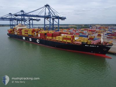
MSC RONIT R
Container Ship

Current Trip
| Time Travelled | 3 h, 6 mins |
|---|---|
| Remaining Time | 18 h, 4 mins |
| Distance Travelled | 19.86 nm |
| Remaining Distance | 159.22 nm |
| AVG Speed | 7.5 Knots |
| MAX Speed | 10.3 Knots |
| AVG Wind | 4.9 knots |
| MAX Wind | 6.1 knots |
| MIN Temp | 22.9°C / 73.22°F |
| MAX Temp | 23.5°C / 74.3°F |
| Draught | 12.1 m |
| Position Received | 3 d ago |
Current Position
| Longitude | -81.38145° |
|---|---|
| Latitude | -5.07524° |
| Status | Under way using engine |
| Speed | 13.5 Knots |
| Course | 83.8° |
| Area | South Pacific Ocean |
| Station | T-AIS |
| Position Received | 3 d ago |
Information
The current position of MSC RONIT R is in South Pacific Ocean with coordinates -5.07524° / -81.38145° as reported on 2025-05-29 16:22 by AIS to our vessel tracker app. The vessel's current speed is 13.5 Knots and is heading at the port of PAITA. The estimated time of arrival as calculated by MyShipTracking vessel tracking app is 2025-06-02 17:59 LT
The vessel MSC RONIT R (IMO: 9293167, MMSI: 636017000) is a Container Ship that was built in 2005 ( 20 years old ). It's sailing under the flag of [LR] Liberia.
In this page you can find informations about the vessels current position, last detected port calls, and current voyage information. If the vessels is not in coverage by AIS you will find the latest position.
The current position of MSC RONIT R is detected by our AIS receivers and we are not responsible for the reliability of the data. The last position was recorded while the vessel was in Coverage by the Ais receivers of our vessel tracking app.
The current draught of MSC RONIT R as reported by AIS is 12.1 meters
Weather
| Temperature | 23.3°C / 73.94°F |
|---|---|
| Wind Speed | 6 knots |
| Direction | 259° W |
| Pressure | 1015.1 hPa |
| Humidity | 84 % |
| Cloud Coverage | 66 % |


Featured Company
Last Port Calls
| Port | Arrival | Departure | Time In Port |
|---|---|---|---|
| 2025-05-30 10:53 | 2025-06-01 20:49 | 2 d | |
| 2025-05-29 13:19 | 2025-05-29 20:25 | 7 h | |
| 2025-05-24 19:23 | 2025-05-25 20:08 | 1 d | |
| 2025-05-23 15:32 | 2025-05-24 08:48 | 17 h | |
| 2025-05-16 17:52 | 2025-05-17 02:08 | 8 h | |
| 2025-05-15 03:14 | 2025-05-15 21:45 | 18 h | |
| 2025-05-13 04:24 | 2025-05-13 23:33 | 19 h | |
| 2025-05-04 16:53 | 2025-05-05 00:10 | 7 h | |
| 2025-04-29 09:39 | 2025-05-04 15:51 | 5 d | |
| 2025-04-28 13:43 | 2025-04-29 08:41 | 18 h |
Most Visited Ports (Last year)
| Port | Arrivals | |
|---|---|---|
| 8 | ||
| 7 | ||
| 7 | ||
| 6 | ||
| 6 | ||
| 5 |
Last Trips
| Origin | Departure | Destination | Arrival | Distance | |
|---|---|---|---|---|---|
| 2025-05-29 20:25 | 2025-05-30 10:53 | 173.26 nm | |||
| 2025-05-25 20:08 | 2025-05-29 13:19 | 950.23 nm | |||
| 2025-05-24 08:48 | 2025-05-24 19:23 | 36.35 nm | |||
| 2025-05-17 02:08 | 2025-05-23 15:32 | 2182.54 nm | |||
| 2025-05-15 21:45 | 2025-05-16 17:52 | 290.26 nm | |||
| 2025-05-13 23:33 | 2025-05-15 03:14 | 290.83 nm | |||
| 2025-05-05 00:10 | 2025-05-13 04:24 | 3274.12 nm | |||
| 2025-05-04 15:51 | 2025-05-04 16:53 | 6.16 nm | |||
| 2025-04-29 08:41 | 2025-04-29 09:39 | 4.54 nm | |||
| 2025-04-27 09:23 | 2025-04-28 13:43 | 232.88 nm |
Events
| Time | Event | Details | Position / Dest | Info |
|---|---|---|---|---|
| 2025-06-02 01:50 | START Moving | 0.92 nm, North of PUERTO BOLIVAR |
-3.24295 / -80.00623
PEPAI!ISBURG TRIMODA
|
Speed: 4.7 kn Course: 347° |
| 2025-06-02 01:49 | PORT DEPARTURE |
|
-3.24295 / -80.00623
PEPAI!ISBURG TRIMODA
|
Speed: 0.6 kn Course: 352° |
| 2025-05-30 15:53 | STOP Moving |
-3.25441 / -80.00410
[EC] PUERTO BOLIVAR
|
Speed: 0.3 kn Course: 153° |
|
| 2025-05-30 15:53 | PORT ARRIVAL |
|
-3.25441 / -80.00410
[EC] PUERTO BOLIVAR
|
Speed: 3 kn Course: 168° |
| 2025-05-30 01:25 | PORT DEPARTURE |
|
-5.07108 / -81.11141
PEPAI!ISBURG TRIMODA
|
Speed: 4.1 kn Course: 325° |
| 2025-05-30 01:22 | START Moving |
-5.07397 / -81.10963
[PE] PAITA
|
Speed: 4.1 kn Course: 325° |
|
| 2025-05-29 18:33 | STOP Moving |
-5.08063 / -81.10683
[PE] PAITA
|
Speed: 0.2 kn Course: 56° |
|
| 2025-05-29 18:19 | PORT ARRIVAL |
|
-5.07695 / -81.11007
[PE] PAITA
|
Speed: 4.8 kn Course: 146° |
| 2025-05-29 16:25 | Status Changed | Default Under way using engine |
-5.07374 / -81.36902
PEPAI!ISBURG TRIMODA
|
Speed: 13.5 kn Course: 83.8° |
| 2025-05-29 16:22 | OUT of Coverage |
-5.07524 / -81.38145
South Pacific Ocean
|
Speed: 13.5 kn Course: 83.8° |