
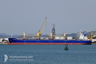
OCEAN BRAVE
Cargo
Current Trip
| Time Travelled | 18 days |
|---|---|
| Remaining Time | 18 days |
| Distance Travelled | 4448.32 nm |
| Remaining Distance | 4197.99 nm |
| AVG Speed | 10.1 Knopen |
| MAX Speed | 11.9 Knopen |
| AVG Wind | 9.6 knots |
| MAX Wind | 16 knots |
| MIN Temp | 15.4°C / 59.72°F |
| MAX Temp | 28°C / 82.4°F |
| Diepgang | 13.2 M |
| Positie ontvangen | 5 d geleden |
Current Position
| Lengtegraad | 18.38200° |
|---|---|
| Breedtegraat | -34.50914° |
| Status | Under way using engine |
| Snelheid | 10 Knopen |
| Koers | 115.9° |
| Gebied | South Atlantic Ocean |
| Station | T-AIS |
| Positie ontvangen | 5 d geleden |
Info
Information
The current position of OCEAN BRAVE is in South Atlantic Ocean with coordinates -34.50914° / 18.38200° as reported on 2025-12-31 10:19 by AIS to our vessel tracker app. The vessel's current speed is 10 Knopen and is heading at the port of SINGAPORE. The estimated time of arrival as calculated by MyShipTracking vessel tracking app is 2026-01-25 12:29 LT
The vessel OCEAN BRAVE (IMO: 9883352, MMSI: 636019924) is a Cargo It's sailing under the flag of [LR] Liberia.
In this page you can find informations about the vessels current position, last detected port calls, and current voyage information. If the vessels is not in coverage by AIS you will find the latest position.
The current position of OCEAN BRAVE is detected by our AIS receivers and we are not responsible for the reliability of the data. The last position was recorded while the vessel was in Coverage by the Ais receivers of our vessel tracking app.
The current draught of OCEAN BRAVE as reported by AIS is 13.2 meters
Weather
| Temperature | 26.1°C / 78.98°F |
|---|---|
| Wind Speed | 9 knots |
| Direction | 275° W |
| Pressure | 1010.6 hPa |
| Humidity | 74.2 % |
| Cloud Coverage | 7 % |
Featured Company
Events
| Tijd | Evenement | Details | Positie / Bestemming | Info |
|---|---|---|---|---|
| 2025-12-31 10:26 | Status Changed | Default Under way using engine |
-34.51716 / 18.40241
SG SIN
|
Snelheid: 10 kn Koers: 115.9° |
| 2025-12-31 10:19 | Buitenbereik |
-34.50914 / 18.38200
South Atlantic Ocean
SG SIN
|
Snelheid: 10 kn Koers: 115.9° |
|
| 2025-12-31 10:16 | Status Changed | Under way using engine Default |
-34.50574 / 18.37341
SG SIN
|
Snelheid: 9 kn Koers: 115° |
| 2025-12-31 10:14 | Status Changed | Default Under way using engine |
-34.50167 / 18.36500
SG SIN
|
Snelheid: 9.9 kn Koers: 114.8° |
| 2025-12-31 10:11 | Status Changed | Under way using engine Default |
-34.49893 / 18.35571
SG SIN
|
Snelheid: 9.7 kn Koers: 114° |
| 2025-12-31 10:04 | Status Changed | Default Under way using engine |
-34.49182 / 18.33734
SG SIN
|
Snelheid: 9.6 kn Koers: 114.1° |
| 2025-12-31 09:56 | Status Changed | Under way using engine Default |
-34.48246 / 18.31290
SG SIN
|
Snelheid: 9.5 kn Koers: 113° |
| 2025-12-31 09:55 | Status Changed | Default Under way using engine |
-34.48178 / 18.31099
SG SIN
|
Snelheid: 9.5 kn Koers: 113.9° |
| 2025-12-31 09:43 | Status Changed | Under way using engine Default |
-34.46735 / 18.27707
SG SIN
|
Snelheid: 9.3 kn Koers: 129° |
| 2025-12-31 09:40 | Status Changed | Default Under way using engine |
-34.46163 / 18.26855
SG SIN
|
Snelheid: 9.3 kn Koers: 128.1° |