
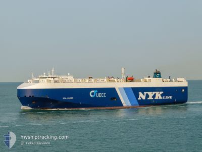
OPAL LEADER
Vehicles Carrier
Current Trip
| Time Travelled | 3 days |
|---|---|
| Remaining Time | --- |
| Distance Travelled | 962.72 nm |
| Remaining Distance | --- |
| AVG Speed | 13 Knopen |
| MAX Speed | 16.6 Knopen |
| AVG Wind | 8.9 knots |
| MAX Wind | 16.7 knots |
| MIN Temp | 19.1°C / 66.38°F |
| MAX Temp | 24°C / 75.2°F |
| Diepgang | 7.6 M |
| Positie ontvangen | 2 d geleden |
Current Position
| Lengtegraad | 57.05511° |
|---|---|
| Breedtegraat | 25.42248° |
| Status | Under way using engine |
| Snelheid | 14.4 Knopen |
| Koers | 129.5° |
| Gebied | Gulf of Oman |
| Station | T-AIS |
| Positie ontvangen | 2 d geleden |
Info
Information
The current position of OPAL LEADER is in Gulf of Oman with coordinates 25.42248° / 57.05511° as reported on 2025-02-04 16:08 by AIS to our vessel tracker app. The vessel's current speed is 14.4 Knopen and is heading at the port of JAKARTA. The estimated time of arrival as calculated by MyShipTracking vessel tracking app is 2025-02-14 09:00 LT
The vessel OPAL LEADER (IMO: 9318498, MMSI: 309285000) is a Vehicles Carrier that was built in 2007 ( 18 Jaar oud ). It's sailing under the flag of [BS] Bahamas.
In this page you can find informations about the vessels current position, last detected port calls, and current voyage information. If the vessels is not in coverage by AIS you will find the latest position.
The current position of OPAL LEADER is detected by our AIS receivers and we are not responsible for the reliability of the data. The last position was recorded while the vessel was in Coverage by the Ais receivers of our vessel tracking app.
The current draught of OPAL LEADER as reported by AIS is 7.6 meters
Weather
| Temperature | 24.2°C / 75.56°F |
|---|---|
| Wind Speed | 12 knots |
| Direction | 40° NE |
| Pressure | 1011.6 hPa |
| Humidity | 61.7 % |
| Cloud Coverage | --- |
Featured Company
Last Port Calls
| Port | Arrival | Departure | Time In Port |
|---|---|---|---|
| 2025-02-03 10:14 | 2025-02-03 22:48 | 12 h | |
| 2025-01-31 09:36 | 2025-02-02 10:32 | 2 d | |
| 2025-01-22 23:58 | 2025-01-23 05:35 | 5 h | |
| 2025-01-17 22:34 | 2025-01-19 03:16 | 1 d | |
| 2025-01-14 22:09 | 2025-01-15 11:33 | 13 h | |
| 2024-12-19 03:13 | 2025-01-05 06:45 | 17 d |
Most Visited Ports (Last year)
| Port | Arrivals | |
|---|---|---|
| 3 | ||
| 3 | ||
| 3 | ||
| 3 | ||
| 3 | ||
| 3 |
Last Trips
| Origin | Departure | Destination | Arrival | Distance | |
|---|---|---|---|---|---|
| 2025-02-02 13:32 | 2025-02-03 14:14 | 316.40 nm | |||
| 2025-01-23 11:05 | 2025-01-31 12:36 | 2376.33 nm | |||
| 2025-01-19 11:16 | 2025-01-23 05:28 | 1455.02 nm | |||
| 2025-01-15 18:33 | 2025-01-18 06:34 | 813.37 nm | |||
| 2025-01-05 13:45 | 2025-01-15 05:09 | 95.71 nm | |||
| 2024-11-22 16:35 | 2024-12-19 10:13 | 10595.89 nm |
Events
| Tijd | Evenement | Details | Positie / Bestemming | Info |
|---|---|---|---|---|
| 2025-02-04 16:09 | Status Changed | Default Under way using engine |
25.41892 / 57.05989
AE_KHL>ID_JKT
|
Snelheid: 14.4 kn Koers: 129.5° |
| 2025-02-04 16:08 | Status Changed | Under way using engine Default |
25.42248 / 57.05511
AE_KHL>ID_JKT
|
Snelheid: 14.4 kn Koers: 130° |
| 2025-02-04 16:08 | Buitenbereik |
25.42248 / 57.05511
Gulf of Oman
AE_KHL>ID_JKT
|
Snelheid: 14.4 kn Koers: 129.5° |
|
| 2025-02-04 15:57 | Status Changed | Default Under way using engine |
25.45166 / 57.01646
AE_KHL>ID_JKT
|
Snelheid: 14.4 kn Koers: 145.2° |
| 2025-02-04 15:38 | Status Changed | Under way using engine Default |
25.51024 / 56.96554
AE_KHL>ID_JKT
|
Snelheid: 14.3 kn Koers: 137° |
| 2025-02-04 15:29 | Status Changed | Default Under way using engine |
25.53590 / 56.93891
AE_KHL>ID_JKT
|
Snelheid: 14.3 kn Koers: 137.2° |
| 2025-02-04 14:31 | Wijzig zee gebeid | Iranian part of the Gulf of Oman Omani part of the Gulf of Oman |
25.73831 / 56.85175
Gulf of Oman
AE_KHL>ID_JKT
|
Snelheid: 14.1 kn Koers: 170.7° |
| 2025-02-04 13:53 | Wijzig zee gebeid | Omani part of the Gulf of Oman Omani part of the Persian Gulf |
25.88611 / 56.82205
Gulf of Oman
AE_KHL>ID_JKT
|
Snelheid: 14.2 kn Koers: 167.4° |
| 2025-02-04 13:50 | Status Changed | Under way using engine Default |
25.89635 / 56.81923
AE_KHL>ID_JKT
|
Snelheid: 14.4 kn Koers: 160° |
| 2025-02-04 13:50 | Binnenbereik |
25.88611 / 56.82205
Gulf of Oman
AE_KHL>ID_JKT
|
Snelheid: 14.2 kn Koers: 167.4° |