
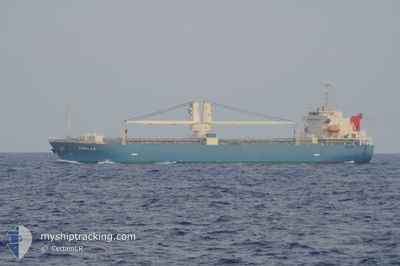
PERLAS
Cargo
Current Trip
VN SGN
| Time Travelled | 22 days |
|---|---|
| Remaining Time | --- |
| Distance Travelled | 3246.20 nm |
| Remaining Distance | --- |
| AVG Speed | 8.8 Knopen |
| MAX Speed | 11.9 Knopen |
| AVG Wind | 14.6 knots |
| MAX Wind | 29 knots |
| MIN Temp | 0.1°C / 32.18°F |
| MAX Temp | 34.6°C / 94.28°F |
| Diepgang | 6.3 M |
| Positie ontvangen | 4 d geleden |
Current Position
| Lengtegraad | 138.08802° |
|---|---|
| Breedtegraat | 37.58012° |
| Status | Under way using engine |
| Snelheid | 9.8 Knopen |
| Koers | 90.8° |
| Gebied | Japan Sea |
| Station | T-AIS |
| Positie ontvangen | 4 d geleden |
Info
Information
The current position of PERLAS is in Japan Sea with coordinates 37.58012° / 138.08802° as reported on 2025-02-21 18:56 by AIS to our vessel tracker app. The vessel's current speed is 9.8 Knopen
The vessel PERLAS (IMO: 9900291, MMSI: 548956000) is a Cargo It's sailing under the flag of [PH] Philippines.
In this page you can find informations about the vessels current position, last detected port calls, and current voyage information. If the vessels is not in coverage by AIS you will find the latest position.
The current position of PERLAS is detected by our AIS receivers and we are not responsible for the reliability of the data. The last position was recorded while the vessel was in Coverage by the Ais receivers of our vessel tracking app.
The current draught of PERLAS as reported by AIS is 6.3 meters
Weather
| Temperature | 7.7°C / 45.86°F |
|---|---|
| Wind Speed | 23 knots |
| Direction | 277° W |
| Pressure | 1016 hPa |
| Humidity | 63.2 % |
| Cloud Coverage | 100 % |
Featured Company
Last Port Calls
| Port | Arrival | Departure | Time In Port |
|---|---|---|---|
| 2025-02-03 11:04 | 2025-02-03 18:04 | 6 h | |
| 2025-01-29 23:37 | 2025-01-31 02:46 | 1 d | |
| 2025-01-27 16:12 | 2025-01-29 16:09 | 1 d | |
| 2025-01-08 12:17 | 2025-01-11 12:17 | 3 d | |
| 2025-01-07 06:58 | 2025-01-08 06:35 | 23 h | |
| 2024-12-28 07:58 | 2024-12-30 11:49 | 2 d | |
| 2024-12-19 21:52 | 2024-12-26 04:13 | 6 d | |
| 2024-12-03 08:40 |
Last Trips
| Origin | Departure | Destination | Arrival | Distance | |
|---|---|---|---|---|---|
| 2025-01-31 09:46 | 2025-02-03 19:04 | 861.50 nm | |||
| 2025-01-29 23:09 | 2025-01-30 06:37 | 36.69 nm | |||
| 2025-01-11 21:17 | 2025-01-27 23:12 | 3411.11 nm | |||
| 2025-01-08 15:35 | 2025-01-08 21:17 | 40.91 nm | |||
| 2024-12-30 20:49 | 2025-01-07 15:58 | 624.15 nm | |||
| 2024-12-26 13:13 | 2024-12-28 16:58 | 339.19 nm | |||
| 2024-12-03 16:40 | 2024-12-20 06:52 | 3318.94 nm |
Events
| Tijd | Evenement | Details | Positie / Bestemming | Info |
|---|---|---|---|---|
| 2025-02-22 02:25 | Stop beweging | 3.1 nm, East of NIIGATA |
37.97627 / 139.23538
VN SGN
|
Snelheid: 0.1 kn Koers: 340° |
| 2025-02-21 18:56 | Buitenbereik |
37.58012 / 138.08802
Japan Sea
|
Snelheid: 9.8 kn Koers: 90.8° |
|
| 2025-02-21 18:34 | Status Changed | Under way using engine Default |
37.58010 / 138.01279
VN SGN
|
Snelheid: 9.7 kn Koers: 90° |
| 2025-02-21 18:28 | Status Changed | Default Under way using engine |
37.58011 / 137.99252
VN SGN
|
Snelheid: 9.7 kn Koers: 91° |
| 2025-02-21 17:56 | Wijzig zee gebeid | Japanese part of the Japan Sea Indonesian part of the Singapore Strait |
37.58326 / 137.88314
Japan Sea
|
Snelheid: 9.7 kn Koers: 95.2° |
| 2025-02-21 17:56 | Status Changed | Under way using engine Default |
37.58326 / 137.88314
VN SGN
|
Snelheid: 9.7 kn Koers: 94° |
| 2025-02-21 17:54 | Binnenbereik |
37.58326 / 137.88314
Japan Sea
|
Snelheid: 9.7 kn Koers: 95.2° |