

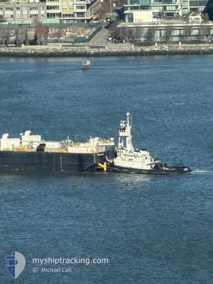
POCOMOKE
Pusher Tug

Current Trip
| Time Travelled | 9 h, 45 mins |
|---|---|
| Remaining Time | --- |
| Distance Travelled | 3.96 nm |
| Remaining Distance | --- |
| AVG Speed | 5.9 Knopen |
| MAX Speed | 7.6 Knopen |
| AVG Wind | 3.9 knots |
| MAX Wind | 6.9 knots |
| MIN Temp | 11.3°C / 52.34°F |
| MAX Temp | 15.6°C / 60.08°F |
| Diepgang | 4.3 M |
| Positie ontvangen | 16 m geleden |
Current Position
| Lengtegraad | -74.20144° |
|---|---|
| Breedtegraat | 40.62635° |
| Status | Pushing Ahead - Towing |
| Snelheid | |
| Koers | 18° |
| Gebied | North Atlantic Ocean |
| Station | T-AIS |
| Positie ontvangen | 16 m geleden |
Information
The current position of POCOMOKE is in North Atlantic Ocean with coordinates 40.62635° / -74.20144° as reported on 2025-06-02 11:01 by AIS to our vessel tracker app. The vessel's current speed is 0 Knopen
The vessel POCOMOKE (IMO: 9535084, MMSI: 367371790) is a Pusher Tug that was built in 2008 ( 17 Jaar oud ). It's sailing under the flag of [US] USA.
In this page you can find informations about the vessels current position, last detected port calls, and current voyage information. If the vessels is not in coverage by AIS you will find the latest position.
The current position of POCOMOKE is detected by our AIS receivers and we are not responsible for the reliability of the data. The last position was recorded while the vessel was in Coverage by the Ais receivers of our vessel tracking app.
The current draught of POCOMOKE as reported by AIS is 4.3 meters
Weather
| Temperature | 11.9°C / 53.42°F |
|---|---|
| Wind Speed | 5 knots |
| Direction | 310° NW |
| Pressure | 1015.1 hPa |
| Humidity | 65.1 % |
| Cloud Coverage | 15 % |


Featured Company
Last Port Calls
| Port | Arrival | Departure | Time In Port |
|---|---|---|---|
| 2025-06-01 19:19 | 2025-06-01 21:32 | 2 h | |
| 2025-05-30 18:39 | 2025-05-30 20:07 | 1 h | |
| 2025-05-30 00:45 | 2025-05-30 13:21 | 12 h | |
| 2025-05-29 16:04 | 2025-05-29 18:43 | 2 h | |
| 2025-05-29 11:49 | 2025-05-29 12:55 | 1 h | |
| 2025-05-29 03:53 | 2025-05-29 09:44 | 5 h | |
| 2025-05-28 11:59 | 2025-05-28 21:56 | 9 h | |
| 2025-05-27 15:41 | 2025-05-28 07:12 | 15 h | |
| 2025-05-23 22:07 | 2025-05-27 09:09 | 3 d | |
| 2025-05-20 14:39 | 2025-05-23 02:34 | 2 d |
Most Visited Ports (Last year)
| Port | Arrivals | |
|---|---|---|
| 156 | ||
| 33 | ||
| 12 | ||
| 7 | ||
| 7 | ||
| 7 |
Last Trips
| Origin | Departure | Destination | Arrival | Distance | |
|---|---|---|---|---|---|
| 2025-05-30 20:07 | 2025-06-01 19:19 | 8.49 nm | |||
| 2025-05-30 13:21 | 2025-05-30 18:39 | 44.85 nm | |||
| 2025-05-29 18:43 | 2025-05-30 00:45 | 44.63 nm | |||
| 2025-05-29 12:55 | 2025-05-29 16:04 | 15.77 nm | |||
| 2025-05-29 09:44 | 2025-05-29 11:49 | 10.48 nm | |||
| 2025-05-28 21:56 | 2025-05-29 03:53 | 32.95 nm | |||
| 2025-05-28 07:12 | 2025-05-28 11:59 | 44.04 nm | |||
| 2025-05-27 09:09 | 2025-05-27 15:41 | 44.56 nm | |||
| 2025-05-23 02:34 | 2025-05-23 22:07 | 12.96 nm | |||
| 2025-05-19 16:11 | 2025-05-20 14:39 | 17.81 nm |
Events
| Tijd | Evenement | Details | Positie / Bestemming | Info |
|---|---|---|---|---|
| 2025-06-02 11:07 | Status Changed | Default Pushing Ahead - Towing |
40.62635 / -74.20143
NEW YORK
|
Snelheid: Koers: 18° |
| 2025-06-02 02:54 | Stop beweging | 5.95 nm, North East of PERTH AMBOY |
40.62645 / -74.20148
NEW YORK
|
Snelheid: 0.2 kn Koers: 103° |
| 2025-06-02 02:37 | Start beweging | 5.89 nm, North of PERTH AMBOY |
40.62600 / -74.20348
NEW YORK
|
Snelheid: 3.5 kn Koers: 174° |
| 2025-06-02 01:57 | Stop beweging | 5.73 nm, North East of PERTH AMBOY |
40.62299 / -74.20329
NEW YORK
|
Snelheid: 0.3 kn Koers: 166° |
| 2025-06-02 01:32 | Vertrekhaven |
|
40.64665 / -74.17642
NEW YORK
|
Snelheid: 5.3 kn Koers: 258° |
| 2025-06-01 23:19 | Aankomsthaven |
|
40.78159 / -73.99811
[US] NEW YORK
|
Snelheid: 7.1 kn Koers: 206.9° |
| 2025-06-01 23:02 | Start beweging | 0.38 nm, East of FAIR VIEW |
40.81150 / -73.97336
NEW YORK
|
Snelheid: 4.5 kn Koers: 146° |
| 2025-06-01 22:23 | Status Changed | Pushing Ahead - Towing At anchor |
40.81235 / -73.97376
NEW YORK
|
Snelheid: Koers: 19° |
| 2025-06-01 00:00 | ETA Changed | 2026/05/31 05:00 2025/05/31 05:00 |
40.81228 / -73.97389
NEW YORK
|
Snelheid: 0.1 kn Koers: 22° |
| 2025-05-31 00:30 | Status Changed | At anchor Pushing Ahead - Towing |
40.81254 / -73.97461
NEW YORK
|
Snelheid: 0.1 kn Koers: 28° |