

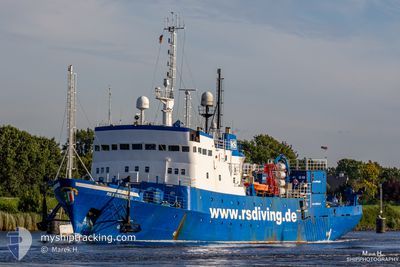
RS SENTINEL
Research/Survey Vessel

Current Trip
OWF WIKINGER
| Time Travelled | 15 days |
|---|---|
| Remaining Time | --- |
| Distance Travelled | 248.90 nm |
| Remaining Distance | --- |
| AVG Speed | 8.2 Knopen |
| MAX Speed | 8.2 Knopen |
| AVG Wind | 9.8 knots |
| MAX Wind | 21 knots |
| MIN Temp | 4.9°C / 40.82°F |
| MAX Temp | 10.8°C / 51.44°F |
| Diepgang | 4.6 M |
| Positie ontvangen | 1 m geleden |
Current Position
| Lengtegraad | 14.05437° |
|---|---|
| Breedtegraat | 54.83620° |
| Status | Restricted manoeuverability |
| Snelheid | |
| Koers | 47° |
| Gebied | Baltic Sea |
| Station | T-AIS |
| Positie ontvangen | 1 m geleden |
Information
The current position of RS SENTINEL is in Baltic Sea with coordinates 54.83620° / 14.05437° as reported on 2025-04-26 09:02 by AIS to our vessel tracker app. The vessel's current speed is 0 Knopen
The vessel RS SENTINEL (IMO: 7106877, MMSI: 229964000) is a Research/Survey Vessel that was built in 1971 ( 54 Jaar oud ). It's sailing under the flag of [MT] Malta.
In this page you can find informations about the vessels current position, last detected port calls, and current voyage information. If the vessels is not in coverage by AIS you will find the latest position.
The current position of RS SENTINEL is detected by our AIS receivers and we are not responsible for the reliability of the data. The last position was recorded while the vessel was in Coverage by the Ais receivers of our vessel tracking app.
The current draught of RS SENTINEL as reported by AIS is 4.6 meters
Weather
| Temperature | 7°C / 44.6°F |
|---|---|
| Wind Speed | 8 knots |
| Direction | 147° SSE |
| Pressure | 1028.6 hPa |
| Humidity | 68 % |
| Cloud Coverage | 90 % |


Featured Company
Events
| Tijd | Evenement | Details | Positie / Bestemming | Info |
|---|---|---|---|---|
| 2025-04-25 11:26 | Stop beweging |
54.83633 / 14.05429
OWF WIKINGER
|
Snelheid: 0.1 kn Koers: 45° |
|
| 2025-04-25 11:06 | Start beweging |
54.83298 / 14.07053
OWF WIKINGER
|
Snelheid: 3.2 kn Koers: 257° |
|
| 2025-04-24 12:04 | Stop beweging |
54.83749 / 14.10989
OWF WIKINGER
|
Snelheid: 0.1 kn Koers: 133° |
|
| 2025-04-24 11:49 | Start beweging |
54.85071 / 14.10713
OWF WIKINGER
|
Snelheid: 3.2 kn Koers: 156° |
|
| 2025-04-24 01:01 | Stop beweging |
54.84496 / 14.10524
OWF WIKINGER
|
Snelheid: 0.3 kn Koers: 219° |
|
| 2025-04-24 00:50 | Start beweging |
54.84417 / 14.11413
OWF WIKINGER
|
Snelheid: 3.1 kn Koers: 312° |
|
| 2025-04-23 07:06 | Stop beweging |
54.85464 / 14.10815
OWF WIKINGER
|
Snelheid: 0.3 kn Koers: 225° |
|
| 2025-04-23 06:46 | Start beweging |
54.84749 / 14.11918
OWF WIKINGER
|
Snelheid: 3.1 kn Koers: 327° |
|
| 2025-04-21 10:16 | Stop beweging |
54.84732 / 14.08738
OWF WIKINGER
|
Snelheid: 0.3 kn Koers: 45° |
|
| 2025-04-21 10:05 | Start beweging |
54.85247 / 14.08636
OWF WIKINGER
|
Snelheid: 3.1 kn Koers: 1° |