
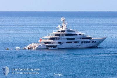
SAMSARA
Pleasure Craft
Current Trip
GREENPORT
| Trip Time | 34 mins |
|---|---|
| Trip Distance | 1.83 nm |
| AVG Speed | 3.8 Knopen |
| MAX Speed | 4.5 Knopen |
| Diepgang | 4 M |
| AVG Wind | 4.9 knots |
| MAX Wind | 5 knots |
| MIN Temp | 3°C / 37.4°F |
| MAX Temp | 3.3°C / 37.94°F |
| Positie ontvangen | 2 m geleden |
Current Position
| Lengtegraad | 4.40185° |
|---|---|
| Breedtegraat | 51.88817° |
| Status | Moored |
| Snelheid | |
| Koers | 19° |
| Gebied | North Sea |
| Station | T-AIS |
| Positie ontvangen | 2 m geleden |
Info
Information
The current position of SAMSARA is in North Sea with coordinates 51.88817° / 4.40185° as reported on 2025-02-19 13:27 by AIS to our vessel tracker app. The vessel's current speed is 0 Knopen and is currently inside the port of ROTTERDAM PERNIS.
The vessel SAMSARA (IMO: 1012177, MMSI: 319068100) is a Pleasure Craft It's sailing under the flag of [KY] Cayman Is.
In this page you can find informations about the vessels current position, last detected port calls, and current voyage information. If the vessels is not in coverage by AIS you will find the latest position.
The current position of SAMSARA is detected by our AIS receivers and we are not responsible for the reliability of the data. The last position was recorded while the vessel was in Coverage by the Ais receivers of our vessel tracking app.
The current draught of SAMSARA as reported by AIS is 4 meters
Weather
| Temperature | 4.1°C / 39.38°F |
|---|---|
| Wind Speed | 9 knots |
| Direction | 128° SE |
| Pressure | 1020.6 hPa |
| Humidity | 36.5 % |
| Cloud Coverage | 100 % |
Featured Company
Last Port Calls
| Port | Arrival | Departure | Time In Port |
|---|---|---|---|
| 2025-02-14 11:31 | |||
| 2025-02-14 10:57 |
Most Visited Ports (Last year)
| Port | Arrivals | |
|---|---|---|
| 2 | ||
| 2 | ||
| 2 | ||
| 2 | ||
| 1 | ||
| 1 |
Last Trips
| Origin | Departure | Destination | Arrival | Distance | |
|---|---|---|---|---|---|
| 2025-02-14 11:57 | 2025-02-14 12:31 | 1.83 nm |
Events
| Tijd | Evenement | Details | Positie / Bestemming | Info |
|---|---|---|---|---|
| 2025-02-18 23:58 | Destination Changed | GREENPORT E0%EN8ORW |
51.88817 / 4.40185
[NL] ROTTERDAM PERNIS
|
Snelheid: Koers: 18° |
| 2025-02-18 23:58 | ETA Changed | 2025/10/31 19:00 2025/10/31 19:24 |
51.88817 / 4.40185
[NL] ROTTERDAM PERNIS
|
Snelheid: Koers: 18° |
| 2025-02-18 23:52 | Destination Changed | E0%EN8ORW GREENPORT |
51.88818 / 4.40184
[NL] ROTTERDAM PERNIS
|
Snelheid: Koers: 18° |
| 2025-02-18 23:52 | ETA Changed | 2025/10/31 19:24 2025/10/31 19:00 |
51.88818 / 4.40184
[NL] ROTTERDAM PERNIS
|
Snelheid: Koers: 18° |
| 2025-02-18 08:28 | Status Changed | Moored Under way using engine |
51.88817 / 4.40185
[NL] ROTTERDAM PERNIS
|
Snelheid: Koers: 18° |
| 2025-02-18 08:27 | Status Changed | Under way using engine Moored |
51.88817 / 4.40185
[NL] ROTTERDAM PERNIS
|
Snelheid: Koers: 18° |
| 2025-02-14 13:10 | Status Changed | Moored Restricted manoeuverability |
51.88817 / 4.40186
[NL] ROTTERDAM PERNIS
|
Snelheid: Koers: 18° |
| 2025-02-14 11:31 | Aankomsthaven |
|
51.88878 / 4.40242
[NL] ROTTERDAM PERNIS
|
Snelheid: 0.4 kn Koers: 44° |
| 2025-02-14 11:25 | Stop beweging | 0.42 nm, East of ROTTERDAM PERNIS |
51.88859 / 4.40267
GREENPORT
|
Snelheid: 0.3 kn Koers: 143° |
| 2025-02-14 10:57 | Vertrekhaven |
|
51.90219 / 4.42944
GREENPORT
|
Snelheid: 4.3 kn Koers: 292° |