
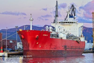
SOMBEKE
Lpg Tanker
Current Trip
| Time Travelled | 9 days |
|---|---|
| Remaining Time | --- |
| Distance Travelled | 2934.50 nm |
| Remaining Distance | --- |
| AVG Speed | 14.3 Knopen |
| MAX Speed | 16.1 Knopen |
| AVG Wind | 10.9 knots |
| MAX Wind | 18 knots |
| MIN Temp | 23.6°C / 74.48°F |
| MAX Temp | 28.3°C / 82.94°F |
| Diepgang | 7.1 M |
| Positie ontvangen | 3 d geleden |
Current Position
| Lengtegraad | -24.86951° |
|---|---|
| Breedtegraat | 9.92154° |
| Status | Under way using engine |
| Snelheid | 14.3 Knopen |
| Koers | 288.5° |
| Gebied | North Atlantic Ocean |
| Station | T-AIS |
| Positie ontvangen | 3 d geleden |
Info
Information
The current position of SOMBEKE is in North Atlantic Ocean with coordinates 9.92154° / -24.86951° as reported on 2026-01-04 18:07 by AIS to our vessel tracker app. The vessel's current speed is 14.3 Knopen and is heading at the port of CORPUS CHRISTI. The estimated time of arrival as calculated by MyShipTracking vessel tracking app is 2026-01-17 14:00 LT
The vessel SOMBEKE (IMO: 9292113, MMSI: 538010789) is a Lpg Tanker that was built in 2006 ( 20 Jaar oud ). It's sailing under the flag of [MH] Marshall Is.
In this page you can find informations about the vessels current position, last detected port calls, and current voyage information. If the vessels is not in coverage by AIS you will find the latest position.
The current position of SOMBEKE is detected by our AIS receivers and we are not responsible for the reliability of the data. The last position was recorded while the vessel was in Coverage by the Ais receivers of our vessel tracking app.
The current draught of SOMBEKE as reported by AIS is 7.1 meters
Weather
| Temperature | 24.5°C / 76.1°F |
|---|---|
| Wind Speed | 13 knots |
| Direction | 90° E |
| Pressure | 1016.3 hPa |
| Humidity | 75.5 % |
| Cloud Coverage | 100 % |
Featured Company
Most Visited Ports (Last year)
| Port | Arrivals | |
|---|---|---|
| 8 | ||
| 6 | ||
| 4 | ||
| 2 | ||
| 2 | ||
| 2 |
Events
| Tijd | Evenement | Details | Positie / Bestemming | Info |
|---|---|---|---|---|
| 2026-01-04 18:14 | Status Changed | Default Under way using engine |
9.93114 / -24.89809
USCRP
|
Snelheid: 14.3 kn Koers: 288.5° |
| 2026-01-04 18:07 | Status Changed | Under way using engine Default |
9.92154 / -24.86951
USCRP
|
Snelheid: 14.5 kn Koers: 289° |
| 2026-01-04 18:07 | Binnenbereik |
9.92154 / -24.86951
North Atlantic Ocean
USCRP
|
Snelheid: 14.3 kn Koers: 288.5° |
|
| 2026-01-04 18:07 | Buitenbereik |
9.92154 / -24.86951
North Atlantic Ocean
USCRP
|
Snelheid: 14.3 kn Koers: 288.5° |
|
| 2026-01-04 05:52 | Status Changed | Default Under way using engine |
8.96667 / -22.00833
USCRP
|
Snelheid: 14.7 kn Koers: 292° |
| 2026-01-04 05:49 | Buitenbereik |
8.96214 / -21.99630
North Atlantic Ocean
USCRP
|
Snelheid: 14.7 kn Koers: 292° |
|
| 2026-01-04 05:49 | Status Changed | Under way using engine Default |
8.96202 / -21.99598
USCRP
|
Snelheid: 14.6 kn Koers: 291° |
| 2026-01-04 05:45 | Status Changed | Default Under way using engine |
8.95623 / -21.98055
USCRP
|
Snelheid: 14.8 kn Koers: 290.7° |
| 2026-01-04 04:45 | Status Changed | Under way using engine Default |
8.87715 / -21.74759
USCRP
|
Snelheid: 14.3 kn Koers: 288° |
| 2026-01-04 04:42 | Status Changed | Default Under way using engine |
8.87371 / -21.73686
USCRP
|
Snelheid: 14.7 kn Koers: 289.4° |