
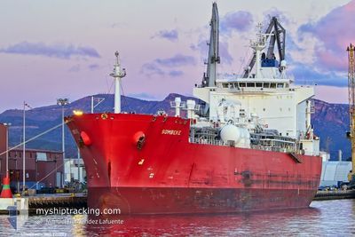
SOMBEKE
Lpg Tanker
Current Trip
| Trip Time | 19 days |
|---|---|
| Trip Distance | 6100.30 nm |
| AVG Speed | 13.2 Knots |
| MAX Speed | 16 Knots |
| Draught | 10 m |
| AVG Wind | 14.5 knots |
| MAX Wind | 25.8 knots |
| MIN Temp | 17.9°C / 64.22°F |
| MAX Temp | 27.9°C / 82.22°F |
| Position Received | 7 d ago |
Current Position
| Longitude | -20.28422° |
|---|---|
| Latitude | 8.36806° |
| Status | Under way using engine |
| Speed | 13.4 Knots |
| Course | 117.5° |
| Area | North Atlantic Ocean |
| Station | T-AIS |
| Position Received | 7 d ago |
Info
Information
The current position of SOMBEKE is in North Atlantic Ocean with coordinates 8.36806° / -20.28422° as reported on 2025-12-11 03:50 by AIS to our vessel tracker app. The vessel's current speed is 13.4 Knots and is currently inside the port of LAGOS.
The vessel SOMBEKE (IMO: 9292113, MMSI: 538010789) is a Lpg Tanker that was built in 2006 ( 19 years old ). It's sailing under the flag of [MH] Marshall Is.
In this page you can find informations about the vessels current position, last detected port calls, and current voyage information. If the vessels is not in coverage by AIS you will find the latest position.
The current position of SOMBEKE is detected by our AIS receivers and we are not responsible for the reliability of the data. The last position was recorded while the vessel was in Coverage by the Ais receivers of our vessel tracking app.
The current draught of SOMBEKE as reported by AIS is 10 meters
Weather
| Temperature | 27.1°C / 80.78°F |
|---|---|
| Wind Speed | 6 knots |
| Direction | 217° SW |
| Pressure | 1009.4 hPa |
| Humidity | 73.6 % |
| Cloud Coverage | 70 % |
Featured Company
Most Visited Ports (Last year)
| Port | Arrivals | |
|---|---|---|
| 8 | ||
| 6 | ||
| 4 | ||
| 3 | ||
| 2 | ||
| 1 |
Events
| Time | Event | Details | Position / Dest | Info |
|---|---|---|---|---|
| 2025-12-16 02:14 | STOP Moving |
6.43421 / 3.37146
[NG] LAGOS
|
Speed: 0.1 kn Course: 247° |
|
| 2025-12-16 02:14 | PORT ARRIVAL |
|
6.43421 / 3.37146
[NG] LAGOS
|
Speed: 0.6 kn Course: 246° |
| 2025-12-16 00:38 | START Moving | 6.5 nm, South East of LAGOS |
6.34023 / 3.42334
LAGOS, NIGERIA
|
Speed: 6 kn Course: 324° |
| 2025-12-15 23:50 | STOP Moving | 6.86 nm, South East of LAGOS |
6.33476 / 3.42579
LAGOS, NIGERIA
|
Speed: 0.2 kn Course: 350° |
| 2025-12-15 23:29 | START Moving | 7.7 nm, South East of LAGOS |
6.31943 / 3.42758
LAGOS, NIGERIA
|
Speed: 3.1 kn Course: 6° |
| 2025-12-15 19:38 | STOP Moving | 8.92 nm, South East of LAGOS |
6.29969 / 3.43392
LAGOS, NIGERIA
|
Speed: 0.2 kn Course: 176° |
| 2025-12-15 18:42 | START Moving | 9.89 nm, South East of LAGOS |
6.28313 / 3.43741
LAGOS, NIGERIA
|
Speed: 3.5 kn Course: 357° |
| 2025-12-15 18:34 | STOP Moving | 9.95 nm, South East of LAGOS |
6.28392 / 3.44132
LAGOS, NIGERIA
|
Speed: 0.3 kn Course: 196° |
| 2025-12-15 18:02 | START Moving | 6.57 nm, South East of LAGOS |
6.33135 / 3.40917
LAGOS, NIGERIA
|
Speed: 5.9 kn Course: 151° |
| 2025-12-15 16:50 | STOP Moving | 6.15 nm, South East of LAGOS |
6.33997 / 3.41095
LAGOS, NIGERIA
|
Speed: 0.3 kn Course: 258° |