
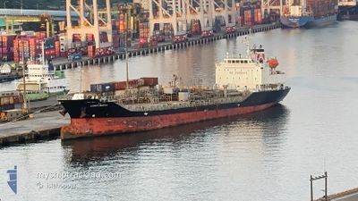
SUNNY QUEEN
Tanker
Current Trip
| Time Travelled | 3 days |
|---|---|
| Remaining Time | 5 h, 31 mins |
| Distance Travelled | 584.85 nm |
| Remaining Distance | 268.80 nm |
| AVG Speed | 9.8 Knopen |
| MAX Speed | 14.2 Knopen |
| AVG Wind | 20.2 knots |
| MAX Wind | 35 knots |
| MIN Temp | 8.8°C / 47.84°F |
| MAX Temp | 15.3°C / 59.54°F |
| Diepgang | 5.9 M |
| Positie ontvangen | 3 d geleden |
Current Position
| Lengtegraad | 120.15985° |
|---|---|
| Breedtegraat | 22.66991° |
| Status | Under way using engine |
| Snelheid | 13.3 Knopen |
| Koers | 301.9° |
| Gebied | South China Sea |
| Station | T-AIS |
| Positie ontvangen | 3 d geleden |
Info
Information
The current position of SUNNY QUEEN is in South China Sea with coordinates 22.66991° / 120.15985° as reported on 2025-02-08 15:52 by AIS to our vessel tracker app. The vessel's current speed is 13.3 Knopen and is heading at the port of INCHEON. The estimated time of arrival as calculated by MyShipTracking vessel tracking app is 2025-02-12 10:36 LT
The vessel SUNNY QUEEN (IMO: 9725809, MMSI: 440374000) is a Tanker It's sailing under the flag of [KR] Korea.
In this page you can find informations about the vessels current position, last detected port calls, and current voyage information. If the vessels is not in coverage by AIS you will find the latest position.
The current position of SUNNY QUEEN is detected by our AIS receivers and we are not responsible for the reliability of the data. The last position was recorded while the vessel was in Coverage by the Ais receivers of our vessel tracking app.
The current draught of SUNNY QUEEN as reported by AIS is 5.9 meters
Weather
| Temperature | 3.3°C / 37.94°F |
|---|---|
| Wind Speed | 2 knots |
| Direction | 20° NNE |
| Pressure | 1014.7 hPa |
| Humidity | 92.4 % |
| Cloud Coverage | 100 % |
Featured Company
Last Port Calls
| Port | Arrival | Departure | Time In Port |
|---|---|---|---|
| 2025-02-07 07:05 | 2025-02-08 15:24 | 1 d | |
| 2025-02-05 23:15 | 2025-02-06 23:25 | 1 d | |
| 2025-01-31 22:33 | 2025-02-01 11:36 | 13 h | |
| 2025-01-29 23:08 | 2025-01-30 10:17 | 11 h | |
| 2025-01-23 22:57 | 2025-01-24 09:17 | 10 h | |
| 2025-01-12 04:18 | 2025-01-13 02:41 | 22 h | |
| 2025-01-06 23:33 | 2025-01-07 09:45 | 10 h | |
| 2024-12-31 12:11 | 2025-01-01 12:49 | 1 d | |
| 2024-12-25 11:29 | 2024-12-27 05:33 | 1 d | |
| 2024-12-01 00:32 |
Last Trips
| Origin | Departure | Destination | Arrival | Distance | |
|---|---|---|---|---|---|
| 2025-02-07 07:25 | 2025-02-07 15:05 | 88.74 nm | |||
| 2025-02-01 20:36 | 2025-02-06 07:15 | 1166.68 nm | |||
| 2025-01-30 19:17 | 2025-02-01 07:33 | 285.10 nm | |||
| 2025-01-24 18:17 | 2025-01-30 08:08 | 637.43 nm | |||
| 2025-01-13 11:41 | 2025-01-24 07:57 | 2517.96 nm | |||
| 2025-01-07 18:45 | 2025-01-12 13:18 | 1055.87 nm | |||
| 2025-01-01 21:49 | 2025-01-07 08:33 | 975.21 nm | |||
| 2024-12-27 13:33 | 2024-12-31 21:11 | 671.91 nm | |||
| 2024-12-01 09:32 | 2024-12-25 19:29 | 1256.61 nm |
Events
| Tijd | Evenement | Details | Positie / Bestemming | Info |
|---|---|---|---|---|
| 2025-02-08 15:57 | Status Changed | Default Under way using engine |
22.68383 / 120.14626
KR INC
|
Snelheid: 13.3 kn Koers: 301.9° |
| 2025-02-08 15:52 | Buitenbereik |
22.66991 / 120.15985
South China Sea
KR INC
|
Snelheid: 13.3 kn Koers: 301.9° |
|
| 2025-02-08 15:24 | Vertrekhaven |
|
22.62070 / 120.25333
KR INC
|
Snelheid: 11.4 kn Koers: 293° |
| 2025-02-08 15:13 | Draught Changed | 5.9 6.5 |
22.61223 / 120.27967
[TW] KAOHSIUNG
|
Snelheid: 4.1 kn Koers: 289° |
| 2025-02-08 15:13 | Destination Changed | KR INC TW KHH |
22.61223 / 120.27967
[TW] KAOHSIUNG
|
Snelheid: 4.1 kn Koers: 289° |
| 2025-02-08 15:13 | ETA Changed | 2025/02/11 18:00 2025/02/07 14:00 |
22.61223 / 120.27967
[TW] KAOHSIUNG
|
Snelheid: 4.1 kn Koers: 289° |
| 2025-02-08 15:12 | Start beweging |
22.61200 / 120.28039
[TW] KAOHSIUNG
|
Snelheid: 3.3 kn Koers: 290° |
|
| 2025-02-08 15:09 | Status Changed | Under way using engine Default |
22.61116 / 120.28178
[TW] KAOHSIUNG
|
Snelheid: 0.1 kn Koers: 60° |
| 2025-02-08 14:55 | Binnenbereik |
22.61168 / 120.28125
South China Sea
[TW] KAOHSIUNG
|
Snelheid: 2 kn Koers: 310.8° |
|
| 2025-02-07 16:55 | Status Changed | Default Moored |
22.58352 / 120.30016
[TW] KAOHSIUNG
|
Snelheid: Koers: 185° |