
TB BRIGHT CITY
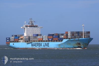
Container Ship
Current Trip
SUEZ
| Time Travelled | 11 days |
|---|---|
| Remaining Time | --- |
| Distance Travelled | 3145.29 nm |
| Remaining Distance | --- |
| AVG Speed | 14.1 Knopen |
| MAX Speed | 17.9 Knopen |
| AVG Wind | 13.2 knots |
| MAX Wind | 30.5 knots |
| MIN Temp | 7.8°C / 46.04°F |
| MAX Temp | 27°C / 80.6°F |
| Diepgang | 11.1 M |
| Positie ontvangen | 2 d geleden |
Current Position
| Lengtegraad | 32.30350° |
|---|---|
| Breedtegraat | 31.49160° |
| Status | Under way using engine |
| Snelheid | 14.9 Knopen |
| Koers | 275.7° |
| Gebied | Mediterranean Sea - Eastern Basin |
| Station | T-AIS |
| Positie ontvangen | 2 d geleden |
Info
Information
The current position of TB BRIGHT CITY is in Mediterranean Sea - Eastern Basin with coordinates 31.49160° / 32.30350° as reported on 2025-02-09 16:28 by AIS to our vessel tracker app. The vessel's current speed is 14.9 Knopen
The vessel TB BRIGHT CITY (IMO: 9168192, MMSI: 636020265) is a Container Ship that was built in 1998 ( 27 Jaar oud ). It's sailing under the flag of [LR] Liberia.
In this page you can find informations about the vessels current position, last detected port calls, and current voyage information. If the vessels is not in coverage by AIS you will find the latest position.
The current position of TB BRIGHT CITY is detected by our AIS receivers and we are not responsible for the reliability of the data. The last position was recorded while the vessel was in Coverage by the Ais receivers of our vessel tracking app.
The current draught of TB BRIGHT CITY as reported by AIS is 11.1 meters
Weather
| Temperature | 14.4°C / 57.92°F |
|---|---|
| Wind Speed | 19 knots |
| Direction | 320° NW |
| Pressure | 1022.5 hPa |
| Humidity | 53.9 % |
| Cloud Coverage | 100 % |
Featured Company
Last Port Calls
| Port | Arrival | Departure | Time In Port |
|---|---|---|---|
| 2025-02-09 05:32 | 2025-02-09 14:49 | 9 h | |
| 2025-01-30 03:53 | 2025-01-31 08:06 | 1 d | |
| 2025-01-25 13:01 | 2025-01-26 06:13 | 17 h | |
| 2025-01-23 13:21 | 2025-01-24 09:05 | 19 h | |
| 2025-01-16 16:17 | 2025-01-17 07:49 | 15 h | |
| 2025-01-06 04:54 | 2025-01-06 13:52 | 8 h | |
| 2024-12-21 19:49 | 2024-12-23 03:44 | 1 d | |
| 2024-12-20 11:28 | |||
| 2024-12-20 10:16 | |||
| 2024-12-20 09:51 |
Most Visited Ports (Last year)
| Port | Arrivals | |
|---|---|---|
| 14 | ||
| 6 | ||
| 5 | ||
| 5 | ||
| 5 | ||
| 3 |
Last Trips
| Origin | Departure | Destination | Arrival | Distance | |
|---|---|---|---|---|---|
| 2025-01-31 12:06 | 2025-02-09 07:32 | 2888.05 nm | |||
| 2025-01-26 11:43 | 2025-01-30 07:53 | 937.27 nm | |||
| 2025-01-24 14:35 | 2025-01-25 18:31 | 424.17 nm | |||
| 2025-01-17 13:19 | 2025-01-23 18:51 | 923.43 nm | |||
| 2024-12-23 06:44 | 2025-01-16 21:47 | 8298.46 nm | |||
| 2024-12-23 06:44 | 2025-01-06 06:54 | 4757.67 nm | |||
| 2024-12-20 13:16 | 2024-12-21 22:49 | 73.16 nm | |||
| 2024-12-20 12:51 | 2024-12-20 14:28 | 9.75 nm | |||
| 2024-11-22 04:14 | 2024-12-17 11:40 | 7976.59 nm | |||
| 2024-11-22 04:14 | 2024-12-17 09:15 | 7948.42 nm |
Events
| Tijd | Evenement | Details | Positie / Bestemming | Info |
|---|---|---|---|---|
| 2025-02-10 02:49 | Stop beweging | 6.2 nm, North West of EL DEKHEILA |
31.22935 / 29.73397
SUEZ
|
Snelheid: 0.3 kn Koers: 331° |
| 2025-02-09 16:33 | Status Changed | Default Under way using engine |
31.49812 / 32.28209
SUEZ
|
Snelheid: 14.9 kn Koers: 275.7° |
| 2025-02-09 16:28 | Buitenbereik |
31.49160 / 32.30350
Mediterranean Sea - Eastern Basin
|
Snelheid: 14.9 kn Koers: 275.7° |
|
| 2025-02-09 16:26 | Wijzig zee gebeid | Egyptian part of the Mediterranean Sea - Eastern Basin Egyptian part of the Gulf of Suez |
31.49077 / 32.31412
Mediterranean Sea - Eastern Basin
|
Snelheid: 14.9 kn Koers: 275.6° |
| 2025-02-09 16:23 | Status Changed | Under way using engine Default |
31.49016 / 32.32751
SUEZ
|
Snelheid: 14.4 kn Koers: 304° |
| 2025-02-09 16:23 | Binnenbereik |
31.49077 / 32.31412
Mediterranean Sea - Eastern Basin
|
Snelheid: 14.9 kn Koers: 275.6° |
|
| 2025-02-09 14:49 | Vertrekhaven |
|
31.23491 / 32.34812
SUEZ
|
Snelheid: 7.9 kn Koers: 17° |
| 2025-02-09 07:16 | Status Changed | Default Under way using engine |
30.20482 / 32.56436
[EG] SUEZ CANAL
|
Snelheid: 8.7 kn Koers: 356° |
| 2025-02-09 07:07 | Buitenbereik |
30.18528 / 32.56904
Gulf of Suez
[EG] SUEZ CANAL
|
Snelheid: 8.7 kn Koers: 355.6° |
|
| 2025-02-09 05:32 | Aankomsthaven |
|
29.94796 / 32.57900
[EG] SUEZ CANAL
|
Snelheid: 8 kn Koers: 37.3° |