
VASSA
Yacht
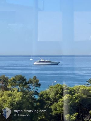
Current Trip
CAPE ARNAUTI
| Time Travelled | 1 day |
|---|---|
| Remaining Time | --- |
| Distance Travelled | 73.71 nm |
| Remaining Distance | --- |
| AVG Speed | 10.7 Knopen |
| MAX Speed | 13.2 Knopen |
| AVG Wind | 6.1 knots |
| MAX Wind | 11.2 knots |
| MIN Temp | 12.8°C / 55.04°F |
| MAX Temp | 15.5°C / 59.9°F |
| Diepgang | 3.7 M |
| Positie ontvangen | 3 m geleden |
Current Position
| Lengtegraad | 32.30946° |
|---|---|
| Breedtegraat | 35.08611° |
| Status | At anchor |
| Snelheid | |
| Koers | 316° |
| Gebied | Mediterranean Sea - Eastern Basin |
| Station | T-AIS |
| Positie ontvangen | 3 m geleden |
Info
Information
The current position of VASSA is in Mediterranean Sea - Eastern Basin with coordinates 35.08611° / 32.30946° as reported on 2025-03-01 16:37 by AIS to our vessel tracker app. The vessel's current speed is 0 Knopen
The vessel VASSA (IMO: 1011719, MMSI: 256701000) is a Yacht that was built in 2012 ( 13 Jaar oud ). It's sailing under the flag of [MT] Malta.
In this page you can find informations about the vessels current position, last detected port calls, and current voyage information. If the vessels is not in coverage by AIS you will find the latest position.
The current position of VASSA is detected by our AIS receivers and we are not responsible for the reliability of the data. The last position was recorded while the vessel was in Coverage by the Ais receivers of our vessel tracking app.
The current draught of VASSA as reported by AIS is 3.7 meters
Weather
| Temperature | 14.9°C / 58.82°F |
|---|---|
| Wind Speed | 7 knots |
| Direction | 342° NNW |
| Pressure | 1021.5 hPa |
| Humidity | 67.9 % |
| Cloud Coverage | --- |
Featured Company
Events
| Tijd | Evenement | Details | Positie / Bestemming | Info |
|---|---|---|---|---|
| 2025-03-01 00:02 | ETA Changed | 2026/02/28 18:00 2025/02/28 18:00 |
35.08687 / 32.30850
CAPE ARNAUTI
|
Snelheid: Koers: 138° |
| 2025-02-28 21:25 | Status Changed | At anchor Under way using engine |
35.08675 / 32.30864
CAPE ARNAUTI
|
Snelheid: 0.1 kn Koers: 146° |
| 2025-02-28 21:17 | Stop beweging | 20.59 nm, North of PAPHOS |
35.08664 / 32.30883
CAPE ARNAUTI
|
Snelheid: 0.3 kn Koers: 174° |
| 2025-02-28 20:12 | Binnenbereik |
35.00660 / 32.22351
Mediterranean Sea - Eastern Basin
CAPE ARNAUTI
|
Snelheid: 13.2 kn Koers: 359.9° |
|
| 2025-02-28 17:21 | Buitenbereik |
34.59865 / 32.65133
Mediterranean Sea - Eastern Basin
CAPE ARNAUTI
|
Snelheid: 12.3 kn Koers: 287.6° |
|
| 2025-02-28 14:49 | Vertrekhaven |
|
34.66153 / 33.04396
CAPE ARNAUTI
|
Snelheid: 11.4 kn Koers: 108° |
| 2025-02-28 14:44 | Start beweging |
34.66508 / 33.03842
[CY] LIMASSOL
|
Snelheid: 3.8 kn Koers: 249° |
|
| 2025-02-28 14:37 | Destination Changed | CAPE ARNAUTI CYPRESS |
34.66675 / 33.04063
[CY] LIMASSOL
|
Snelheid: Koers: 170° |
| 2025-02-28 14:37 | ETA Changed | 2025/02/28 18:00 2025/02/27 20:30 |
34.66675 / 33.04063
[CY] LIMASSOL
|
Snelheid: Koers: 170° |
| 2025-02-28 14:37 | Status Changed | Under way using engine Moored |
34.66675 / 33.04063
[CY] LIMASSOL
|
Snelheid: 0.1 kn Koers: 170° |