
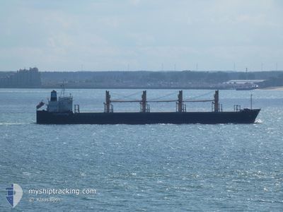
AEOLOS
Bulk Carrier
Current Trip
| Time Travelled | 1 day |
|---|---|
| Remaining Time | --- |
| Distance Travelled | 484.98 морская миля |
| Remaining Distance | --- |
| AVG Speed | 13.1 Узлы |
| MAX Speed | 17.3 Узлы |
| AVG Wind | 11.1 knots |
| MAX Wind | 22 knots |
| MIN Temp | 24°C / 75.2°F |
| MAX Temp | 29.9°C / 85.82°F |
| Осадка | 7.7 м |
| Позиция Получена | 22 h, 17 m тому назад |
Current Position
| Долгота | -48.71035° |
|---|---|
| Широта | -28.74104° |
| Статус | Under way using engine |
| Скорость | 13.4 Узлы |
| Курс | 209.6° |
| Район | South Atlantic Ocean |
| Станция | T-AIS |
| Позиция Получена | 22 h, 17 m тому назад |
Info
Information
The current position of AEOLOS is in South Atlantic Ocean with coordinates -28.74104° / -48.71035° as reported on 2025-02-27 17:59 by AIS to our vessel tracker app. The vessel's current speed is 13.4 Узлы
The vessel AEOLOS (IMO: 9228382, MMSI: 538003275) is a Bulk Carrier that was built in 2001 ( 24 лет ). It's sailing under the flag of [MH] Marshall Is.
In this page you can find informations about the vessels current position, last detected port calls, and current voyage information. If the vessels is not in coverage by AIS you will find the latest position.
The current position of AEOLOS is detected by our AIS receivers and we are not responsible for the reliability of the data. The last position was recorded while the vessel was in Coverage by the Ais receivers of our vessel tracking app.
The current draught of AEOLOS as reported by AIS is 7.7 meters
Weather
| Temperature | 25.7°C / 78.26°F |
|---|---|
| Wind Speed | 6 knots |
| Direction | 352° N |
| Pressure | 1013.1 hPa |
| Humidity | 87.4 % |
| Cloud Coverage | 100 % |
Featured Company
Last Trips
| Origin | Departure | Destination | Arrival | Distance | |
|---|---|---|---|---|---|
| 2025-01-27 15:35 | 2025-02-23 23:45 | 5211.79 морская миля | |||
| 2025-01-09 11:59 | 2025-01-20 20:38 | 500.37 морская миля | |||
| 2024-12-11 21:37 | 2025-01-07 12:35 | 7176.81 морская миля | |||
| 2024-12-01 09:18 | 2024-12-02 07:36 | 299.46 морская миля |
Events
| Время | Событие | Детали | Позиция / Направление | Информация |
|---|---|---|---|---|
| 2025-02-28 15:01 | Окончание движения | 11.59 nm, South East of RIO GRANDE |
-32.12529 / -51.88895
BR RIG
|
Скорость: 0.1 kn Курс: 74° |
| 2025-02-27 18:07 | Статус изменился | Default Under way using engine |
-28.76640 / -48.72742
BR RIG
|
Скорость: 13.4 kn Курс: 209.6° |
| 2025-02-27 17:59 | Вне покрытия |
-28.74104 / -48.71035
South Atlantic Ocean
BR RIG
|
Скорость: 13.4 kn Курс: 209.6° |
|
| 2025-02-27 09:37 | Осадка изменилась | 7.7 11.2 |
-26.91754 / -48.13592
BR RIG
|
Скорость: 13.8 kn Курс: 181.4° |
| 2025-02-27 09:37 | Пункт назначения изменился | BR RIG BR PNG |
-26.91754 / -48.13592
BR RIG
|
Скорость: 13.8 kn Курс: 181.4° |
| 2025-02-27 09:37 | ETA изменился | 2025/02/28 16:00 2025/02/15 21:00 |
-26.91754 / -48.13592
BR RIG
|
Скорость: 13.8 kn Курс: 181.4° |
| 2025-02-27 09:27 | Статус изменился | Under way using engine Default |
-26.87846 / -48.13426
BR PNG
|
Скорость: 13.9 kn Курс: 184° |
| 2025-02-27 09:14 | Статус изменился | Default Under way using engine |
-26.82968 / -48.13113
BR PNG
|
Скорость: 13.9 kn Курс: 180.9° |
| 2025-02-27 08:35 | Статус изменился | Under way using engine Default |
-26.67830 / -48.14211
BR PNG
|
Скорость: 13.8 kn Курс: 172° |
| 2025-02-27 08:29 | Статус изменился | Default Under way using engine |
-26.65522 / -48.14529
BR PNG
|
Скорость: 13.9 kn Курс: 175.3° |