
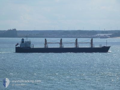
AEOLOS
Bulk Carrier
Current Trip
| Time Travelled | 1 day |
|---|---|
| Remaining Time | --- |
| Distance Travelled | 484.98 nm |
| Remaining Distance | --- |
| AVG Speed | 13.1 Knop |
| MAX Speed | 17.3 Knop |
| AVG Wind | 11.1 knots |
| MAX Wind | 22 knots |
| MIN Temp | 24°C / 75.2°F |
| MAX Temp | 29.9°C / 85.82°F |
| Djupgående | 7.7 m |
| Position mottagen | 22 h, 17 m sen |
Current Position
| Longitud | -48.71035° |
|---|---|
| Latitude | -28.74104° |
| Status | Under way using engine |
| Fart | 13.4 Knop |
| Kurs | 209.6° |
| Område | South Atlantic Ocean |
| Station | T-AIS |
| Position mottagen | 22 h, 17 m sen |
Info
Information
The current position of AEOLOS is in South Atlantic Ocean with coordinates -28.74104° / -48.71035° as reported on 2025-02-27 17:59 by AIS to our vessel tracker app. The vessel's current speed is 13.4 Knop
The vessel AEOLOS (IMO: 9228382, MMSI: 538003275) is a Bulk Carrier that was built in 2001 ( 24 År gammal ). It's sailing under the flag of [MH] Marshall Is.
In this page you can find informations about the vessels current position, last detected port calls, and current voyage information. If the vessels is not in coverage by AIS you will find the latest position.
The current position of AEOLOS is detected by our AIS receivers and we are not responsible for the reliability of the data. The last position was recorded while the vessel was in Coverage by the Ais receivers of our vessel tracking app.
The current draught of AEOLOS as reported by AIS is 7.7 meters
Weather
| Temperature | 25.7°C / 78.26°F |
|---|---|
| Wind Speed | 6 knots |
| Direction | 352° N |
| Pressure | 1013.1 hPa |
| Humidity | 87.4 % |
| Cloud Coverage | 100 % |
Featured Company
Events
| Tid | Event | Detaljer | Position / Dest | Information |
|---|---|---|---|---|
| 2025-02-28 15:01 | STOPPAR förflyttning | 11.59 nm, South East of RIO GRANDE |
-32.12529 / -51.88895
BR RIG
|
Fart: 0.1 kn Kurs: 74° |
| 2025-02-27 18:07 | Status ändrad | Default Under way using engine |
-28.76640 / -48.72742
BR RIG
|
Fart: 13.4 kn Kurs: 209.6° |
| 2025-02-27 17:59 | UTANFÖR täckningsområde |
-28.74104 / -48.71035
South Atlantic Ocean
BR RIG
|
Fart: 13.4 kn Kurs: 209.6° |
|
| 2025-02-27 09:37 | Djupgående ändrat | 7.7 11.2 |
-26.91754 / -48.13592
BR RIG
|
Fart: 13.8 kn Kurs: 181.4° |
| 2025-02-27 09:37 | Destination ändrad | BR RIG BR PNG |
-26.91754 / -48.13592
BR RIG
|
Fart: 13.8 kn Kurs: 181.4° |
| 2025-02-27 09:37 | ETA ändrat | 2025/02/28 16:00 2025/02/15 21:00 |
-26.91754 / -48.13592
BR RIG
|
Fart: 13.8 kn Kurs: 181.4° |
| 2025-02-27 09:27 | Status ändrad | Under way using engine Default |
-26.87846 / -48.13426
BR PNG
|
Fart: 13.9 kn Kurs: 184° |
| 2025-02-27 09:14 | Status ändrad | Default Under way using engine |
-26.82968 / -48.13113
BR PNG
|
Fart: 13.9 kn Kurs: 180.9° |
| 2025-02-27 08:35 | Status ändrad | Under way using engine Default |
-26.67830 / -48.14211
BR PNG
|
Fart: 13.8 kn Kurs: 172° |
| 2025-02-27 08:29 | Status ändrad | Default Under way using engine |
-26.65522 / -48.14529
BR PNG
|
Fart: 13.9 kn Kurs: 175.3° |